2000-2009 Maps of Jefferson County, Mississippi
Explore 5 historic maps of Jefferson County from 2000-2009. These maps offer a rare glimpse into what life looked like during the 2000s — showing old roads, neighborhoods, homes, and landmarks that have changed or disappeared over time.
Whether you're researching your family's past, planning a metal detecting trip, or studying how Jefferson County's landscape evolved across the 2000s, these high-resolution maps are a powerful tool for exploring the history of this region.
- Focus on a specific era: All maps on this page are from the 2000s, giving you a focused view of this time period.
- See what’s changed: Compare century-old streets, trails, and buildings to today's modern landscape using overlays and satellite layers.
- Research with precision: Use these maps for genealogy, historical research, land use analysis, or educational projects.
- View, download, or print: Maps are fully viewable online in high resolution, and can be downloaded or printed for your own records.
Start exploring Jefferson County's history through authentic maps from the 2000s. This is your window into the past.
Jefferson County, MS maps
(5)- 2000 Map of Roxie, 2002 Print
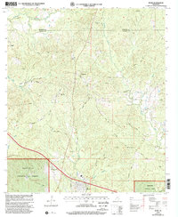 2000 Roxie2002 Print · USGSFranklin and Jefferson Counties are documented here at the turn of the century as the southern forest landscape met rural farmstead life. Genealogists can trace family ties at Old Rose Hill Cem, Daughters Temple, and the settlement of Hamburg.
 - 2000 Map of McBride, 2002 Print
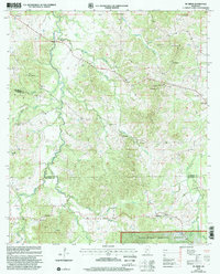 2000 McBride2002 Print · USGSThe rural borderlands of Claiborne and Jefferson counties are shown here as they appeared at the turn of the millennium. Genealogists can trace family roots through numerous remote sites like Clarks Creek Ch, Hedrich Cem, and the settlement of McBride.
 - 2000 Map of McCall Creek, 2002 Print
 2000 McCall Creek2002 Print · USGSSouthwest Mississippi's timber country is documented here at the turn of the century, showing the crossroads of Franklin and Lincoln counties. Genealogists can locate family landmarks like Wright Cem and rural centers such as Shucktown and McCall Creek.
 - 2000 Map of Union Church, 2002 Print
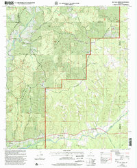
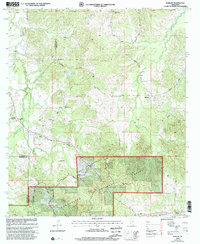
 2000 Union Church2002 Print · USGSJefferson County at the turn of the millennium shows a landscape defined by the Homochitto National Forest and the Middle Fork Homochitto River. Researchers can trace old family sites and rural landmarks like Hickory Block Ch, Perth, and Singletary Cem.
 - 2000 Map of Barlow, 2002 Print
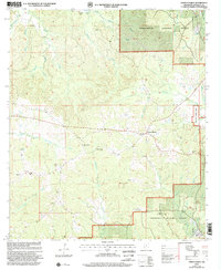
 2000 Barlow2002 Print · USGSThe rural hills of Copiah County are captured here at the turn of the millennium. Researchers can trace family history through numerous remote sites like Shelton Cem, Weeks Cem, and Macedonia Ch.
End of results
Showing maps 1-5 of 5
Top cities of Jefferson County
Frequently asked questions
- What are the different types of historical maps available for Jefferson County?
- What is the oldest map of Jefferson County?
- Where can I purchase historical maps of Jefferson County for my home or office?
- Where can I download high-res historical maps of Jefferson County?
- Are there historical topographic maps available for Jefferson County?
- Is there historical aerial imagery available for Jefferson County?
- Where are historical maps of Jefferson County sourced from?