1900s (20th Century) Maps of Dallas Jones Crossing, Mississippi
Explore 9 historic maps of Dallas Jones Crossing from the 1900s (20th Century). These maps offer a rare glimpse into what life looked like during the 1900s — showing old roads, neighborhoods, homes, and landmarks that have changed or disappeared over time.
Whether you're researching your family's past, planning a metal detecting trip, or studying how Dallas Jones Crossing's landscape evolved across the 1900s, these high-resolution maps are a powerful tool for exploring the history of this region.
- Focus on a specific era: All maps on this page are from the 1900s, giving you a focused view of this time period.
- See what’s changed: Compare century-old streets, trails, and buildings to today's modern landscape using overlays and satellite layers.
- Research with precision: Use these maps for genealogy, historical research, land use analysis, or educational projects.
- View, download, or print: Maps are fully viewable online in high resolution, and can be downloaded or printed for your own records.
Start exploring Dallas Jones Crossing's history through authentic maps from the 1900s. This is your window into the past.
Dallas Jones Crossing, MS maps
(9)- 1954 Map of Water Valley, 1966 Print
 1954 Water Valley1966 Print · USGSYalobusha County was undergoing significant hydrological change in the mid-fifties as the Enid Reservoir reshaped the valley. Researchers can trace dozens of rural church and school sites, from Sylva Rena Ch & Cem to the Pine Valley Sch.2 unique versions available
 - 1954 Map of Water Valley West, 1980 Print
 1954 Water Valley West1980 Print · USGSYalobusha and Lafayette counties are shown here as the Enid Lake reservoir reshaped the Yocona River valley in the early 1980s. Genealogists and local historians can locate numerous rural landmarks like Pine Spring Cem, Kind Providence Ch, and the town of Water Valley.
 - 1955 Map of Water Valley
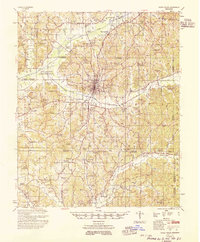 1955 Water Valley1955 Print · USGSYalobusha County enters the mid-fifties with the newly formed Enid Reservoir reshaping the valley's geography. Genealogists and historians can trace family locations through numerous rural sites like Sylva Rena Ch & Cem and the Oak Grove Sch.
 - 1956 Map of Tupelo, 1967 Print
 1956 Tupelo1967 Print · USGSNortheast Mississippi and parts of Tennessee and Alabama are shown here during the mid-fifties, a time of major reservoir construction and forestry management. Researchers can trace the St Louis-San Francisco RR through Tupelo or locate historic sites like Tishomingo State Park and the University.2 unique versions available
 - 1958 Map of Tupelo
 1958 Tupelo1958 Print · USGSNortheast Mississippi and neighboring Alabama and Tennessee appear here during the late fifties as a region defined by new reservoirs and historic rail lines. Genealogists can trace family locations near Sardis Lake, Woodall Mountain, and the St Louis-San Francisco Ry.
 - 1983 Map of Water Valley West
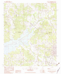 1983 Water Valley West1983 Print · USGSWater Valley and the eastern shore of Enid Lake are shown in the early eighties as the region balanced its reservoir-based recreation with long-standing rural communities. Genealogists can locate family landmarks like Camp Ground Cem, Big Springs Ch, and Sylva Rena Cem.
 - 1984 Map of Tupelo
 1984 Tupelo1984 Print · USGSNorth Mississippi in the 1980s is defined by its massive river basin reservoirs and the growing regional hubs of Tupelo and Oxford. Researchers can trace the legacy of the Pontotoc Ridge, find the University of Mississippi, and map early Interstate corridors near Sardis Lake.3 unique versions available
 - 1984 Map of Oxford, 1985 Print
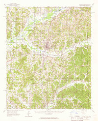
 1984 Oxford1985 Print · USGSOxford and its surrounding hill country are captured in the mid-eighties as university life and rural industry intersected. Genealogists and historians can trace rail lines like the ST LOUIS-SAN FRANCISCO RY and locate old rural centers such as College Hill Sta and Lafayette Springs.
 - 1990 Map of Oxford, 1991 Print
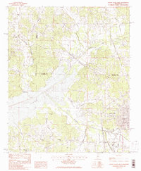
 1990 Oxford1991 Print · USGSNorth Mississippi at the start of the nineties centers on the university town of Oxford and the large reservoirs of the Tallahatchie River valley. Researchers can trace the Illinois Central Gulf RR through towns like Water Valley and locate landmarks such as College Hill Sta.
End of results
Showing maps 1-9 of 9
Top cities near Dallas Jones Crossing
Frequently asked questions
- What are the different types of historical maps available for Dallas Jones Crossing?
- What is the oldest map of Dallas Jones Crossing?
- Where can I purchase historical maps of Dallas Jones Crossing for my home or office?
- Where can I download high-res historical maps of Dallas Jones Crossing?
- Are there historical topographic maps available for Dallas Jones Crossing?
- Is there historical aerial imagery available for Dallas Jones Crossing?
- Where are historical maps of Dallas Jones Crossing sourced from?