1900s (20th Century) Maps of Pearl River County, Mississippi
Explore 64 historic maps of Pearl River County from the 1900s (20th Century). These maps offer a rare glimpse into what life looked like during the 1900s — showing old roads, neighborhoods, homes, and landmarks that have changed or disappeared over time.
Whether you're researching your family's past, planning a metal detecting trip, or studying how Pearl River County's landscape evolved across the 1900s, these high-resolution maps are a powerful tool for exploring the history of this region.
- Focus on a specific era: All maps on this page are from the 1900s, giving you a focused view of this time period.
- See what’s changed: Compare century-old streets, trails, and buildings to today's modern landscape using overlays and satellite layers.
- Research with precision: Use these maps for genealogy, historical research, land use analysis, or educational projects.
- View, download, or print: Maps are fully viewable online in high resolution, and can be downloaded or printed for your own records.
Start exploring Pearl River County's history through authentic maps from the 1900s. This is your window into the past.
Pearl River County, MS maps
(64)- 1914 Map of Nicholson, 1957 Print
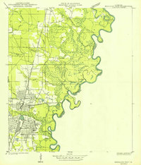
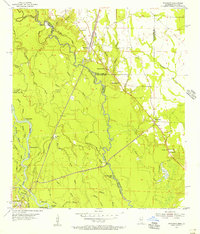
 1914 Nicholson1957 Print · USGSThe Pearl River swamp along the Louisiana-Mississippi border was a landscape of timber and tides during the early twentieth century. Genealogists can locate family-named settlements like Logtown and Gainsville or trace the early paths of the 3 Notch Road.2 unique versions available
 - 1921 Map of Nicholson
 1921 Nicholson1921 Print · USGSThe borderlands of Mississippi and Louisiana are captured here in the early 1920s, showing a river-driven landscape of timber and rail. Researchers can trace the riverfront communities of Gainsville and Logtown alongside the historic 3 Notch Road.
 - 1935 Map of Slidell
 1935 Slidell1935 Print · USGSCoastal Louisiana in the mid-thirties reveals a landscape of growing rail towns and bayou settlements tied to the Gulf and the Pearl River systems. Genealogists and local historians can trace family roots through the Welch Cem, the Peace Grove Sch, and vanished hubs like McClure City.3 unique versions available
 - 1939 Map of Slidell
 1939 Slidell1939 Print · USGSSt. Tammany Parish in the late thirties is a landscape of thriving bayou communities and expanding rail corridors near the lakefront. Genealogists can trace family landmarks like Crawford Cem, McClane City, and the Edgar Doucette Sch.
 - 1941 Map of Honey Island
 1941 Honey Island1941 Print · USGSThe lower Pearl River basin at the start of the 1940s reveals a dense network of swamp bayous and rail sidings. Genealogists and historians can trace the paths of Highway No 11 and the Southern railroad through Benton and past Honey Island.
 - 1942 Map of Walkiah Bluff
 1942 Walkiah Bluff1942 Print · USGSSt. Tammany Parish, Louisiana, during the early 1940s reveals a dense network of river sloughs and active timber lands. Genealogists and historians can trace family burial sites at Thomas Cem and Keller Cem or locate the defunct Logging Railroad Grade.
 - 1942 Map of Pools Bluff
 1942 Pools Bluff1942 Print · USGSThe Pearl River bottomlands at the start of the 1940s reveal a landscape of dense bayous and isolated river settlements. Genealogists can locate family burial grounds like Sheridan Cem and Morris Cem, or trace early transit routes such as the Float Road.
 - 1949 Map of Bogalusa East
 1949 Bogalusa East1949 Print · USGSThe industrial city of Bogalusa sits at the edge of the Pearl River bottomlands in the late 1940s. Researchers can trace the city's growth from Goodyear Park to the Gulf Mobile and Ohio rail lines, or locate family plots at Gann Cem and Adams Cem.
 - 1949 Map of Angie
 1949 Angie1949 Print · USGSNear the Pearl River in the late 1940s, this area of Washington Parish shows a landscape of timber and rail. Genealogists can locate family-named sites like Pleasant Valley Cem, Wesley Ray High Sch, and the community of Varnado.
 - 1950 Map of Slidell, 1962 Print
 1950 Slidell1962 Print · USGSThe Northshore of Lake Pontchartrain comes into focus at mid-century, showing the growing rail hubs and marshland settlements. Genealogists can trace family footprints at Forest Glen School, the Parker Cemetery, and rural outposts like Hickory or Florenville.2 unique versions available
 - 1953 Map of Hattiesburg, 1965 Print
 1953 Hattiesburg1965 Print · USGSSouth Mississippi and western Alabama are shown here during the mid-twentieth century as the timber and rail industries shaped the region. Genealogists and historians can trace rail lines like the Mississippi Central and locate rural centers such as Magee, Richton, and Mount Vernon.4 unique versions available
 - 1953 Map of Mobile, 1968 Print
 1953 Mobile1968 Print · USGSThe Gulf Coast comes alive in this mid-century survey, from the streets of Mobile to the marshes of New Orleans. Trace family roots in coastal towns like Pass Christian and Bayou La Batre or locate military landmarks including Keesler AFB.3 unique versions available
 - 1955 Map of Savannah, 1956 Print
 1955 Savannah1956 Print · USGSCoastal Mississippi's piney woods and river bottoms come alive in the mid-fifties, showing the intersection of four counties. Genealogists can locate family landmarks like Necaise Cem, Riceville, and Steep Hollow Ch among the timber of the De Soto National Forest.3 unique versions available
 - 1955 Map of Nicholson, 1956 Print
 1955 Nicholson1956 Print · USGSThe Pearl River bottomlands at the Mississippi-Louisiana border come to life in the mid-fifties, showing a landscape defined by braided bayous and timbered wetlands. Researchers can locate family landmarks like Turtleskin Cem and Oak Ridge Ch or trace the early footprint of Nicholson.5 unique versions available
 - 1957 Map of Mobile
 1957 Mobile1957 Print · USGSThe Gulf Coast in the mid-1950s reveals a bustling corridor of rail-and-river commerce connecting Alabama to Louisiana. Genealogists and historians can trace old settlements and military hubs from Keesler Afb to the coastal reaches of Ship Island and Bogalusa.3 unique versions available
 - 1958 Map of Hattiesburg
 1958 Hattiesburg1958 Print · USGSSoutheastern Mississippi's timber and rail networks are at their peak during the late fifties, centered on the growing hubs of Hattiesburg and Laurel. Researchers can trace old family landmarks like Sims Chapel, the Busbey Game Refuge, and the vanished stops along the Mississippi Central railroad.2 unique versions available
 - 1958 Map of Carnes, 1959 Print
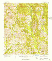
 1958 Carnes1959 Print · USGSPearl River and Lamar counties are shown here during the late fifties as small timber and farming communities were consolidating. You can locate family burial plots like Rouse Field Cem and traces of local education at Bird Line Sch or Magnolia Sch.2 unique versions available
 - 1958 Map of Picayune, 1959 Print
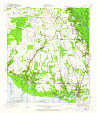
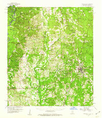
 1958 Picayune1959 Print · USGSPicayune and the surrounding Pearl River County countryside are captured here in the late fifties as the timber and rail economy shaped the landscape. Genealogists and local historians can trace rural family sites like Thigpen Cem, the Lee Sch, and the small settlement at Ozona.2 unique versions available
 - 1959 Map of Nicholson, 1960 Print
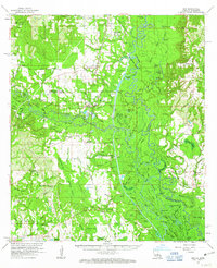
 1959 Nicholson1960 Print · USGSThe Pearl River valley in the late fifties was a network of riverfront settlements and deep-swamp bayous at the Mississippi-Louisiana border. Researchers can trace the river's winding course through Gainesville, locate family sites at Haaswood Cem, or find rural landmarks like Flattop Sch.3 unique versions available
 - 1959 Map of Bogalusa, 1960 Print
 1959 Bogalusa1960 Print · USGSThe Pearl River valley and the industrial hub of Bogalusa are captured here in the late fifties. Genealogists can trace family names through dozens of rural sites like Mitchells Chapel, Old Live Oak Cem, and the Buck Branch School.2 unique versions available
 - 1959 Map of Poplarville, 1960 Print
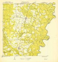
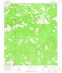
 1959 Poplarville1960 Print · USGSPearl River County during the late fifties shows a rural landscape transitioning around the growing hub of Poplarville. Genealogists and historians can trace old community centers like White Sand, Wesley Chapel Cem, and Stewart Sch.3 unique versions available
 - 1960 Map of Mobile
 1960 Mobile1960 Print · USGSThe Gulf Coast at the dawn of the sixties shows a landscape of busy ports, military airbases, and barrier islands. Trace the rail lines of the Louisville & Nashville through BILOXI and Pascagoula or find family history in towns like Bayou La Batre and Poplarville.
 - 1961 Map of Sun, 1963 Print
 1961 Sun1963 Print · USGSLife along the Louisiana and Mississippi border centered on the river and the rail in the early sixties. Researchers can trace family history through dozens of rural landmarks like Byrds Chapel, Rio, and the Gulf Mobile and Ohio line.3 unique versions available
 - 1963 Map of Mobile
 1963 Mobile1963 Print · USGSThe Gulf Coast at the dawn of the sixties shows a thriving maritime and military corridor from Louisiana to Alabama. Genealogists and historians can trace rail lines like the Louisville & Nashville RR and find landmarks from Brookley AFB to Fort Morgan.
 - 1963 Map of Rock Hill, 1965 Print
 1963 Rock Hill1965 Print · USGSDeep in the Mississippi piney woods during the early sixties, this area shows a landscape defined by timber and rural faith. Researchers can trace family names and local landmarks like Rock Hill, Anderson Cem, and the Rock Hill Lookout Tower.3 unique versions available
Showing maps 1-25 of 64
Top cities of Pearl River County
Frequently asked questions
- What are the different types of historical maps available for Pearl River County?
- What is the oldest map of Pearl River County?
- Where can I purchase historical maps of Pearl River County for my home or office?
- Where can I download high-res historical maps of Pearl River County?
- Are there historical topographic maps available for Pearl River County?
- Is there historical aerial imagery available for Pearl River County?
- Where are historical maps of Pearl River County sourced from?