1960s Maps of Quitman County, Mississippi
Explore 13 historic maps of Quitman County from the 1960s. These maps offer a rare glimpse into what life looked like during the 1960s — showing old roads, neighborhoods, homes, and landmarks that have changed or disappeared over time.
Whether you're researching your family's past, planning a metal detecting trip, or studying how Quitman County's landscape evolved across the 1960s, these high-resolution maps are a powerful tool for exploring the history of this region.
- Focus on a specific era: All maps on this page are from the 1960s, giving you a focused view of this time period.
- See what’s changed: Compare century-old streets, trails, and buildings to today's modern landscape using overlays and satellite layers.
- Research with precision: Use these maps for genealogy, historical research, land use analysis, or educational projects.
- View, download, or print: Maps are fully viewable online in high resolution, and can be downloaded or printed for your own records.
Start exploring Quitman County's history through authentic maps from the 1960s. This is your window into the past.
Quitman County, MS maps
(13)- 1960 Map of Helena
 1960 Helena1960 Print · USGSThe Arkansas and Mississippi Delta regions meet along the great river bends during a period of significant agricultural and rail expansion. Genealogists and historians can trace the paths of the Missouri Pacific railroad through Clarendon or locate landings along the Mississippi River and White River.
 - 1962 Map of Crowder, 1965 Print
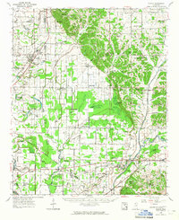
 1962 Crowder1965 Print · USGSThe Mississippi Delta meets the eastern hills in the early sixties, showing a landscape shaped by massive water-management projects and deep family roots. Genealogists can locate Shady Grove Cemetery, Walkers Chapel, and the community of Charleston.3 unique versions available
 - 1963 Map of Sledge, 1965 Print
 1963 Sledge1965 Print · USGSNorthwest Mississippi in the early sixties is shown here as a landscape of Delta bayous and rail-side settlements. Genealogists can trace family roots at McDonald Grove Ch, Curtis Station, and the old Chickasaw Boundary Line.2 unique versions available
 - 1963 Map of Crenshaw, 1965 Print
 1963 Crenshaw1965 Print · USGSNorthwest Mississippi in the early sixties reveals a landscape of delta lowlands and upland reservoirs where the Illinois Central rail line connects small rural hubs. Genealogists can locate family landmarks like Brooks Chapel, Kelley's Crossing, and the small community of Strayhorn.
 - 1967 Map of Tutwiler, 1968 Print
 1967 Tutwiler1968 Print · USGSThe Mississippi Delta's rail-and-bayou landscape comes alive in the late sixties as the ILLINOIS CENTRAL tracks link Tutwiler and Dublin. Researchers can locate numerous country churches and cemeteries, including Thomas Chapel and Rosemound Cem.
 - 1967 Map of Sabino, 1968 Print
 1967 Sabino1968 Print · USGSThe Yazoo-Mississippi Delta comes to life in the late 1960s as a patchwork of bayous and rural church communities. Genealogists and local historians can trace family ties at the Mt Nemo Cemetery or find historic settlements like Sabino and Walnut.2 unique versions available
 - 1967 Map of Lambert, 1968 Print
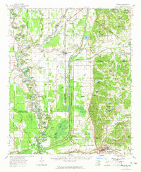
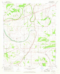
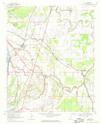
 1967 Lambert1968 Print · USGSQuitman County in the late 1960s shows a landscape of Delta agriculture and railroad towns before modern changes. Genealogists and historians can trace families through the New Mt Carmel Cem or Sykes Ch, and locate landmarks like the Indian Mound.2 unique versions available
 - 1967 Map of Vance, 1968 Print
 1967 Vance1968 Print · USGSThe Mississippi Delta's winding waterways and rural settlements come into focus in the late 1960s as the railroad still connects the cotton country. Researchers can locate family landmarks like Silent Shade Cem, the Indian Mound, and old post offices like Brazil (Stover PO).3 unique versions available
 - 1969 Map of Tutwiler
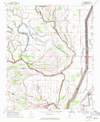
 1969 Tutwiler1969 Print · USGSThe Mississippi Delta's agricultural heartland is captured here in the late sixties, where the Illinois Central rail line links rural centers. Researchers can trace family roots at Stover, the State Penal Farm Camp B, or local landmarks like Pawpaw Ch and New Bethel Ch.
 - 1969 Map of Lula, 1971 Print
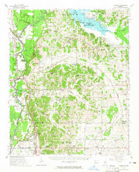
 1969 Lula1971 Print · USGSThe Mississippi Delta's rail-and-bayou geography comes into focus during the late sixties near the Tunica and Coahoma county line. Researchers can trace family history through local landmarks like Bethlehem Cem, the Lula Sch, and the historic Indian Treaty Boundary.
 - 1969 Map of Marks, 1971 Print
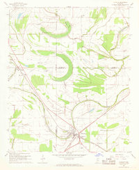
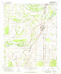
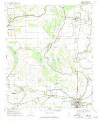 1969 Marks1971 Print · USGSThe Quitman County Delta in the late sixties reveals a landscape shaped by ancient earthworks and the steady flow of the Coldwater River. Genealogists can trace family names at Gleason Grove Cem or locate historic congregations like Macedonia Ch and Belview Ch.
 - 1969 Map of Falcon, 1971 Print
 1969 Falcon1971 Print · USGSThe Mississippi Delta's shifting riverbanks and rail lines are captured here in the late sixties. Genealogists and historians can trace family church sites like Robinson Chapel or Hollywood Ch and follow the Old Indian Treaty Boundary.
 - 1969 Map of Jonestown, 1971 Print
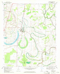 1969 Jonestown1971 Print · USGSThe Mississippi Delta's winding waterways and rail corridors are captured here in the late sixties. Genealogists and researchers can trace rural life through landmarks like Mary Bethel Cem, Eagles Nest, and the Illinois Central railroad line.
End of results
Showing maps 1-13 of 13
Top cities of Quitman County
Frequently asked questions
- What are the different types of historical maps available for Quitman County?
- What is the oldest map of Quitman County?
- Where can I purchase historical maps of Quitman County for my home or office?
- Where can I download high-res historical maps of Quitman County?
- Are there historical topographic maps available for Quitman County?
- Is there historical aerial imagery available for Quitman County?
- Where are historical maps of Quitman County sourced from?