Old Maps of Quitman County, Mississippi for Academic Research
Study the evolution of Quitman County with 120 high-resolution historic maps. Whether you're teaching, researching, or modeling changes in land use, these maps provide essential visual documentation of urban, environmental, and geographic change.
- Analyze long-term change: Track patterns in development, transportation, and natural features.
- Ideal for environmental or urban studies: Support academic projects with primary historical map data.
- Use in the classroom or lab: Educators and researchers rely on these maps to bring historical context to life.
These maps are a powerful tool for teaching, research, and visualizing how Quitman County has changed over the decades.
Quitman County, MS maps
(120)- 1908 Map of Lula, 1957 Print
 1908 Lula1957 Print · USGSThe Mississippi Delta at the start of the twentieth century is defined here by the meeting of rail and river near Lula. Genealogists and historians can trace the early layout of settlements like Rich, Mascot, and Birdie along the various branches of the Yazoo and Mississippi Valley R. R.
 - 1908 Map of Jonestown, 1961 Print
 1908 Jonestown1961 Print · USGSThe Mississippi Delta's intricate river systems and early rail settlements are preserved here as they appeared in the first decade of the 1900s. Trace the path of the Yazoo and Mississippi Valley railroad through Jonestown and find historic landmarks like Hopewell Church and Eagles Nest.
 - 1908 Map of Walnut Lake, 1961 Print
 1908 Walnut Lake1961 Print · USGSThe Mississippi Delta's shifting waters and early settlements are captured here in the decade before the First World War. Genealogists and researchers can trace the locations of Walnut Lake School, Gerbach Mill, and local hubs like Dubbs.
 - 1910 Map of Walnut Lake
 1910 Walnut Lake1910 Print · USGSThe Mississippi Delta's winding waterways and early drainage districts are meticulously detailed in this early twentieth-century survey. Trace the family names and rural hubs of Tunica and Quitman Counties, locating landmarks like Walnut Lake School, Gerlach Mill, and the settlement of Pink.
 - 1910 Map of Jonestown
 1910 Jonestown1910 Print · USGSCoahoma and Quitman counties appear here in the early twentieth century as a landscape of winding oxbow lakes and essential rail lines. Genealogists and historians can trace local life through rural landmarks like Hopewell Church, the settlement at Eagles Nest, and the Yazoo and Mississippi Valley RR.
 - 1912 Map of Lula
 1912 Lula1912 Print · USGSThe Mississippi Delta at the start of the twentieth century shows a landscape defined by lumber rails and oxbow lakes. Trace the early growth of Lula and Rich along the Yazoo and Mississippi Valley R. R. and the winding Yazoo Pass.
 - 1932 Map of Sledge
 1932 Sledge1932 Print · USGSThe Mississippi Delta's complex water and rail networks are preserved here as they existed in the early thirties. Genealogists and local historians can trace family locations near the Yazoo and Mississippi Valley RR, Porters Ferry Sch, and Sanfords Chapel.2 unique versions available
 - 1932 Map of Tutwiler
 1932 Tutwiler1932 Print · USGSTallahatchie County was a landscape of winding oxbows and rail-linked settlements in the early 1930s. Genealogists and historians can trace numerous rural congregations like Whitfield Ch and New Bethlehem Ch, alongside industry at Fitches Gin.
 - 1932 Map of Marks
 1932 Marks1932 Print · USGSThe Mississippi Delta in the early 1930s is a landscape of complex bayous and tight-knit rural communities. Genealogists can trace family roots through numerous local landmarks like Swan Lake Normal College, Robinson Chapel, and the Yazoo and Mississippi Valley Railroad.2 unique versions available
 - 1932 Map of Crenshaw, 1964 Print
 1932 Crenshaw1964 Print · USGSNorthwest Mississippi in the early thirties reveals a complex network of Delta bayous and hill-country settlements. Genealogists can trace family roots through dozens of rural landmarks, from Cottonville Store to Brooks Chapel and the Longtown Sch.
 - 1935 Map of Crowder
 1935 Crowder1935 Print · USGSThe Mississippi Delta's intricate river systems and rural communities are captured here in the mid-1930s. Researchers can locate vanished landmarks like Dry Bayou Plantation, the Quitman Co Hunting Club, and numerous schools such as Pharsalia Sch.3 unique versions available
 - 1935 Map of Marks
 1935 Marks1935 Print · USGSThe Mississippi Delta landscape of the 1930s is captured here in rich detail, showcasing a network of bayous and rail towns. Genealogists can locate family landmarks like Swan Lake College, Macedonia Chapel, and the Posey Mound near Jonestown.2 unique versions available
 - 1935 Map of Crenshaw
 1935 Crenshaw1935 Print · USGSNorthwest Mississippi in the mid-thirties was a landscape of intricate bayous and thriving rural communities tied to the rail and river. Genealogists can trace family roots through numerous local landmarks like Cottonville Store, New Salem Ch, and Spring Hill Sch.2 unique versions available
 - 1935 Map of Tutwiler
 1935 Tutwiler1935 Print · USGSThe Mississippi Delta in the 1930s was a landscape defined by the winding Cassidy Bayou and the railroads that sustained its cotton towns. Genealogists can trace the rural communities of Tutwiler and Lambert, or locate local landmarks like Mud Bridge and Holly Grove Ch.2 unique versions available
 - 1935 Map of Sledge
 1935 Sledge1935 Print · USGSThe Tallahatchie River bottomlands come to life in this mid-1930s survey of the Quitman and Panola county line. Genealogists and local historians can trace the foundations of rural life through family-named landmarks like Harmonious Sch, the railroad hub at Sledge, and Carnes Landing Field.2 unique versions available
 - 1939 Map of Clayton, 1941 Print
 1939 Clayton1941 Print · USGSTunica County and the Mississippi Delta are shown here during the pre-war years, revealing a rural landscape shaped by river bends and rail lines. Genealogists can trace family names through dozens of community landmarks like Reed Normal Sch, Oakwood Cem, and Hamlin Ch.2 unique versions available
 - 1939 Map of Sledge, 1943 Print
 1939 Sledge1943 Print · USGSThe Mississippi Delta's intricate river and rail network comes to life in this late 1930s survey of the Sledge and Batesville area. Genealogists can trace family footprints across dozens of country landmarks like Curtis Station, Mastodon Sch, and Porters Ferry.
 - 1939 Map of Crowder, 1943 Print
 1939 Crowder1943 Print · USGSThe Delta lowlands near the Panola and Quitman border are captured here during a period of transition in water management. Researchers can locate vanished rural landmarks like Independence Sch, Oak Grove Ch, and the Quitman Co Hunting Club.
 - 1939 Map of Tutwiler, 1943 Print
 1939 Tutwiler1943 Print · USGSNorthwestern Mississippi in the 1930s shows a landscape defined by meandering bayous and the cotton economy of the Delta. Genealogists and historians can trace numerous small communities like Tutwiler and Vance, alongside rural landmarks like St Elmo Chapel and State Farm Camp B.
 - 1939 Map of Marks, 1943 Print
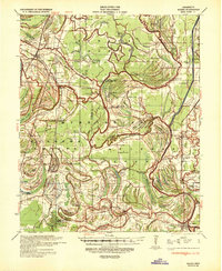 1939 Marks1943 Print · USGSThe Mississippi Delta era is preserved here just before the war, showing a landscape defined by the Coldwater River and the Yazoo and Mississippi Valley RR. Genealogists can trace local roots at Swan Lake College, Belen, and Strangers Rest Ch.
 - 1948 Map of Helena
 1948 Helena1948 Print · USGSEastern Arkansas and the Mississippi Delta are captured here just after the war, showing a landscape defined by its great rivers and rail lines. Genealogists can trace family locations near Bemis Plantation, Helena, and smaller rail stops like Wheatley and Moro.
 - 1950 Map of Helena
 1950 Helena1950 Print · USGSMid-century Phillips County and the surrounding Delta region are shown at a peak of rail and river commerce. Genealogists and historians can trace family locations through numerous rural communities like Old Austin, Cotton Plant, and West Helena, or follow the routes of the Missouri Pacific RR across Grand Prairie.2 unique versions available
 - 1955 Map of Clayton
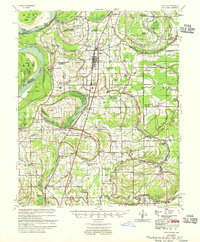 1955 Clayton1955 Print · USGSTunica County and the Mississippi Delta at mid-century reveal a dense network of river-town life and rail-line commerce. Researchers can trace family roots through numerous church and school sites like Shady Grove Ch Sch & Cem, Reed Normal Sch, and Dundee Sch.2 unique versions available
 - 1955 Map of Helena, 1967 Print
 1955 Helena1967 Print · USGSThe Arkansas Delta and Mississippi floodplains are captured here in the mid-fifties, during a period of expanding flood control and rail commerce. Researchers can trace the extensive Chicago Rock Island and Pacific RR lines and locate sites like the Arkansas State College Experimental Rice Farm or Friars Point.2 unique versions available
 - 1959 Map of Helena
 1959 Helena1959 Print · USGSThe Arkansas and Mississippi Delta regions are captured here in the late fifties, showing a landscape defined by the Mississippi River and the Grand Prairie. Genealogists and researchers can trace the rail networks of the Illinois Central RR and locate community landmarks like Helena and the White River National Wildlife Refuge.
Showing maps 1-25 of 120
Top cities of Quitman County
Frequently asked questions
- What are the different types of historical maps available for Quitman County?
- What is the oldest map of Quitman County?
- Where can I purchase historical maps of Quitman County for my home or office?
- Where can I download high-res historical maps of Quitman County?
- Are there historical topographic maps available for Quitman County?
- Is there historical aerial imagery available for Quitman County?
- Where are historical maps of Quitman County sourced from?