Old Maps of Eureka, Mississippi
Explore 12 old maps of Eureka, spanning from 1953 to today. These high-resolution historic maps reveal how streets, neighborhoods, landmarks, and natural features evolved over time — perfect for genealogy, metal detecting, research, and local history exploration.
What you can do with these maps:
- See how Eureka changed over time: Compare historical maps to modern-day views to trace roads, homesites, rail lines & more.
- View detailed metadata: Each map includes creators, publishers, year, scale, and archive source.
- Overlay maps with satellite & LiDAR: Visualize the past alongside modern tools to explore terrain & human change.
- Trusted historical sources: Maps sourced from the USGS, Library of Congress, and other archives.
- Access maps your way: View online, download high-res files, or order prints for personal or research use.
Start exploring old maps of Eureka to uncover forgotten places, hidden landmarks, and the deep history beneath your feet.
Eureka, MS maps
(12)- 1953 Map of Meridian, 1966 Print
 1953 Meridian1966 Print · USGSEast Central Mississippi and the Alabama borderlands are captured here during a period of steady growth and infrastructure expansion. Genealogists and historians can trace rail-town development along the Gulf Mobile & Ohio Railroad and find early settlements like Scooba, Pelahatchie, and De Kalb.2 unique versions available
 - 1957 Map of Meridian
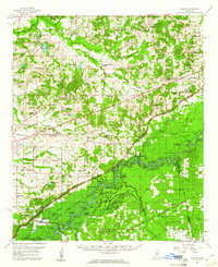
 1957 Meridian1957 Print · USGSEast Central Mississippi and parts of Western Alabama come alive in the mid-1950s, centered on the transit hub of Meridian. Researchers can trace old rail lines like the Illinois Central and find historic sites such as the Choctaw Indian Reservation and Roosevelt State Park.
 - 1960 Map of Sharon, 1961 Print
 1960 Sharon1961 Print · USGSMadison County in the early sixties sits at a crossroads as the Pearl River Valley Reservoir begins to take shape. Genealogists and local historians can trace rural roots through landmarks like Zion Chapel Cem, the Sacred Heart Mission, and small hubs like Farmhaven.2 unique versions available
 - 1965 Map of Meridian
 1965 Meridian1965 Print · USGSEast Mississippi and West Alabama are mapped here in the mid-sixties as the region's modern highway and reservoir systems began to take shape. Researchers can trace rural lineages through local landmarks like Prince Chapel and Tuscahoma Landing, or follow the historic Gulf Mobile & Ohio rail lines.
 - 1984 Map of Carthage
 1984 Carthage1984 Print · USGSLeake and Neshoba counties in the mid-1980s showcase a transition from the Government Hills to the dense Bienville National Forest. Genealogists and researchers can trace the historic Natchez Trace Parkway and local settlements like Plattsburg and Williamsville.
 - 1988 Map of Sharon SE, 1989 Print
 1988 Sharon SE1989 Print · USGSThe borderlands of Madison, Rankin, and Scott Counties are captured in the late eighties as the Pearl River basin remained a mosaic of oxbow lakes and wetlands. Trace family roots at Sand Hill Ch, Lone Pine Ch, or Pisgah Cem while exploring the corridor of the Old Natzhez Trace Parkway.
 - 1994 Map of Carthage
 1994 Carthage1994 Print · USGSCentral Mississippi in the mid-nineties is a region of dense river bottoms and historic travel ways. Genealogists can trace family names and small-town roots across the Choctaw Indian Reservation or follow the path of the Natchez Trace Parkway past Carthage and Walnut Grove.
 - 2012 Map of Sharon SE, 2012 Print
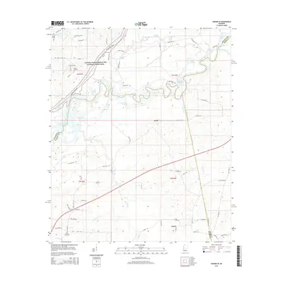
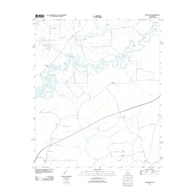 2012 Sharon SE2012 Print · USGSCovers Eureka, including Ratliff, Rankin County, and other nearby areas
 - 2015 Map of Sharon SE, 2015 Print
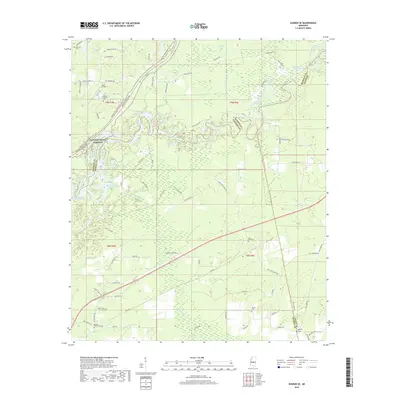
 2015 Sharon SE2015 Print · USGSCovers Eureka, including Ratliff, Rankin County, and other nearby areas
 - 2018 Map of Sharon SE, 2018 Print
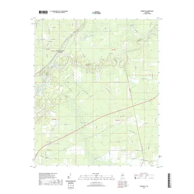
 2018 Sharon SE2018 Print · USGSCovers Eureka, including Ratliff, Rankin County, and other nearby areas
 - 2020 Map of Sharon SE, 2020 Print
 2020 Sharon SE2020 Print · USGSCovers Eureka, including Ratliff, Rankin County, and other nearby areas
 - 2024 Map of Sharon SE, 2024 Print
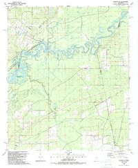
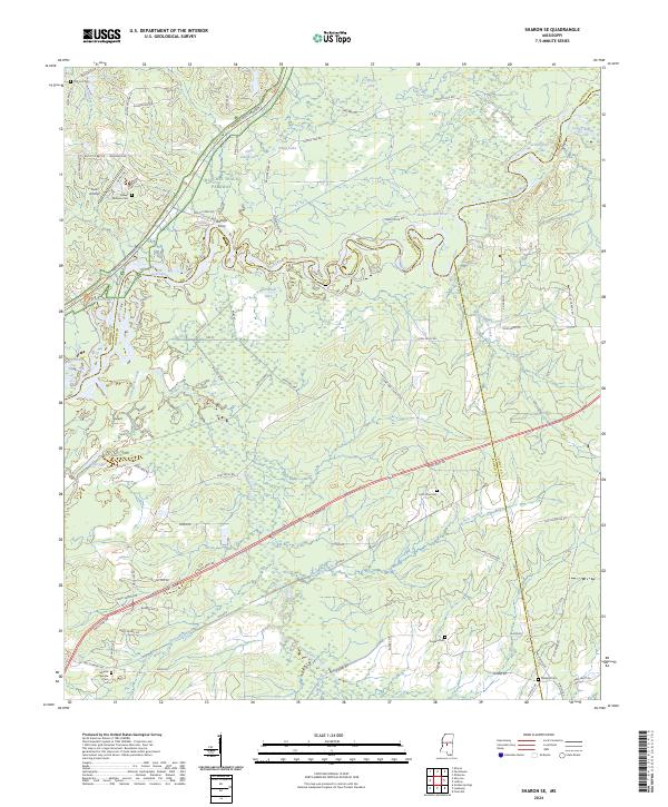 2024 Sharon SE2024 Print · USGSThe intersection of the Pearl River and the Natchez Trace in the early 2020s reveals a landscape shaped by water and tradition. Genealogists can locate family sites at Old Iron Cem or Eureka Cem while tracing the historic path of Ratliffs Ferry.
End of results
Showing maps 1-12 of 12
Top cities near Eureka
- Brandon historical maps
- Canton historical maps
- Flowood historical maps
- Morton historical maps
- Pelahatchie historical maps
- Lena historical maps
Frequently asked questions
- What are the different types of historical maps available for Eureka?
- What is the oldest map of Eureka?
- Where can I purchase historical maps of Eureka for my home or office?
- Where can I download high-res historical maps of Eureka?
- Are there historical topographic maps available for Eureka?
- Is there historical aerial imagery available for Eureka?
- Where are historical maps of Eureka sourced from?