Old Maps of Whitehead, Mississippi
Explore 14 old maps of Whitehead, spanning from 1931 to today. These high-resolution historic maps reveal how streets, neighborhoods, landmarks, and natural features evolved over time — perfect for genealogy, metal detecting, research, and local history exploration.
What you can do with these maps:
- See how Whitehead changed over time: Compare historical maps to modern-day views to trace roads, homesites, rail lines & more.
- View detailed metadata: Each map includes creators, publishers, year, scale, and archive source.
- Overlay maps with satellite & LiDAR: Visualize the past alongside modern tools to explore terrain & human change.
- Trusted historical sources: Maps sourced from the USGS, Library of Congress, and other archives.
- Access maps your way: View online, download high-res files, or order prints for personal or research use.
Start exploring old maps of Whitehead to uncover forgotten places, hidden landmarks, and the deep history beneath your feet.
Whitehead, MS maps
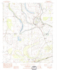
(14)- 1931 Map of Sumner
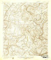 1931 Sumner1931 Print · USGSTallahatchie County in the early thirties is captured here as a landscape of cotton fields and bayous connected by the Yazoo and Mississippi Valley Railroad. Researchers can locate community centers like Glendora and Sumner, or trace family ties to the Brooks-Rosenwald Sch and Indian Mounds.4 unique versions available
 - 1935 Map of Sumner
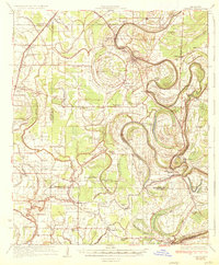 1935 Sumner1935 Print · USGSThe Mississippi Delta's intricate river bends and rail towns are captured here in the mid-1930s. Family historians can trace numerous rural sites like Brooks Rosenwald Sch, the State Reservation at Parchman, and the town of Glendora.2 unique versions available
 - 1939 Map of Sumner, 1943 Print
 1939 Sumner1943 Print · USGSTallahatchie County in the late thirties is a landscape of winding river bends and Delta rail towns like Sumner and Glendora. Genealogists and historians can trace numerous rural landmarks, including the Brooks Rosenwald Sch and the ancient Indian Mounds.
 - 1953 Map of Greenwood, 1966 Print
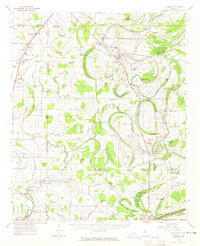
 1953 Greenwood1966 Print · USGSThe Mississippi Delta in the mid-fifties is captured here as a thriving network of river towns, railroads, and oxbow lakes. Researchers can trace the legacy of the Illinois Central Railroad and locate landmarks like the State Penal Farm and Greenville Air Force Base.5 unique versions available
 - 1956 Map of Greenwood
 1956 Greenwood1956 Print · USGSThe Mississippi Delta in the mid-fifties is captured here during a period of significant military and agricultural activity. Researchers can trace the rail lines of the Illinois Central RR, find the Greenville Air Force Base, or locate the State Penal Farm.
 - 1962 Map of Sumner, 1965 Print
 1962 Sumner1965 Print · USGSThe Mississippi Delta in the early sixties remains a landscape of bayous and rails, centered on the Tallahatchie River and its cut-offs. Genealogists can trace family roots through numerous local landmarks like Parchman, Glendora, and the Frierson Chapel.2 unique versions available
 - 1974 Map of Sumner SE, 1975 Print
 1974 Sumner SE1975 Print · USGSThe Mississippi Delta landscape comes into focus in the mid-1970s, showing the intricate agricultural patterns of Tallahatchie County. Researchers can trace the river's winding path past Glendora and Minter City to see how the land was farmed.
 - 1983 Map of Greenwood
 1983 Greenwood1983 Print · USGSThe Mississippi Delta in the early eighties shows a landscape of rail-connected towns and vast river systems. Genealogists and historians can trace family roots in towns like Mound Bayou, Ruleville, and the grounds of Mississippi Valley State University.
 - 1983 Map of Glendora, 1984 Print
 1983 Glendora1984 Print · USGSThe Tallahatchie River delta in the early 1980s is shown here in detail, from Glendora to Minter City. Researchers can locate Black Bayou Sch, St Marys Cem, and the Illinois Central Gulf rail line.
 - 2012 Map of Glendora, 2012 Print
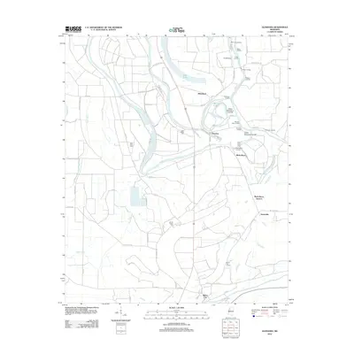 2012 Glendora2012 Print · USGSCovers Whitehead, including Glendora, Black Bayou Junction, and other nearby areas
 - 2015 Map of Glendora, 2015 Print
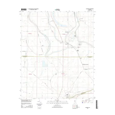 2015 Glendora2015 Print · USGSCovers Whitehead, including Glendora, Black Bayou Junction, and other nearby areas
 - 2018 Map of Glendora, 2018 Print
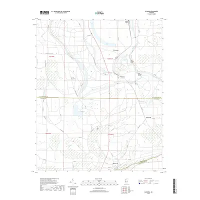 2018 Glendora2018 Print · USGSCovers Whitehead, including Glendora, Black Bayou Junction, and other nearby areas
 - 2020 Map of Glendora, 2020 Print
 2020 Glendora2020 Print · USGSCovers Whitehead, including Glendora, Black Bayou Junction, and other nearby areas
 - 2024 Map of Glendora, 2024 Print
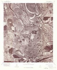
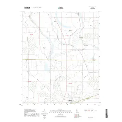
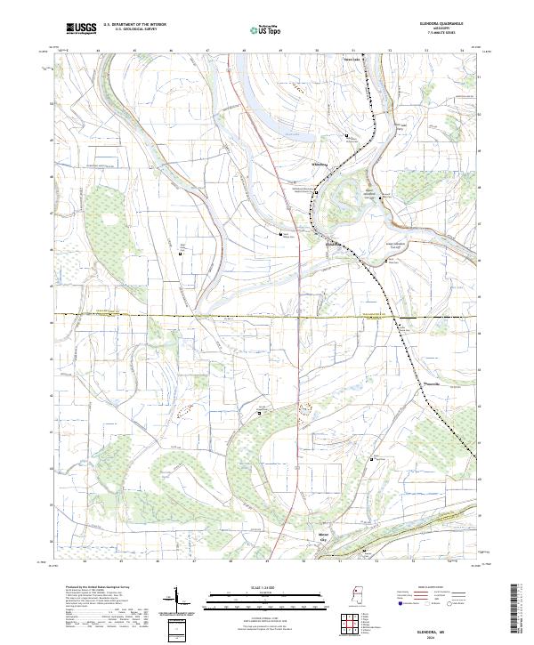 2024 Glendora2024 Print · USGSTallahatchie and Leflore Counties come together in this delta region during the early 2020s, where river bends and bayous dictate the layout of rural life. Family historians can locate several remote burial grounds like Jones Grove Cem or trace the river near Swan Lake Ferry.
End of results
Showing maps 1-14 of 14
Top cities near Whitehead
- Drew historical maps
- Tutwiler historical maps
- Webb historical maps
- Sumner historical maps
- Schlater historical maps
- Glendora historical maps
See more
Frequently asked questions
- What are the different types of historical maps available for Whitehead?
- What is the oldest map of Whitehead?
- Where can I purchase historical maps of Whitehead for my home or office?
- Where can I download high-res historical maps of Whitehead?
- Are there historical topographic maps available for Whitehead?
- Is there historical aerial imagery available for Whitehead?
- Where are historical maps of Whitehead sourced from?