Old Maps of Paden, Mississippi for Genealogy
Trace your family roots with 20 historic maps of Paden. These high-res maps reveal old neighborhoods, homesites, landmarks, and streets — helping you uncover where your ancestors lived and how the area evolved over time.
- Explore historic neighborhoods: Identify where your relatives may have lived in the 1800s or 1900s.
- Compare maps over time: Trace the changes in streets, buildings, and landmarks for multi-generational research.
- Perfect for genealogy & ancestry research: Used by family historians and researchers to map out lineage and migration.
These maps are an incredible resource for exploring your personal connection to Paden's past.
Paden, MS maps
(20)- 1935 Map of Holcut
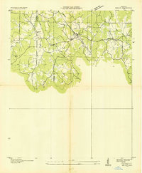 1935 Holcut1935 Print · USGSNortheast Mississippi was undergoing significant federal study in the mid-1930s as the railroad and river systems defined local life. Researchers can locate the community centers of the day, from the town of Holcut to rural landmarks like Lebanon Ch and Liberty Sch.
 - 1936 Map of Tishomingo
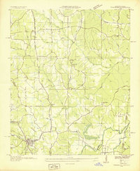 1936 Tishomingo1936 Print · USGSThe Tennessee-Mississippi borderlands come alive in the mid-1930s as the Natchez Trace and Illinois Central railroad define the region's movement. Researchers can trace rural lineages through local landmarks like Nunley Cem, Bogg Chapel, and the Rutledge Salem Sch.
 - 1950 Map of Paden, 1954 Print
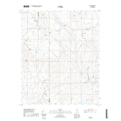
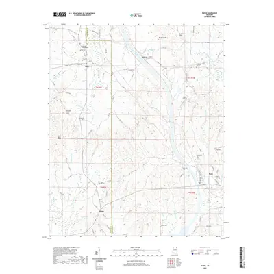
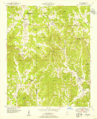 1950 Paden1954 Print · USGSIn the Tishomingo hills during the early 1950s, the rural life of northeast Mississippi centered on rail sidings and remote creek crossings. Researchers can locate family landmarks like Stricklen Cem, follow the Illinois Central through Paden, and trace the historic Natchez Trace.3 unique versions available
 - 1950 Map of Tishomingo, 1974 Print
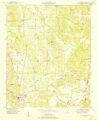
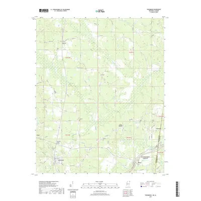
 1950 Tishomingo1974 Print · USGSTishomingo and the surrounding hill country of northeast Mississippi are captured here in the mid-twentieth century. Researchers can trace the development of the Natchez Trace Parkway and locate rural landmarks like Boggs Chapel, Petertown, and the Illinois Central rail line.3 unique versions available
 - 1951 Map of Tishomingo
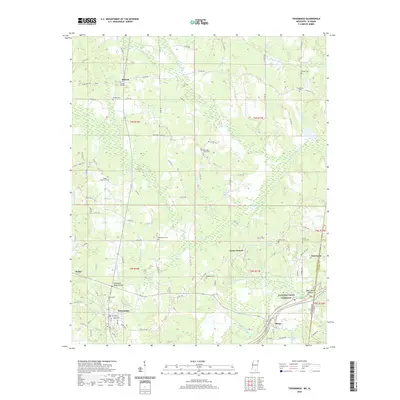
 1951 Tishomingo1951 Print · USGSThe Tennessee and Mississippi borderland comes into focus in the early 1950s as the Natchez Trace winds through the hills of Tishomingo. Researchers can trace the Illinois Central rail line, find the Indian mound near the state line, or locate family sites like Hodges Cem and Boggs Chapel.
 - 1956 Map of Tupelo, 1967 Print
 1956 Tupelo1967 Print · USGSNortheast Mississippi and parts of Tennessee and Alabama are shown here during the mid-fifties, a time of major reservoir construction and forestry management. Researchers can trace the St Louis-San Francisco RR through Tupelo or locate historic sites like Tishomingo State Park and the University.2 unique versions available
 - 1958 Map of Tupelo
 1958 Tupelo1958 Print · USGSNortheast Mississippi and neighboring Alabama and Tennessee appear here during the late fifties as a region defined by new reservoirs and historic rail lines. Genealogists can trace family locations near Sardis Lake, Woodall Mountain, and the St Louis-San Francisco Ry.
 - 1984 Map of Corinth
 1984 Corinth1984 Print · USGSNortheast Mississippi and its borders with Alabama and Tennessee are captured here in the mid-1980s, showcasing a landscape of rail-connected towns and ridge-top settlements. Researchers can trace the path of the Natchez Trace Parkway or locate family-named landmarks near Biggersville, Kossuth, and the historic Tennessee Divide.
 - 1984 Map of Tupelo
 1984 Tupelo1984 Print · USGSNorth Mississippi in the 1980s is defined by its massive river basin reservoirs and the growing regional hubs of Tupelo and Oxford. Researchers can trace the legacy of the Pontotoc Ridge, find the University of Mississippi, and map early Interstate corridors near Sardis Lake.3 unique versions available
 - 1994 Map of Corinth
 1994 Corinth1994 Print · USGSNortheast Mississippi and the Tennessee borderlands are captured in the mid-1990s as the region's modern industrial and recreational landscape took shape. Genealogists and historians can trace rail-to-river connections through Corinth, the old courthouse at Jacinto, and the route of the Natchez Trace Parkway.
 - 2012 Map of Paden, 2012 Print
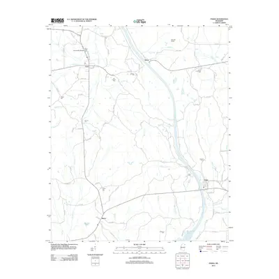 2012 Paden2012 Print · USGSCovers Paden, including Holcut, Burton, and other nearby areas
 - 2012 Map of Tishomingo, 2012 Print
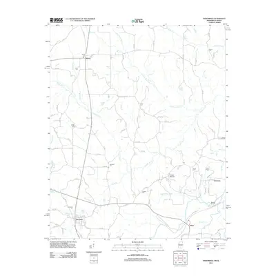 2012 Tishomingo2012 Print · USGSCovers Paden, including Tishomingo, Midway, and other nearby areas
 - 2015 Map of Paden, 2015 Print
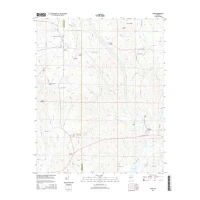 2015 Paden2015 Print · USGSCovers Paden, including Holcut, Burton, and other nearby areas
 - 2015 Map of Tishomingo, 2015 Print
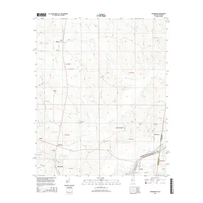 2015 Tishomingo2015 Print · USGSCovers Paden, including Tishomingo, Midway, and other nearby areas
 - 2018 Map of Paden, 2018 Print
 2018 Paden2018 Print · USGSCovers Paden, including Holcut, Burton, and other nearby areas
 - 2018 Map of Tishomingo, 2018 Print
 2018 Tishomingo2018 Print · USGSCovers Paden, including Tishomingo, Midway, and other nearby areas
 - 2020 Map of Tishomingo, 2020 Print
 2020 Tishomingo2020 Print · USGSCovers Paden, including Tishomingo, Midway, and other nearby areas
 - 2021 Map of Paden, 2021 Print
 2021 Paden2021 Print · USGSCovers Paden, including Holcut, Burton, and other nearby areas
 - 2024 Map of Paden, 2024 Print
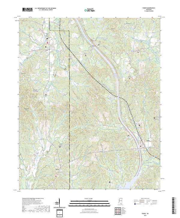 2024 Paden2024 Print · USGSThe Tishomingo County hill country comes into focus in this recent survey, showcasing the monumental Tennessee Tombigbee Waterway near Paden. Researchers can locate several family burial grounds like the Callicot Family Cem and the Stephens Cem near Bay Springs Lake.
 - 2024 Map of Tishomingo, 2024 Print
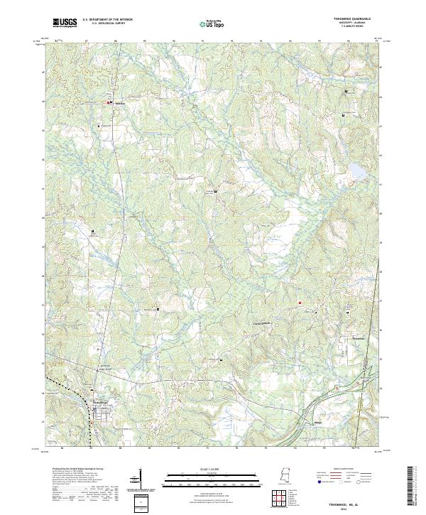 2024 Tishomingo2024 Print · USGSTishomingo County at the Mississippi and Alabama border remains a landscape of historic crossroads and winding creeks. Genealogists can locate family landmarks such as Nunley Cem, Bethlehem Cem, and the community of Petertown near the state line.
End of results
Showing maps 1-20 of 20
Top cities near Paden
- Red Bay historical maps
- Iuka historical maps
- Belmont historical maps
- Burnsville historical maps
- Tishomingo historical maps
- Marietta historical maps
See more
Frequently asked questions
- What are the different types of historical maps available for Paden?
- What is the oldest map of Paden?
- Where can I purchase historical maps of Paden for my home or office?
- Where can I download high-res historical maps of Paden?
- Are there historical topographic maps available for Paden?
- Is there historical aerial imagery available for Paden?
- Where are historical maps of Paden sourced from?