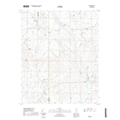
2018 Map of Paden
USGS Topo · Published 2018About this map
Cairo and Holcut anchor the northern landscape of this Tishomingo and Prentiss County border region. The terrain is defined by the Tennessee Valley Divide, where water flows between systems like Yellow Creek and Mackeys Creek. This geography created a network of ridges and knobs, including Odom Hill, Riddle Wind Ridge, and Barnett Knob, which influenced early road patterns and settlement locations. The area is dense with genealogical markers, featuring numerous country cemeteries such as South Crossroads Cemetery, Forked Oak Cemetery, and New Lebanon Cemetery. To the south, the settlement of Burton sits near the edges of Burton Lake and the significant reach of Bay Springs Lake. The map details the rural character of these Northeast Mississippi communities, connected by a web of county roads that navigate the complex drainage basins of Cripple Deer and Hurricane Creek.
Find a feature on this map
113 named features on this map. Tap any name to fly to it.
Don’t see what you’re looking for? This feature index may not catch every label — zoom into the map to look around manually.
Map Details
Editions of this 2018 Paden Map
This is the sole edition of this map. No revisions or reprints were ever made.
Other maps of this area

1911 · Iuka
USGS Topo · 1:48,000

1914 · Iuka
USGS Topo · 1:62,500

1935 · Holcut
USGS Topo · 1:24,000

1935 · Iuka
USGS Topo · 1:24,000

1935 · Leedy
USGS Topo · 1:24,000

1935 · Glens
USGS Topo · 1:24,000

1936 · Belmont
USGS Topo · 1:24,000

1936 · Tishomingo
USGS Topo · 1:24,000

1950 · Paden
USGS Topo · 1:24,000
1950 · Burnsville
USGS Topo · 1:24,000