Old Maps of Prentiss County, Mississippi
Explore 109 old maps of Prentiss County, spanning from 1921 to today. These high-resolution historic maps reveal how streets, neighborhoods, landmarks, and natural features evolved over time — perfect for genealogy, metal detecting, research, and local history exploration.
What you can do with these maps:
- See how Prentiss County changed over time: Compare historical maps to modern-day views to trace roads, homesites, rail lines & more.
- View detailed metadata: Each map includes creators, publishers, year, scale, and archive source.
- Overlay maps with satellite & LiDAR: Visualize the past alongside modern tools to explore terrain & human change.
- Trusted historical sources: Maps sourced from the USGS, Library of Congress, and other archives.
- Access maps your way: View online, download high-res files, or order prints for personal or research use.
Start exploring old maps of Prentiss County to uncover forgotten places, hidden landmarks, and the deep history beneath your feet.
Prentiss County, MS maps
(109)- 1921 Map of Booneville
 1921 Booneville1921 Print · USGSNortheast Mississippi was a landscape of tightly-knit rural communities in the early 1920s. Researchers can trace dozens of family-named schools and churches like Bynum School, Gaston Church, and Jumpertown along the Mobile and Ohio RR.2 unique versions available
 - 1921 Map of Tupelo
 1921 Tupelo1921 Print · USGSNortheast Mississippi in the early twenties centers on the rail hub at Tupelo as it begins to connect with the fledgling Bankhead Highway system. Genealogists and local historians can trace rural family life through numerous landmarks like Campbelltown Cemetery, Clayton Store, and the Pratts School.2 unique versions available
 - 1922 Map of Booneville
 1922 Booneville1922 Print · USGSPrentiss County during the early 1920s is centered on the Mobile and Ohio RR line connecting Booneville and Baldwyn. Family historians can trace local landmarks like Crossroads Church, Jumper School, and Blackland across this detailed rural landscape.
 - 1923 Map of Tupelo
 1923 Tupelo1923 Print · USGSLee County in the early twenties is a landscape of rural schoolhouses and rail junctions centered on the growing hub of Tupelo. Researchers can trace old family footprints at Campbelltown Cemetery or locate vanished sites like Kirks Gin and Beech Springs School.2 unique versions available
 - 1935 Map of Holcut
 1935 Holcut1935 Print · USGSNortheast Mississippi was undergoing significant federal study in the mid-1930s as the railroad and river systems defined local life. Researchers can locate the community centers of the day, from the town of Holcut to rural landmarks like Lebanon Ch and Liberty Sch.
 - 1935 Map of Leedy
 1935 Leedy1935 Print · USGSIn the mid-1930s, the Tishomingo County countryside was a landscape of small rail spurs and country churches centered around Burnsville. Researchers can locate vanished rural landmarks such as Rolands Mill Sch, Opossum Trot Cem, and the Illinois Central rail line.
 - 1935 Map of Glens
 1935 Glens1935 Print · USGSNortheastern Mississippi at the height of the mid-1930s reveals a landscape defined by crossing rail lines and rural church communities. Genealogists can trace family roots through sites like Cooks Chapel, the Glen PO, and the Zion Sch near the Alcorn Co Prentiss Co line.
 - 1950 Map of Corinth, 1952 Print
 1950 Corinth1952 Print · USGSAlcorn County's rail-and-river landscape comes alive in the early fifties as Corinth expands at the junction of three major railroads. Genealogists can trace family roots through dozens of rural landmarks like Wesley Chapel, Kossuth, and the National Cemetery.3 unique versions available
 - 1950 Map of Paden, 1954 Print
 1950 Paden1954 Print · USGSIn the Tishomingo hills during the early 1950s, the rural life of northeast Mississippi centered on rail sidings and remote creek crossings. Researchers can locate family landmarks like Stricklen Cem, follow the Illinois Central through Paden, and trace the historic Natchez Trace.3 unique versions available
 - 1950 Map of Burnsville, 1954 Print
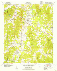 1950 Burnsville1954 Print · USGSTishomingo County at mid-century reveals a landscape of rural schools, family cemeteries, and critical rail junctions during the post-war era. Researchers can trace ancestral roots at Opossum Trot Cem or locate the old Gravel Hill School and Hazard Switch.3 unique versions available
 - 1950 Map of Glens, 1954 Print
 1950 Glens1954 Print · USGSThe crossroads at Jacinto and the rail stop at Glens anchor this mid-century survey of the Alcorn and Prentiss county border. Genealogists can locate family landmarks like Piney Grove Cem and Macedonia Sch.3 unique versions available
 - 1950 Map of Altitude, 1954 Print
 1950 Altitude1954 Print · USGSThe hills of northern Prentiss County come into focus during the early fifties, showing a rural landscape of ridge-top roads and creek-side settlements. Researchers can locate many family landmarks, including Jones Chapel, the New Candler School, and the Blue Hill Lookout Tower.3 unique versions available
 - 1956 Map of Tupelo, 1967 Print
 1956 Tupelo1967 Print · USGSNortheast Mississippi and parts of Tennessee and Alabama are shown here during the mid-fifties, a time of major reservoir construction and forestry management. Researchers can trace the St Louis-San Francisco RR through Tupelo or locate historic sites like Tishomingo State Park and the University.2 unique versions available
 - 1958 Map of Tupelo
 1958 Tupelo1958 Print · USGSNortheast Mississippi and neighboring Alabama and Tennessee appear here during the late fifties as a region defined by new reservoirs and historic rail lines. Genealogists can trace family locations near Sardis Lake, Woodall Mountain, and the St Louis-San Francisco Ry.
 - 1965 Map of Paden SE, 1966 Print
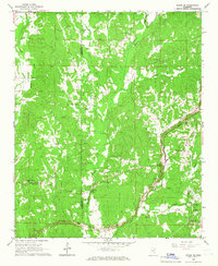 1965 Paden SE1966 Print · USGSThe Prentiss and Tishomingo county line area appears here in the mid-sixties, dominated by rural creek bottoms and family-named ridges. Trace the path of the Natchez Trace Parkway while it was Under Construction near Trollinger Cem and Mt Zion Ch.
 - 1965 Map of Fulton NE, 1966 Print
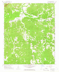 1965 Fulton NE1966 Print · USGSItawamba County and the surrounding tri-county area are shown in the mid-1960s as the modern parkway system began to reshape the landscape. Genealogists can locate numerous rural landmarks such as Moores Mill, Old Bethel Ch, and the Walker House Cem Ch.
 - 1965 Map of Marietta, 1966 Print
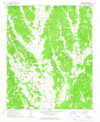 1965 Marietta1966 Print · USGSNorth Mississippi's rural landscape comes into focus during the mid-sixties, centered on the Marietta community and the Natchez Trace Parkway. Researchers can trace old family sites and local landmarks like Hobo Station, Zions Rest Ch, and the Marietta Lookout Tower.2 unique versions available
 - 1965 Map of Kirkville, 1966 Print
 1965 Kirkville1966 Print · USGSNortheast Mississippi rural life and early parkway development are captured here in the mid-sixties. Trace family history through Kirkville and Sandy Springs, or find old community sites like Houston Sch and Gilmers Chapel.2 unique versions available
 - 1972 Map of Jumpertown, 1975 Print
 1972 Jumpertown1975 Print · USGSNortheast Mississippi’s upland border country is documented here in the early 1970s, showing the small communities and rural churches across the Tippah Hills. Genealogists can locate family landmarks like Morton Chapel Cem, Jumpertown Ch, and the outlying settlement of Blackland.
 - 1973 Map of Wheeler, 1975 Print
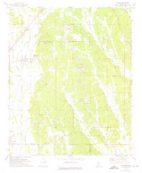 1973 Wheeler1975 Print · USGSNortheast Mississippi in the early seventies shows a landscape of deep-rooted rural communities and active rail lines. Researchers can trace family history through numerous landmarks like Hodges Chapel Cem, Meadow Creek Ch, and the small settlement at Wheeler.
 - 1973 Map of Baldwyn, 1975 Print
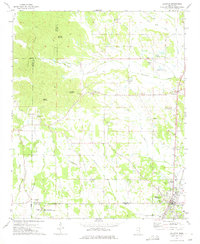 1973 Baldwyn1975 Print · USGSNorthern Mississippi's hill country and rail corridors are detailed in the early seventies, centered on the historic crossroads at Baldwyn. Researchers can trace the Brice's Cross Roads National Battlefield Site or find old family landmarks like Oak Hill Ch and Sheppard Cem.2 unique versions available
 - 1973 Map of Booneville, 1975 Print
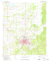 1973 Booneville1975 Print · USGSBooneville and the surrounding Prentiss County countryside are captured here in the early seventies as the region's modern infrastructure took shape. Local historians can trace the development of the Illinois Central Gulf rail line and locate landmarks like Northeast Mississippi Jr College or the Oak Hill Cem.
 - 1973 Map of Ratliff, 1975 Print
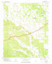 1973 Ratliff1975 Print · USGSNortheast Mississippi was a landscape of quiet crossroads and historic creek bottoms in the early seventies. Genealogists can trace family names and local landmarks like Ratliff, the Peterson Cem, and the Natchez Trace Parkway.
 - 1982 Map of Kossuth South, 1983 Print
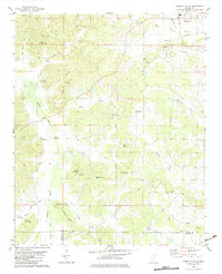 1982 Kossuth South1983 Print · USGSAlcorn County in the early eighties remains a landscape of small rural settlements and family-named ridges. Researchers can locate community anchors like Kossuth, trace the Hatchie River crossings, and find genealogy-rich sites like Antioch Ch No 1 and Pleasant Grove Cem.
 - 1982 Map of Rienzi, 1983 Print
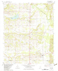 1982 Rienzi1983 Print · USGSNortheast Mississippi’s rural landscape comes into focus during the late seventies, showing the rail-and-creek networks of the Alcorn and Prentiss county line. Genealogists can locate family burial sites at Stockade Cem and Rienzi Cem or trace the early settlement of Biggersville.
Showing maps 1-25 of 109
Top cities of Prentiss County
Frequently asked questions
- What are the different types of historical maps available for Prentiss County?
- What is the oldest map of Prentiss County?
- Where can I purchase historical maps of Prentiss County for my home or office?
- Where can I download high-res historical maps of Prentiss County?
- Are there historical topographic maps available for Prentiss County?
- Is there historical aerial imagery available for Prentiss County?
- Where are historical maps of Prentiss County sourced from?