1950s Maps of Prentiss County, Mississippi
Explore 7 historic maps of Prentiss County from the 1950s. These maps offer a rare glimpse into what life looked like during the 1950s — showing old roads, neighborhoods, homes, and landmarks that have changed or disappeared over time.
Whether you're researching your family's past, planning a metal detecting trip, or studying how Prentiss County's landscape evolved across the 1950s, these high-resolution maps are a powerful tool for exploring the history of this region.
- Focus on a specific era: All maps on this page are from the 1950s, giving you a focused view of this time period.
- See what’s changed: Compare century-old streets, trails, and buildings to today's modern landscape using overlays and satellite layers.
- Research with precision: Use these maps for genealogy, historical research, land use analysis, or educational projects.
- View, download, or print: Maps are fully viewable online in high resolution, and can be downloaded or printed for your own records.
Start exploring Prentiss County's history through authentic maps from the 1950s. This is your window into the past.
Prentiss County, MS maps
(7)- 1950 Map of Corinth, 1952 Print
 1950 Corinth1952 Print · USGSAlcorn County's rail-and-river landscape comes alive in the early fifties as Corinth expands at the junction of three major railroads. Genealogists can trace family roots through dozens of rural landmarks like Wesley Chapel, Kossuth, and the National Cemetery.3 unique versions available
 - 1950 Map of Paden, 1954 Print
 1950 Paden1954 Print · USGSIn the Tishomingo hills during the early 1950s, the rural life of northeast Mississippi centered on rail sidings and remote creek crossings. Researchers can locate family landmarks like Stricklen Cem, follow the Illinois Central through Paden, and trace the historic Natchez Trace.3 unique versions available
 - 1950 Map of Burnsville, 1954 Print
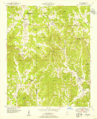
 1950 Burnsville1954 Print · USGSTishomingo County at mid-century reveals a landscape of rural schools, family cemeteries, and critical rail junctions during the post-war era. Researchers can trace ancestral roots at Opossum Trot Cem or locate the old Gravel Hill School and Hazard Switch.3 unique versions available
 - 1950 Map of Glens, 1954 Print
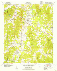
 1950 Glens1954 Print · USGSThe crossroads at Jacinto and the rail stop at Glens anchor this mid-century survey of the Alcorn and Prentiss county border. Genealogists can locate family landmarks like Piney Grove Cem and Macedonia Sch.3 unique versions available
 - 1950 Map of Altitude, 1954 Print
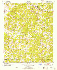
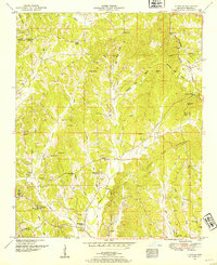 1950 Altitude1954 Print · USGSThe hills of northern Prentiss County come into focus during the early fifties, showing a rural landscape of ridge-top roads and creek-side settlements. Researchers can locate many family landmarks, including Jones Chapel, the New Candler School, and the Blue Hill Lookout Tower.3 unique versions available
 - 1956 Map of Tupelo, 1967 Print
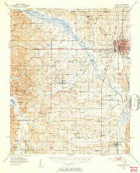
 1956 Tupelo1967 Print · USGSNortheast Mississippi and parts of Tennessee and Alabama are shown here during the mid-fifties, a time of major reservoir construction and forestry management. Researchers can trace the St Louis-San Francisco RR through Tupelo or locate historic sites like Tishomingo State Park and the University.2 unique versions available
 - 1958 Map of Tupelo
 1958 Tupelo1958 Print · USGSNortheast Mississippi and neighboring Alabama and Tennessee appear here during the late fifties as a region defined by new reservoirs and historic rail lines. Genealogists can trace family locations near Sardis Lake, Woodall Mountain, and the St Louis-San Francisco Ry.
End of results
Showing maps 1-7 of 7
Top cities of Prentiss County
Frequently asked questions
- What are the different types of historical maps available for Prentiss County?
- What is the oldest map of Prentiss County?
- Where can I purchase historical maps of Prentiss County for my home or office?
- Where can I download high-res historical maps of Prentiss County?
- Are there historical topographic maps available for Prentiss County?
- Is there historical aerial imagery available for Prentiss County?
- Where are historical maps of Prentiss County sourced from?