1970s Maps of Wayne County, Mississippi
Explore 6 historic maps of Wayne County from the 1970s. These maps offer a rare glimpse into what life looked like during the 1970s — showing old roads, neighborhoods, homes, and landmarks that have changed or disappeared over time.
Whether you're researching your family's past, planning a metal detecting trip, or studying how Wayne County's landscape evolved across the 1970s, these high-resolution maps are a powerful tool for exploring the history of this region.
- Focus on a specific era: All maps on this page are from the 1970s, giving you a focused view of this time period.
- See what’s changed: Compare century-old streets, trails, and buildings to today's modern landscape using overlays and satellite layers.
- Research with precision: Use these maps for genealogy, historical research, land use analysis, or educational projects.
- View, download, or print: Maps are fully viewable online in high resolution, and can be downloaded or printed for your own records.
Start exploring Wayne County's history through authentic maps from the 1970s. This is your window into the past.
Wayne County, MS maps
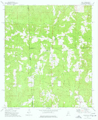
(6)- 1974 Map of State Line, 1977 Print
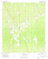 1974 State Line1977 Print · USGSThe Mississippi-Alabama borderlands come into focus in the mid-1970s, showing the vital rail and timber corridor near State Line. Genealogists and local historians can locate rural landmarks like Yellow Pine, the Gilley Cem, and the Milstead Lookout Tower.2 unique versions available
 - 1974 Map of Melvin, 1977 Print
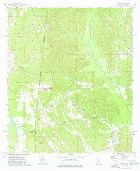 1974 Melvin1977 Print · USGSThe Alabama and Mississippi borderlands come to life in the mid-1970s, showing a landscape defined by old treaty lines and early oil exploration. Genealogists can trace family names at Zion Chapel Cem, Stroud Cem, and rural settlements like Melvin and Eiler.
 - 1974 Map of Copeland, 1977 Print
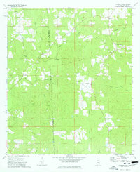 1974 Copeland1977 Print · USGSStraddling the border in the 1970s, this area shows a landscape defined by traditional rural life and historical lines. You can trace the Old Indian Treaty Boundary and locate community anchors like Lewis Chapel and the Zion Rest Cem.3 unique versions available
 - 1974 Map of Isney, 1977 Print
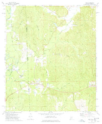 1974 Isney1977 Print · USGSThe Alabama and Mississippi borderlands come to life in the mid-1970s, showing a landscape defined by timber, small farms, and winding waterways. Researchers can trace family sites at Cem Coyt Ch, follow the Old Railroad Grade, or locate the crossroads at Isney.
 - 1974 Map of Aquilla, 1977 Print
 1974 Aquilla1977 Print · USGSThe Alabama-Mississippi borderlands come into focus in the 1970s, revealing a landscape of rural communities and winding creek bottoms. Researchers can trace family history through sites like Old Aquilla Cemetery, Kings Chapel, and the settlement at Shady Grove.2 unique versions available
 - 1978 Map of Melvin, 1987 Print
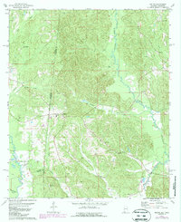 1978 Melvin1987 Print · USGSThe Alabama-Mississippi borderlands come to life in the 1970s, showcasing a landscape defined by traditional rural settlements and early oil exploration. Genealogists can trace family landmarks like Zion Chapel Cem and Donald Ch near the historic Old Indian Treaty Boundary.
End of results
Showing maps 1-6 of 6
Top cities of Wayne County
Frequently asked questions
- What are the different types of historical maps available for Wayne County?
- What is the oldest map of Wayne County?
- Where can I purchase historical maps of Wayne County for my home or office?
- Where can I download high-res historical maps of Wayne County?
- Are there historical topographic maps available for Wayne County?
- Is there historical aerial imagery available for Wayne County?
- Where are historical maps of Wayne County sourced from?