
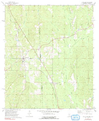
1974 Map of State Line
USGS Topo · Published 1977About this map
The town of State Line anchors this 1970s survey, straddling the border between Mississippi and Alabama where Wayne, Greene, and Washington counties meet. The landscape is defined by the intersection of major transit corridors and natural drainage systems, including the southward-flowing Escatawpa River and the Gulf Mobile and Ohio railroad line. Industrial activity is evident through numerous Gas Wells and a Sandpit dotting the pine-forested terrain. Local life is recorded through a network of rural landmarks, from the Mt Moriah Ch and Union Ch to family-named sites like Gilley Cem. Further south, the timber-dependent economy is signaled by the settlement of Yellow Pine and the Milstead Lookout Tower, positioned to monitor the surrounding woods. The map captures the region's late-century character, balancing small-town rail centers with the ongoing extraction of natural resources.
Find a feature on this map
36 named features on this map. Tap any name to fly to it.
Don’t see what you’re looking for? This feature index may not catch every label — zoom into the map to look around manually.
Map Details
Editions of this 1974 State Line Map
2 editions found
Other maps of this area

1953 · Hattiesburg
USGS Topo · 1:250,000

1958 · Hattiesburg
USGS Topo · 1:250,000

1964 · Knobtown
USGS Topo · 1:24,000

1964 · Clark
USGS Topo · 1:24,000

1964 · Buckatunna
USGS Topo · 1:24,000

1974 · Fruitdale
USGS Topo · 1:24,000

1974 · Millry South
USGS Topo · 1:24,000

1974 · Chatom
USGS Topo · 1:24,000

1974 · Copeland
USGS Topo · 1:24,000

1974 · Vinegar Bend
USGS Topo · 1:24,000