Old Maps of Troy Mills, Missouri for Metal Detecting
Plan your next treasure hunt with 12 historic maps of Troy Mills. Find old homesites, ghost towns, trails, and gathering spots that may be lost to time — perfect for identifying promising metal detecting locations.
- Locate forgotten sites: Uncover places like long-lost settlements, abandoned rail lines, or gathering spots.
- Plan better hunts: Use map overlays combined with LiDAR or satellite views to narrow in on historically rich areas.
- Made for detectorists: Thousands of hobbyists use these maps to discover relics, coins, and hidden history.
Use these historic maps to boost your research and find new opportunities beneath the surface of Troy Mills.
Troy Mills, MO maps
(12)- 1938 Map of Kirksville
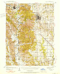 1938 Kirksville1938 Print · USGSAdair and Macon Counties are captured here in the late 1930s, showing a landscape defined by the Chariton River and a dense network of rural schools. Trace family roots at the Grosse P.O. or through numerous landmarks like Sloans Point Sch and Novinger Cem.2 unique versions available
 - 1940 Map of Kirksville
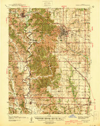 1940 Kirksville1940 Print · USGSAdair County and the city of Kirksville are captured just before the 1940s, showing a landscape defined by crossing railroads and numerous small townships. Genealogists can locate dozens of rural landmarks, from Union Temple Ch to long-gone schoolhouses like Troy Mills Sch and Danforth Sch.
 - 1954 Map of Centerville, 1967 Print
 1954 Centerville1967 Print · USGSThe Iowa-Missouri borderlands at mid-century reveal a landscape shaped by river valleys and the height of the regional rail network. Genealogists and historians can trace the paths of the Wabash railroad and locate old townsites like Mystic, Moulton, and Greentop.3 unique versions available
 - 1957 Map of Centerville
 1957 Centerville1957 Print · USGSThe Iowa-Missouri borderlands in the mid-fifties reveal a landscape of river-valley agriculture and vital rail corridors. Genealogists and historians can trace family-named landmarks and small-town growth in Centerville, Kirksville, and along the Wabash railroad line.
 - 1958 Map of Centerville
 1958 Centerville1958 Print · USGSThe Iowa-Missouri borderlands come into focus during the mid-fifties, showing a landscape defined by river valleys and intersecting rail lines. Genealogists and local historians can trace family roots through dozens of rural hubs like Bloomfield, Unionville, and Corydon.
 - 1974 Map of Kirksville NE, 1976 Print
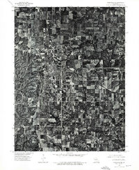 1974 Kirksville NE1976 Print · USGSMissouri's college town of Kirksville is shown in detail during the mid-seventies in this rectified aerial survey. Local historians can trace the exact footprint of residential expansion and agricultural land use as it appeared over forty years ago.
 - 1979 Map of Kirksville
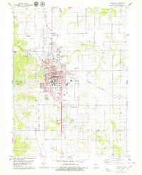 1979 Kirksville1979 Print · USGSKirksville serves as a major regional center in the late seventies, dominated by its university campuses and railroad junctions. Researchers can locate specific local landmarks like Northeast Mo State University, Maple Hill Cem, and Thousand Hills State Park.2 unique versions available
 - 1981 Map of Kirksville, 1982 Print
 1981 Kirksville1982 Print · USGSNortheast Missouri in the early eighties was a landscape of rail-connected trade towns and significant river valleys. Researchers can trace the legacy of medical education at the Kirksville College of Osteopathic Med or locate family roots in Unionville, Edina, and Bible Grove.
 - 2012 Map of Kirksville, 2012 Print
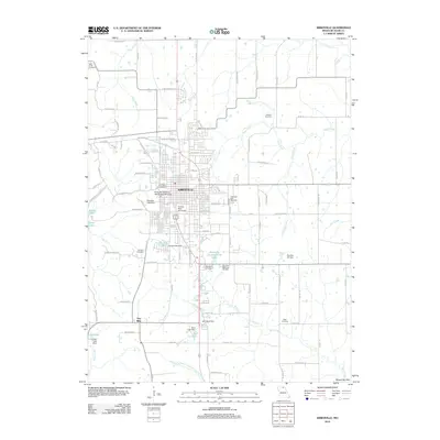 2012 Kirksville2012 Print · USGSCovers Troy Mills, including Kirksville, Adair County, and other nearby areas
 - 2015 Map of Kirksville, 2015 Print
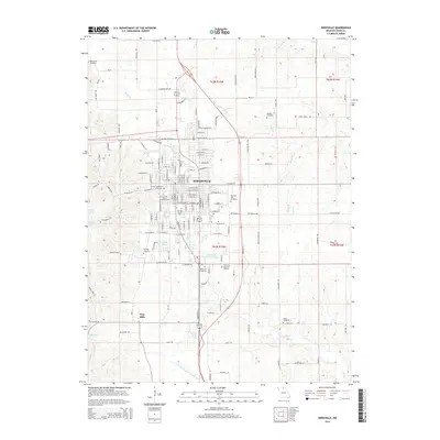 2015 Kirksville2015 Print · USGSCovers Troy Mills, including Kirksville, Adair County, and other nearby areas
 - 2017 Map of Kirksville, 2017 Print
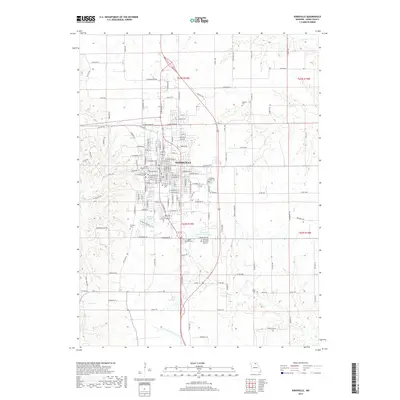 2017 Kirksville2017 Print · USGSCovers Troy Mills, including Kirksville, Adair County, and other nearby areas
 - 2021 Map of Kirksville, 2021 Print
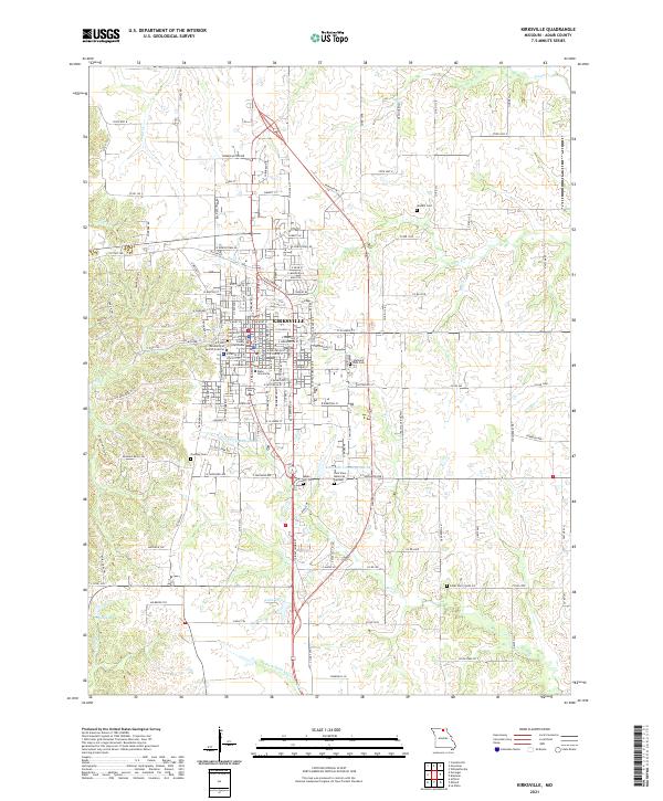 2021 Kirksville2021 Print · USGSKirksville thrives as an academic and county seat in northeastern Missouri during the early twenty-first century. Genealogists and historians can trace the town's development around the Adair County Courthouse and locate burials at Forest Llewellyn Cem or Cater Cem.
End of results
Showing maps 1-12 of 12
Top cities near Troy Mills
- Kirksville historical maps
- La Plata historical maps
- Novinger historical maps
- Brashear historical maps
- Gibbs historical maps
- Elmer historical maps
See more
Frequently asked questions
- What are the different types of historical maps available for Troy Mills?
- What is the oldest map of Troy Mills?
- Where can I purchase historical maps of Troy Mills for my home or office?
- Where can I download high-res historical maps of Troy Mills?
- Are there historical topographic maps available for Troy Mills?
- Is there historical aerial imagery available for Troy Mills?
- Where are historical maps of Troy Mills sourced from?