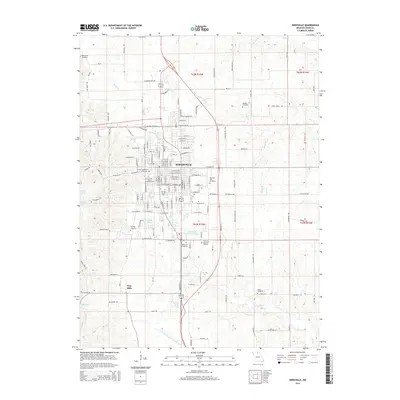
2015 Map of Kirksville
USGS Topo · Published 2015About this map
Kirksville serves as the educational and regional hub of Adair County, defined by the expansive campus of Truman State University and the nearby A.T. Still University of Health Sciences. The city's northern and eastern expansion is balanced by a significant concentration of local heritage sites, including Forest-Llewellyn Cemetery and Highland Park Cemetery. The landscape transitions from the urban grid to the rolling drainage basins of Bear Creek and the East Fork Little Chariton River.
Find a feature on this map
140 named features on this map. Tap any name to fly to it.
Don’t see what you’re looking for? This feature index may not catch every label — zoom into the map to look around manually.
Map Details
Editions of this 2015 Kirksville Map
This is the sole edition of this map. No revisions or reprints were ever made.
Other maps of this area

1903 · Edina
USGS Topo · 1:125,000

1911 · Queen City
USGS Topo · 1:62,500

1913 · Queen City
USGS Topo · 1:62,500

1938 · Kirksville
USGS Topo · 1:62,500

1940 · Kirksville
USGS Topo · 1:62,500

1954 · Centerville
USGS Topo · 1:250,000

1957 · Centerville
USGS Topo · 1:250,000

1958 · Centerville
USGS Topo · 1:250,000

1966 · Brashear
USGS Topo · 1:24,000
1966 · Willmathsville
USGS Topo · 1:24,000