Old Maps of Bates County, Missouri for Metal Detecting
Plan your next treasure hunt with 126 historic maps of Bates County. Find old homesites, ghost towns, trails, and gathering spots that may be lost to time — perfect for identifying promising metal detecting locations.
- Locate forgotten sites: Uncover places like long-lost settlements, abandoned rail lines, or gathering spots.
- Plan better hunts: Use map overlays combined with LiDAR or satellite views to narrow in on historically rich areas.
- Made for detectorists: Thousands of hobbyists use these maps to discover relics, coins, and hidden history.
Use these historic maps to boost your research and find new opportunities beneath the surface of Bates County.
Bates County, MO maps
(126)- 1887 Map of Butler
 1887 Butler1887 Print · USGSBates County is captured here in the 1880s as the rail and river economies converged. Researchers can trace the early footprints of Butler and Rich Hill, or locate smaller disappeared locales like Carbon Centre and Crescent Hill.
 - 1887 Map of Mound City
 1887 Mound City1887 Print · USGSLinn and Miami counties are captured here in the 1880s, showcasing a landscape of river-valley agriculture and rapid railroad growth. Researchers can trace the path of the Kansas City Fort Scott and Gulf Railroad through Pleasanton or locate early settlements like Trading Post and Wall Street.
 - 1893 Map of Mound City
 1893 Mound City1893 Print · USGSEastern Kansas at the close of the nineteenth century is defined here by its rail-and-river network and early township boundaries. Genealogists and historians can trace the early growth of Mound City, Pleasanton, and La Cygne along the Kansas City Osage and Gulf Railroad.4 unique versions available
 - 1894 Map of Butler
 1894 Butler1894 Print · USGSBates County is captured here in the late nineteenth century as the railroad began to redefine its rural economy. Genealogists can trace family roots through the grids of Butler and Rich Hill, or locate smaller centers like Papinsville and Crescent Hill.4 unique versions available
 - 1934 Map of Papinsville
 1934 Papinsville1934 Print · USGSBates and Vernon counties are captured here in the mid-1930s, revealing a landscape defined by the winding Mariais Des Cygnes and Osage rivers. Genealogists can trace early landmarks like the Old Harmony Mission Site and various family-named features such as Helem Lake and Maus Cem.2 unique versions available
 - 1934 Map of Rockville
 1934 Rockville1934 Print · USGSMid-Missouri river life in the 1930s is centered on the shifting currents of the Osage River and the small-town hubs of the Kansas and Texas railroad. Trace the locations of rural schoolhouses like Mc Davitt Sch or find family roots at Spring Grove Cem.
 - 1936 Map of Rich Hill
 1936 Rich Hill1936 Print · USGSRich Hill and the surrounding river bottoms are captured here in the mid-1930s, during an era of transition for Missouri's coal country. Genealogists and local historians can trace rural school districts like Stone Gate Sch and Panama Sch, or locate family-named sites such as Philbrick Hills and the Jonnum Mines.
 - 1937 Map of New Home, 1939 Print
 1937 New Home1939 Print · USGSBates County agriculture and industry meet along the Osage River in the late thirties. Genealogists can locate family landmarks like Thomas Cem or Morris Cem, and trace the rural school system from Belmont Sch to Lost Corner Sch.3 unique versions available
 - 1938 Map of Worland, 1954 Print
 1938 Worland1954 Print · USGSBates County sits at a rail-and-river crossroads in the late 1930s, documenting a landscape defined by the Osage River and competing rail lines. Researchers can trace rural genealogy through landmarks like Klondike Sch, Independence Ch, and Salem Cem.3 unique versions available
 - 1940 Map of Worland
 1940 Worland1940 Print · USGSBates County, Missouri, was a landscape of bustling rail towns and schoolhouse districts just before the Second World War. Genealogists can trace family footprints through numerous rural cemeteries like Woodfin Cem and local school sites such as Johnson Sch and Standish Sch.2 unique versions available
 - 1940 Map of Hume, 1954 Print
 1940 Hume1954 Print · USGSThe Missouri-Kansas borderlands come to life in this late-depression era survey centered on Hume. Genealogists and local historians can trace family roots through numerous rural landmarks like Hume Cem, Union Chapel, and the settlement of Amos.3 unique versions available
 - 1942 Map of Hume
 1942 Hume1942 Print · USGSThe Missouri-Kansas border area near Hume is captured here just before the mid-century, showing a landscape tightly woven with railroads and rural school districts. Genealogists can locate family landmarks like Lawrence Cem, Union Chapel, and the now-vanished rail stop at Amos.2 unique versions available
 - 1942 Map of Sprague
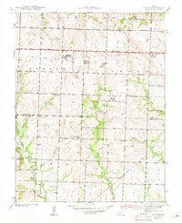 1942 Sprague1942 Print · USGSThe rural borderlands of Bates and Vernon Counties are captured here during the early 1940s, just as the landscape was shifting away from its rail-dependent roots. Researchers can trace the legacy of local education through numerous country schoolhouses like White Rock Sch and Fairview Sch, or locate family sites near Greenlawn Cemetery.3 unique versions available
 - 1947 Map of Lawrence, 1954 Print
 1947 Lawrence1954 Print · USGSEastern Kansas and western Missouri thrive in the late 1940s, showing a landscape defined by major river valleys and a dense railway network. Genealogists can trace family settlements from Lawrence to Greenwood and locate landmarks like Olathe Navy and Lake Lotawana.
 - 1950 Map of Lawrence
 1950 Lawrence1950 Print · USGSMid-century Kansas and Missouri come alive in this map of the river-valley corridors just as the interstate era was beginning. Researchers can trace the legacy of major rail lines like the Union Pacific RR and locate ancestral roots in towns from Lawrence to Harrisonville.
 - 1953 Map of Johnstown, 1954 Print
 1953 Johnstown1954 Print · USGSThe rural border of Henry and Bates counties is captured here in the early fifties, showing a landscape shaped by creek drainage and small farming hubs. Genealogists can locate family burial sites at St Ludger Cem and Poage Cem, or trace the old school districts at Johnstown Sch and Aurora Sch.2 unique versions available
 - 1953 Map of Creighton, 1955 Print
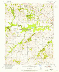 1953 Creighton1955 Print · USGSCreighton and Urich sat at a busy county-line junction in the early fifties, before the landscape was altered by modern river management. Genealogists can trace rural roots at Smoky Row Sch, Cove Creek Ch, and family burial grounds like Parker Cem.
 - 1955 Map of Rich Hill
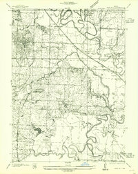 1955 Rich Hill1955 Print · USGSBates and Vernon Counties are captured here in the mid-1930s, showing a landscape shaped by coal mining and river bottomlands. Genealogists can trace rural school districts like Stone Gate Sch and old mining centers at Carbon Center and Monnum Mines.
 - 1956 Map of Lawrence, 1967 Print
 1956 Lawrence1967 Print · USGSEastern Kansas and the Missouri border country are captured here during the mid-century transition to the interstate era. Genealogists and local historians can trace family-named terrain like Summers Mound and the footprint of Sunflower Ordnance Works near Baldwin City.4 unique versions available
 - 1961 Map of Lawrence
 1961 Lawrence1961 Print · USGSThe Kansas-Missouri borderland shows its mid-century transition from a rail-dependent agricultural region to a suburbanizing landscape. Genealogists can trace family footprints through numerous Cem sites and distinctive terrain landmarks like Graves Mound and Summers Mound.
 - 1961 Map of Pleasant Gap, 1962 Print
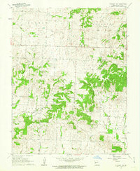 1961 Pleasant Gap1962 Print · USGSBates County, Missouri, is captured here in the early sixties as a region of quiet farmsteads and creek-fed valleys. Genealogists and local historians can locate old landmarks like Double Branch Sch, Round Prairie Ch, and the Smith Cem.2 unique versions available
 - 1961 Map of Drexel, 1962 Print
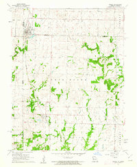 1961 Drexel1962 Print · USGSThe Kansas-Missouri border comes alive in the early sixties as rural townships thrive along the rail lines. Genealogists and historians can trace family land between Drexel and the creeks of Morman Fork, or locate resting places at Sharon Cem and West Point Cem.2 unique versions available
 - 1961 Map of Main City, 1962 Print
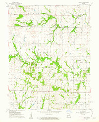 1961 Main City1962 Print · USGSThe borderlands of Cass and Bates counties are captured in the early sixties, showing a landscape defined by small settlements and rural schoolhouses. Genealogists can trace family footprints near Main City, Burdett, and the Fairview Ch.2 unique versions available
 - 1961 Map of Butler, 1962 Print
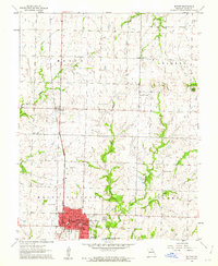 1961 Butler1962 Print · USGSBates County is captured here in the early sixties, centered on the growing town of Butler and the Missouri Pacific rail corridor. Researchers can trace family sites at Oak Hill Cemetery, visit the rural Mt Olivet Ch, or locate the old County Farm.2 unique versions available
 - 1961 Map of Adrian, 1962 Print
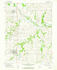 1961 Adrian1962 Print · USGSBates and Cass Counties are captured here in the early sixties, centered on the Missouri Pacific rail line and the meandering South Grand River. Genealogists and local historians can pinpoint the Crescent Hill Cem, Fairview Sch, and the Coleville Community Hall in this rural landscape.3 unique versions available
Showing maps 1-25 of 126
Top cities of Bates County
- Butler historical maps
- Adrian historical maps
- Rich Hill historical maps
- Hume historical maps
- Spruce historical maps
- Amsterdam historical maps
See more
Frequently asked questions
- What are the different types of historical maps available for Bates County?
- What is the oldest map of Bates County?
- Where can I purchase historical maps of Bates County for my home or office?
- Where can I download high-res historical maps of Bates County?
- Are there historical topographic maps available for Bates County?
- Is there historical aerial imagery available for Bates County?
- Where are historical maps of Bates County sourced from?