Old Maps of Bates County, Missouri
Explore 42 old maps of Bates County, spanning from 1887 to today. These high-resolution historic maps reveal how streets, neighborhoods, landmarks, and natural features evolved over time — perfect for genealogy, metal detecting, research, and local history exploration.
What you can do with these maps:
- See how Bates County changed over time: Compare historical maps to modern-day views to trace roads, homesites, rail lines & more.
- View detailed metadata: Each map includes creators, publishers, year, scale, and archive source.
- Overlay maps with satellite & LiDAR: Visualize the past alongside modern tools to explore terrain & human change.
- Trusted historical sources: Maps sourced from the USGS, Library of Congress, and other archives.
- Access maps your way: View online, download high-res files, or order prints for personal or research use.
Start exploring old maps of Bates County to uncover forgotten places, hidden landmarks, and the deep history beneath your feet.
Bates County, MO maps
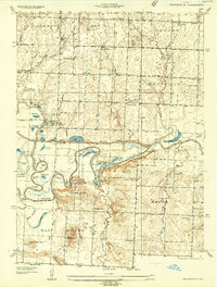
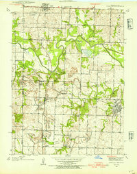
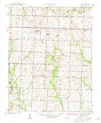
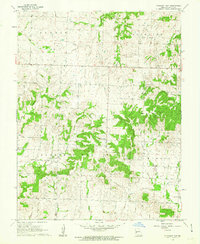
(42)- 1887 Map of Butler
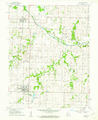
 1887 Butler1887 Print · USGSCovers Bates County, including Butler, Adrian, and other nearby areas
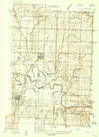
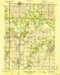
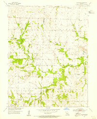
 - 1887 Map of Mound City
 1887 Mound City1887 Print · USGSCovers Bates County, including Osawatomie, Louisburg, and other nearby areas
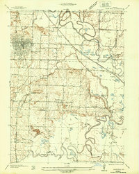
 - 1893 Map of Mound City
 1893 Mound City1893 Print · USGSCovers Bates County, including Osawatomie, Louisburg, and other nearby areas4 unique versions available
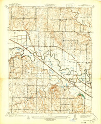
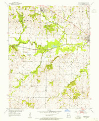
 - 1894 Map of Butler
 1894 Butler1894 Print · USGSCovers Bates County, including Butler, Adrian, and other nearby areas4 unique versions available
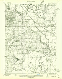
 - 1934 Map of Papinsville
 1934 Papinsville1934 Print · USGSCovers Bates County, including Prairie City, Papinville, and other nearby areas2 unique versions available
 - 1934 Map of Rockville
 1934 Rockville1934 Print · USGSCovers Bates County, including Schell City, Rockville, and other nearby areas
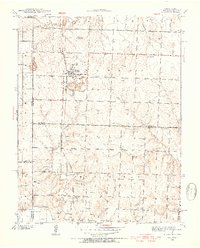
 - 1936 Map of Rich Hill
 1936 Rich Hill1936 Print · USGSCovers Bates County, including Rich Hill, Arthur, and other nearby areas
 - 1937 Map of New Home, 1939 Print
 1937 New Home1939 Print · USGSCovers Bates County, including New Home, Athol, and other nearby areas3 unique versions available
 - 1938 Map of Worland, 1954 Print
 1938 Worland1954 Print · USGSCovers Bates County, including Foster, Worland, and other nearby areas3 unique versions available
 - 1940 Map of Worland
 1940 Worland1940 Print · USGSCovers Bates County, including Foster, Worland, and other nearby areas2 unique versions available
 - 1940 Map of Hume, 1954 Print
 1940 Hume1954 Print · USGSCovers Bates County, including Hume, Rock, and other nearby areas3 unique versions available
 - 1942 Map of Hume
 1942 Hume1942 Print · USGSCovers Bates County, including Hume, Rock, and other nearby areas2 unique versions available
 - 1942 Map of Sprague
 1942 Sprague1942 Print · USGSCovers Bates County, including Sprague, Vernon County, and other nearby areas3 unique versions available
 - 1947 Map of Lawrence, 1954 Print
 1947 Lawrence1954 Print · USGSCovers Bates County, including Kansas City, Overland Park, and other nearby areas
 - 1950 Map of Lawrence
 1950 Lawrence1950 Print · USGSCovers Bates County, including Kansas City, Overland Park, and other nearby areas
 - 1953 Map of Johnstown, 1954 Print
 1953 Johnstown1954 Print · USGSCovers Bates County, including New Piper, Johnstown, and other nearby areas2 unique versions available
 - 1953 Map of Creighton, 1955 Print
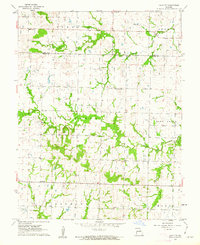
 1953 Creighton1955 Print · USGSCovers Bates County, including Urich, Creighton, and other nearby areas
 - 1955 Map of Rich Hill
 1955 Rich Hill1955 Print · USGSCovers Bates County, including Rich Hill, Arthur, and other nearby areas
 - 1956 Map of Lawrence, 1967 Print
 1956 Lawrence1967 Print · USGSCovers Bates County, including Kansas City, Overland Park, and other nearby areas4 unique versions available
 - 1961 Map of Lawrence
 1961 Lawrence1961 Print · USGSCovers Bates County, including Kansas City, Overland Park, and other nearby areas
 - 1961 Map of Pleasant Gap, 1962 Print
 1961 Pleasant Gap1962 Print · USGSCovers Bates County, including Pleasant Gap, United States, and other nearby areas2 unique versions available
 - 1961 Map of Drexel, 1962 Print
 1961 Drexel1962 Print · USGSCovers Bates County, including Drexel, Merwin, and other nearby areas2 unique versions available
 - 1961 Map of Main City, 1962 Print
 1961 Main City1962 Print · USGSCovers Bates County, including Adrian, Burdett, and other nearby areas2 unique versions available
 - 1961 Map of Butler, 1962 Print
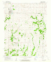
 1961 Butler1962 Print · USGSCovers Bates County, including Butler, Passaic, and other nearby areas2 unique versions available
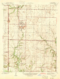
 - 1961 Map of Adrian, 1962 Print
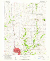
 1961 Adrian1962 Print · USGSCovers Bates County, including Adrian, Archie, and other nearby areas3 unique versions available
Showing maps 1-25 of 42
Top cities of Bates County
- Butler historical maps
- Adrian historical maps
- Rich Hill historical maps
- Hume historical maps
- Spruce historical maps
- Amsterdam historical maps
See more
Frequently asked questions
- What are the different types of historical maps available for Bates County?
- What is the oldest map of Bates County?
- Where can I purchase historical maps of Bates County for my home or office?
- Where can I download high-res historical maps of Bates County?
- Are there historical topographic maps available for Bates County?
- Is there historical aerial imagery available for Bates County?
- Where are historical maps of Bates County sourced from?