1960s Maps of Bollinger County, Missouri
Explore 12 historic maps of Bollinger County from the 1960s. These maps offer a rare glimpse into what life looked like during the 1960s — showing old roads, neighborhoods, homes, and landmarks that have changed or disappeared over time.
Whether you're researching your family's past, planning a metal detecting trip, or studying how Bollinger County's landscape evolved across the 1960s, these high-resolution maps are a powerful tool for exploring the history of this region.
- Focus on a specific era: All maps on this page are from the 1960s, giving you a focused view of this time period.
- See what’s changed: Compare century-old streets, trails, and buildings to today's modern landscape using overlays and satellite layers.
- Research with precision: Use these maps for genealogy, historical research, land use analysis, or educational projects.
- View, download, or print: Maps are fully viewable online in high resolution, and can be downloaded or printed for your own records.
Start exploring Bollinger County's history through authentic maps from the 1960s. This is your window into the past.
Bollinger County, MO maps
(12)- 1960 Map of Rolla
 1960 Rolla1960 Print · USGSThe Ozark Highlands in the mid-twentieth century reveal a landscape of deep timber and heavy industry. Researchers can trace the rail-and-mine economy through the St Louis-San Francisco RR and the Iron Mountain Mine, alongside the growth of Fort Leonard Wood.
 - 1961 Map of Paducah
 1961 Paducah1961 Print · USGSThe Lower Ohio Valley at mid-century is a landscape defined by its great rivers and newly formed reservoirs. Researchers can trace the riverfronts of Paducah and Metropolis, or locate smaller settlements like Old Shawneetown and Cave in Rock along the banks.2 unique versions available
 - 1963 Map of Gipsy, 1964 Print
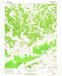
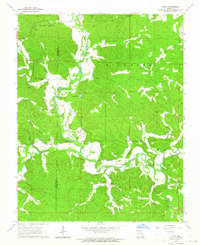 1963 Gipsy1964 Print · USGSBollinger and Wayne counties appear here in the early sixties, centered on the winding path of the Castor River. Researchers can locate rural schools and churches such as Lower Turkey Creek Sch, Cowan Ch, and Maddox Cem.2 unique versions available
 - 1963 Map of Advance, 1964 Print
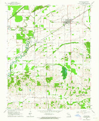 1963 Advance1964 Print · USGSStoddard County in the early 1960s shows a landscape of rail-connected towns and drainage engineering. You can trace family history through sites like St Joseph Cem and Pleasant Grove Ch or follow the St Louis - San Francisco line through Brownwood.
 - 1963 Map of McGee, 1964 Print
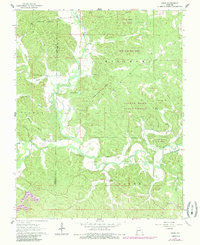
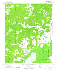 1963 McGee1964 Print · USGSIn the early 1960s, the McGee area of Wayne County was a landscape of small rural congregations and remote cemeteries. Researchers can trace family history through sites like Mt Pleasant Cem, Wilfong Cem, and the McGee Sch.2 unique versions available
 - 1963 Map of Zalma, 1964 Print
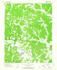 1963 Zalma1964 Print · USGSZalma and the Castor River valley are captured here in the early 1960s, showing a landscape of Ozark foothills and river bottomlands. Researchers can trace the Old Railroad Grade and locate historic family landmarks like Eakers Cem and Ladd Chapel.3 unique versions available
 - 1963 Map of Whitewater, 1964 Print
 1963 Whitewater1964 Print · USGSWhitewater and the surrounding river bottoms are captured here in the early sixties as massive hydrologic projects reshaped the land. Genealogists can trace family roots through locations like Passover Ch, Frazier Cem, and the rural School No R 5.2 unique versions available
 - 1963 Map of Sturdivant, 1964 Print
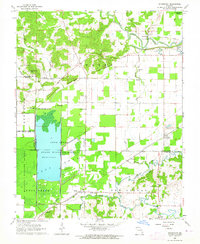 1963 Sturdivant1964 Print · USGSBollinger County and the edge of the Mingo wetlands are captured here in the early sixties as a landscape of river sloughs and quiet rail stops. Researchers can trace family history through sites like Sturdivant Cem, Kinder Chapel, and the small settlement of Arab.2 unique versions available
 - 1963 Map of Dongola, 1964 Print
 1963 Dongola1964 Print · USGSSoutheast Missouri in the early sixties reveals a landscape of upland ridges and managed wetlands along the Bollinger and Stoddard county line. Genealogists and researchers can locate old rural landmarks like New Sylvan Ch, Kellion Cem, and the village of Dongola.2 unique versions available
 - 1964 Map of Paducah
 1964 Paducah1964 Print · USGSThe river-and-rail corridor of Southern Illinois and Western Kentucky is captured here during the height of the mid-century industrial era. Genealogists and researchers can trace local landmarks across several counties, from the rail yards of Paducah to the waters of Crab Orchard Lake and Kentucky Reservoir.2 unique versions available
 - 1964 Map of Gipsy, 1985 Print
 1964 Gipsy1985 Print · USGSBollinger and Wayne Counties are captured in the mid-1960s as the river-cut landscape supported small settlements and timberlands. Genealogists can trace family names at Maddox Cem, Buchanan, and the Lower Turkey Creek Sch.
 - 1966 Map of Rolla
 1966 Rolla1966 Print · USGSThe Missouri Ozarks are revealed here in the mid-1960s, showing the intersection of heavy industry and sprawling national forests. Trace the development of the Lead Belt near Flat River or locate family roots in vanished hamlets like Enough and Howes Mill.
End of results
Showing maps 1-12 of 12
Top cities of Bollinger County
Frequently asked questions
- What are the different types of historical maps available for Bollinger County?
- What is the oldest map of Bollinger County?
- Where can I purchase historical maps of Bollinger County for my home or office?
- Where can I download high-res historical maps of Bollinger County?
- Are there historical topographic maps available for Bollinger County?
- Is there historical aerial imagery available for Bollinger County?
- Where are historical maps of Bollinger County sourced from?