Old Maps of Bollinger County, Missouri for Hiking & Exploration
Hike through history with 134 historic maps of Bollinger County. Explore old trails, ghost towns, and forgotten backroads — perfect for outdoor adventurers and local explorers.
- Rediscover forgotten places: Map out old mining camps, roads, and footpaths that no longer exist on modern maps.
- Layer with modern tools: Combine with LiDAR or satellite views to plan hikes through historical terrain.
- Made for exploration: Popular among hikers, overlanders, and local history lovers.
Use these maps to find adventure and explore the hidden past of Bollinger County.
Bollinger County, MO maps
(134)- 1910 Map of Higdon
 1910 Higdon1910 Print · USGSThe Missouri Ozarks are captured here at the turn of the century as a landscape of mills and mountain hollows. Genealogists can trace family roots through numerous remote landmarks like Nations Mill, Bandenstistle School, and Spring Valley Church.2 unique versions available
 - 1923 Map of Perryville, 1960 Print
 1923 Perryville1960 Print · USGSSoutheast Missouri's rural townships are documented here during the early twenties, showing a landscape of small mill sites and dozens of neighborhood schools. Researchers can trace family origins through locations like St Marys Seminary, Bollingers Mill, and Schumer Springs.2 unique versions available
 - 1924 Map of Perryville
 1924 Perryville1924 Print · USGSSoutheast Missouri in the early 1920s was a landscape of small river towns and family-named landmarks at the intersection of three counties. Genealogists can trace family roots through numerous country schools like Sim Layton School and local mills such as Bollingers Mill.2 unique versions available
 - 1933 Map of Marble Hill, 1964 Print
 1933 Marble Hill1964 Print · USGSBollinger and Cape Girardeau counties in the early 1930s reveal a landscape of rural schoolhouses and family-named landmarks. Trace the Missouri Pacific rail line through Lutesville or find local community sites like Whiskey Sch and Gravel Hill Ch.3 unique versions available
 - 1933 Map of Marquand, 1966 Print
 1933 Marquand1966 Print · USGSMadison and Bollinger counties are shown in the early 1930s, documenting a landscape defined by the Missouri Pacific rail corridor and the Castor River. Genealogists can trace family landmarks like Younts Store, the Starkey Mine, and numerous remote burial grounds including the Whitener Cem.2 unique versions available
 - 1934 Map of Advance
 1934 Advance1934 Print · USGSSoutheast Missouri in the 1930s is mapped here during a period of major hydrological change and railroad activity. You can trace the Diversion Channel across the landscape or find rural schools and family burial sites like Toga No 2 Sch and St Joseph Cem.3 unique versions available
 - 1935 Map of Zalma
 1935 Zalma1935 Print · USGSSoutheast Missouri in the mid-1930s reveals a landscape undergoing transformation through massive drainage projects and the reach of the rail. Trace old schoolhouses like Patterson Sch, vanished landmarks like Sitzke Store, and the path of the St Louis San Francisco railroad.3 unique versions available
 - 1937 Map of Marble Hill
 1937 Marble Hill1937 Print · USGSSoutheast Missouri in the mid-thirties remains a landscape of small crossroads and one-room schools like Hamestring Sch. You can trace the Missouri Pacific rail line through Lutesville or locate family sites at Pulliam Cem and Barks Chapel.2 unique versions available
 - 1938 Map of Marquand
 1938 Marquand1938 Print · USGSThe Missouri Ozarks borderlands appear here in the late 1930s, showing a landscape of river-valley towns and hilltop mines. Researchers can trace ancestral locations through dozens of rural sites, including Rhodes Chapel, Starke Mine, and the Marquand rail depot.2 unique versions available
 - 1939 Map of Advance, 1942 Print
 1939 Advance1942 Print · USGSSoutheast Missouri in the late thirties is defined here by its massive drainage projects and thriving rail towns. Researchers can trace the heritage of rural communities through dozens of local landmarks like Cruse Cem, Dongola Sch, and Union Grove Ch.
 - 1939 Map of Zalma, 1943 Print
 1939 Zalma1943 Print · USGSSoutheast Missouri’s river hills and delta margins are captured here in the late thirties, as the region’s drainage and rail networks were undergoing significant change. Genealogists can trace family names through landmarks like the Buchanan Post Office, Bright Prospect Ch, and Snake Bluff School No 2.2 unique versions available
 - 1949 Map of Paducah
 1949 Paducah1949 Print · USGSThe confluence of the Ohio, Mississippi, Tennessee, and Cumberland rivers at the close of the 1940s reveals a region bound by water and rail. Researchers can trace historic river landings, timberlands in the Shawnee National Forest, and the coal-mining infrastructure around West Frankfort and Herrin.2 unique versions available
 - 1949 Map of Rolla, 1950 Print
 1949 Rolla1950 Print · USGSThe Missouri Ozarks are captured here just after the war, showing a landscape of deep river valleys and emerging reservoir projects. Genealogists and historians can trace the mining towns of Bonne Terre and Potosi or follow the early route of U.S. Highway 66.
 - 1950 Map of Paducah
 1950 Paducah1950 Print · USGSThe confluence of the great midwestern rivers defines this mid-century landscape at the intersection of Illinois, Kentucky, and Missouri. Genealogists and historians can trace the rail-and-river economy through the hubs of Paducah, Cairo, and Metropolis or locate family roots near the Wildcat Hills.
 - 1953 Map of Rolla
 1953 Rolla1953 Print · USGSSoutheast Missouri’s mining towns and timberlands are seen here at the start of the 1950s. Genealogists and historians can trace the rail-and-river economy through local hubs like Fredericktown and the lead-mining heritage of Potosi and Desloge.
 - 1954 Map of Paducah
 1954 Paducah1954 Print · USGSSouthern Illinois and Western Kentucky intersect at the great river confluences during this mid-century era of rail and river industry. Genealogists and historians can trace family roots and commerce through river towns like Cairo, Metropolis, and Golconda, or along the tracks of the Illinois Central Railroad.2 unique versions available
 - 1954 Map of Rolla, 1970 Print
 1954 Rolla1970 Print · USGSThe Missouri Ozarks and the historic Lead Belt are captured in the late sixties, showing a landscape of deep river hollows and industrial mines. Researchers can trace the routes of the Missouri Pacific RR to extraction sites like the Iron Mountain Mine or Pea Ridge Mine.2 unique versions available
 - 1958 Map of Rolla
 1958 Rolla1958 Print · USGSThe Missouri Ozarks and the lead-rich hills of the southeast are captured here in the late fifties as timber and mining shaped the local economy. Researchers can locate family landmarks like the Rolla Cemetery or trace old rail lines including the Missouri-Illinois RR and St Louis-San Francisco RR.
 - 1959 Map of Rolla
 1959 Rolla1959 Print · USGSMid-century Missouri is defined here by the deep forests of the Ozarks and the industrial peaks of the St Francois Mountains. Genealogists and historians can trace the development of towns like Potosi and Fredericktown or locate rural landmarks like Dry Fork Church and the Phelps County Courthouse.
 - 1959 Map of Patton, 1960 Print
 1959 Patton1960 Print · USGSBollinger County in the late fifties shows a rural network of river-valley farms and forest boundaries. Genealogists can locate family landmarks like Oak Grove School, the Yount Cemetery, and local congregations at Bethel Church and Reagan Chapel.2 unique versions available
 - 1959 Map of Higdon, 1960 Print
 1959 Higdon1960 Print · USGSThe rural borderlands of Madison, Perry, and Bollinger counties are captured here in the late fifties, defined by the winding Castor River and Whitewater River. Genealogists and historians can locate old mill sites like Hahns Mill, numerous country schools including Walnut Grove Sch, and family burial grounds like Underwood Cem.2 unique versions available
 - 1959 Map of Higdon, 1960 Print
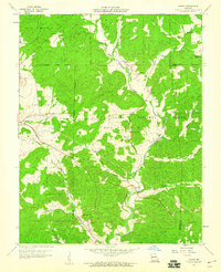 1959 Higdon1960 Print · USGSMadison County's forested river valleys are captured here in the late fifties, showing a landscape of remote settlements and timbered hills. Genealogists and historians can trace family locations through Hahns Mill, Underwood Cem, and the Missouri Pacific rail siding at Cornwall.3 unique versions available
 - 1960 Map of Rolla
 1960 Rolla1960 Print · USGSThe Ozark Highlands in the mid-twentieth century reveal a landscape of deep timber and heavy industry. Researchers can trace the rail-and-mine economy through the St Louis-San Francisco RR and the Iron Mountain Mine, alongside the growth of Fort Leonard Wood.
 - 1961 Map of Paducah
 1961 Paducah1961 Print · USGSThe Lower Ohio Valley at mid-century is a landscape defined by its great rivers and newly formed reservoirs. Researchers can trace the riverfronts of Paducah and Metropolis, or locate smaller settlements like Old Shawneetown and Cave in Rock along the banks.2 unique versions available
 - 1963 Map of Gipsy, 1964 Print
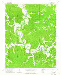 1963 Gipsy1964 Print · USGSBollinger and Wayne counties appear here in the early sixties, centered on the winding path of the Castor River. Researchers can locate rural schools and churches such as Lower Turkey Creek Sch, Cowan Ch, and Maddox Cem.2 unique versions available
Showing maps 1-25 of 134
Top cities of Bollinger County
Frequently asked questions
- What are the different types of historical maps available for Bollinger County?
- What is the oldest map of Bollinger County?
- Where can I purchase historical maps of Bollinger County for my home or office?
- Where can I download high-res historical maps of Bollinger County?
- Are there historical topographic maps available for Bollinger County?
- Is there historical aerial imagery available for Bollinger County?
- Where are historical maps of Bollinger County sourced from?