Old Maps of Leemon, Missouri for Academic Research
Study the evolution of Leemon with 16 high-resolution historic maps. Whether you're teaching, researching, or modeling changes in land use, these maps provide essential visual documentation of urban, environmental, and geographic change.
- Analyze long-term change: Track patterns in development, transportation, and natural features.
- Ideal for environmental or urban studies: Support academic projects with primary historical map data.
- Use in the classroom or lab: Educators and researchers rely on these maps to bring historical context to life.
These maps are a powerful tool for teaching, research, and visualizing how Leemon has changed over the decades.
Leemon, MO maps
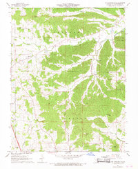
(16)- 1922 Map of Cape Girardeau, 1954 Print
 1922 Cape Girardeau1954 Print · USGSThe Missouri-Illinois riverfront was a bustling corridor of rail and river commerce in the early 1920s. Genealogists can trace family names through dozens of rural landmarks like Rock Hill Church, Needmore School, and the river landing at Neelys Landing.3 unique versions available
 - 1924 Map of Cape Girardeau
 1924 Cape Girardeau1924 Print · USGSCape Girardeau County in the early twenties shows a bustling riverfront and a landscape dotted with over twenty rural schoolhouses. Genealogists can trace family roots near Needmore School, Pocahontas Sta, and the historic Pleasant Hill Church.2 unique versions available
 - 1949 Map of Paducah
 1949 Paducah1949 Print · USGSThe confluence of the Ohio, Mississippi, Tennessee, and Cumberland rivers at the close of the 1940s reveals a region bound by water and rail. Researchers can trace historic river landings, timberlands in the Shawnee National Forest, and the coal-mining infrastructure around West Frankfort and Herrin.2 unique versions available
 - 1950 Map of Paducah
 1950 Paducah1950 Print · USGSThe confluence of the great midwestern rivers defines this mid-century landscape at the intersection of Illinois, Kentucky, and Missouri. Genealogists and historians can trace the rail-and-river economy through the hubs of Paducah, Cairo, and Metropolis or locate family roots near the Wildcat Hills.
 - 1954 Map of Paducah
 1954 Paducah1954 Print · USGSSouthern Illinois and Western Kentucky intersect at the great river confluences during this mid-century era of rail and river industry. Genealogists and historians can trace family roots and commerce through river towns like Cairo, Metropolis, and Golconda, or along the tracks of the Illinois Central Railroad.2 unique versions available
 - 1961 Map of Paducah
 1961 Paducah1961 Print · USGSThe Lower Ohio Valley at mid-century is a landscape defined by its great rivers and newly formed reservoirs. Researchers can trace the riverfronts of Paducah and Metropolis, or locate smaller settlements like Old Shawneetown and Cave in Rock along the banks.2 unique versions available
 - 1964 Map of Paducah
 1964 Paducah1964 Print · USGSThe river-and-rail corridor of Southern Illinois and Western Kentucky is captured here during the height of the mid-century industrial era. Genealogists and researchers can trace local landmarks across several counties, from the rail yards of Paducah to the waters of Crab Orchard Lake and Kentucky Reservoir.2 unique versions available
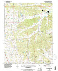
 - 1967 Map of Cape Girardeau NE, 1968 Print
 1967 Cape Girardeau NE1968 Print · USGSCape Girardeau County in the late sixties maintains its rural heritage and historical landmarks before modern expansion. Genealogists and local historians can trace family locations through Old McKendree Chapel and numerous burial grounds like Zierath Cem and Noland Cem.2 unique versions available
 - 1984 Map of Cape Girardeau, 1985 Print
 1984 Cape Girardeau1985 Print · USGSThe tri-state junction of Missouri, Illinois, and Kentucky in the mid-1980s was a bustling corridor defined by its massive river systems and complex rail lines. Researchers can trace the paths of the Missouri Pacific RR, explore the Shawnee National Forest, or locate small settlements like Marble Hill and Advance.
 - 1986 Map of Cape Girardeau
 1986 Cape Girardeau1986 Print · USGSThe Missouri-Illinois-Kentucky borderlands come into focus in the mid-1980s as the river-and-rail economy shapes the landscape near the Great Rivers confluence. Researchers can trace historic rail lines and old settlements like Gordonville, New Hamburg, and the Trail of Tears State Park.
 - 1987 Map of Paducah, 1988 Print
 1987 Paducah1988 Print · USGSThe Lower Ohio Valley and the Illinois Ozarks come alive in this late twentieth-century regional survey. Genealogists and local historians can trace river-town roots and state park landmarks from Metropolis to Cape Girardeau and Trail of Tears State Park.
 - 1993 Map of Cape Girardeau NE, 1996 Print
 1993 Cape Girardeau NE1996 Print · USGSThe bluffs and creek valleys of Cape Girardeau County are captured here in the early nineties, centered on the riverfront at Neelys Landing. Researchers can trace local lineage through a dozen small burial grounds like Iona Cemetery and Vangilder Cemetery or explore the bounds of Trail of Tears State Park.
 - 2012 Map of Cape Girardeau NE, 2012 Print
 2012 Cape Girardeau NE2012 Print · USGSCovers Leemon, including Cape Girardeau, Jackson, and other nearby areas
 - 2015 Map of Cape Girardeau NE, 2015 Print
 2015 Cape Girardeau NE2015 Print · USGSCovers Leemon, including Cape Girardeau, Jackson, and other nearby areas
 - 2017 Map of Cape Girardeau NE, 2017 Print
 2017 Cape Girardeau NE2017 Print · USGSCovers Leemon, including Cape Girardeau, Jackson, and other nearby areas
 - 2021 Map of Cape Girardeau NE, 2021 Print
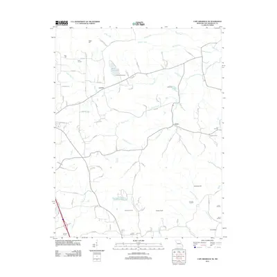
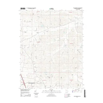
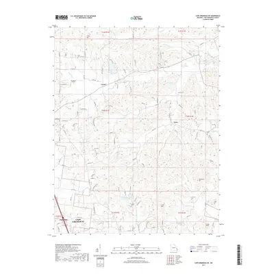
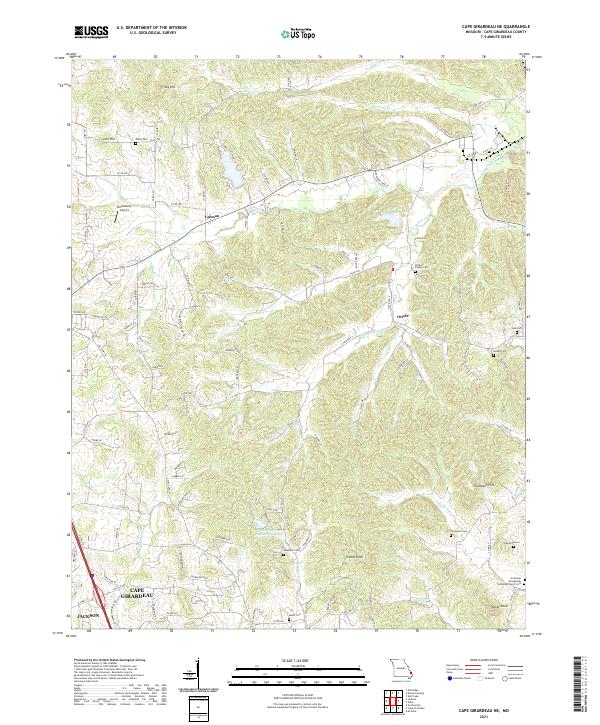 2021 Cape Girardeau NE2021 Print · USGSUpper Cape Girardeau County in the early 2020s shows a landscape where modern subdivisions meet deeply rooted family farmsteads and cemeteries. Genealogists and historians can trace local lineages at McLains Chapel Cem, Vangilder Cem, and the settlement of Leemon.
End of results
Showing maps 1-16 of 16
Top cities near Leemon
- Cape Girardeau historical maps
- Jackson historical maps
- Scott City historical maps
- Grand Tower historical maps
- Gordonville historical maps
- McClure historical maps
See more
Frequently asked questions
- What are the different types of historical maps available for Leemon?
- What is the oldest map of Leemon?
- Where can I purchase historical maps of Leemon for my home or office?
- Where can I download high-res historical maps of Leemon?
- Are there historical topographic maps available for Leemon?
- Is there historical aerial imagery available for Leemon?
- Where are historical maps of Leemon sourced from?