Old Maps of Carroll County, Missouri for Metal Detecting
Plan your next treasure hunt with 133 historic maps of Carroll County. Find old homesites, ghost towns, trails, and gathering spots that may be lost to time — perfect for identifying promising metal detecting locations.
- Locate forgotten sites: Uncover places like long-lost settlements, abandoned rail lines, or gathering spots.
- Plan better hunts: Use map overlays combined with LiDAR or satellite views to narrow in on historically rich areas.
- Made for detectorists: Thousands of hobbyists use these maps to discover relics, coins, and hidden history.
Use these historic maps to boost your research and find new opportunities beneath the surface of Carroll County.
Carroll County, MO maps
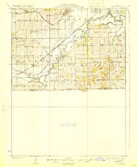
(133)- 1889 Map of Lexington
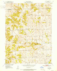
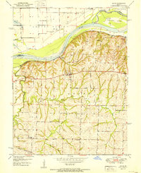
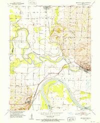
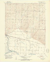
 1889 Lexington1889 Print · USGSLafayette and Ray Counties are captured here during the late nineteenth-century rail boom. Researchers can trace the development of river towns and rail junctions like Lexington, Lexington Junction, and the riverside landing at Miles Point.6 unique versions available
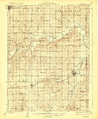
 - 1890 Map of Marshall
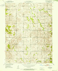
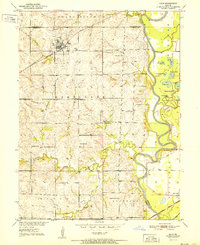
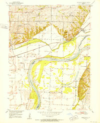
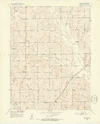
 1890 Marshall1890 Print · USGSSaline and Carroll counties come alive in this late nineteenth-century survey, showing the Missouri River bottomlands before modern channelization. Genealogists and historians can trace defunct river landings and rail stops like Eugene City, Laynesville, and Miami Station.
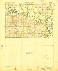
 - 1892 Map of Marshall, 1896 Print
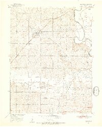
 1892 Marshall1896 Print · USGSNorth-central Missouri in the 1890s is defined by its vibrant river commerce and expanding rail networks. Genealogists and historians can trace family roots through old settlements like Malta Bend, Laynesville, and Salt Springs along the Missouri River.
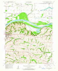
 - 1901 Map of Marshall
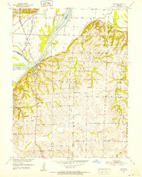
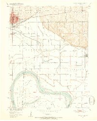
 1901 Marshall1901 Print · USGSCentral Missouri thrives along the river and rail lines at the turn of the century. Trace the early footprints of Marshall and Slater, or locate long-standing river landings and rural stations like Miami Station, Malta Bend, and Laynesville.5 unique versions available
 - 1924 Map of Dawn
 1924 Dawn1924 Print · USGSLivingston County's agricultural heartland is captured here in the mid-twenties, a landscape defined by small rail towns and one-room schoolhouses. Genealogists can locate family landmarks like Johnson School or Swain School along the busy Chicago Milwaukee and St. Paul rail line.4 unique versions available
 - 1924 Map of Braymer
 1924 Braymer1924 Print · USGSNorthwest Missouri's agricultural heartland is documented here in the early twenties, showing a landscape defined by the railroad and a dense grid of rural schoolhouses. Genealogists can locate specific family landmarks like Brown Jug School, Hopewell Church, and the Gould Farm Bridge.3 unique versions available
 - 1924 Map of Hale
 1924 Hale1924 Print · USGSThe Grand River valley in the early 1920s reveals a landscape of winding waterways and rail-connected settlements at the borders of Livingston and Carroll counties. Genealogists can locate numerous country schools like Lowland School and Morgan School, or trace family roots near Grace Church and Avalon.4 unique versions available
 - 1949 Map of Lexington East, 1963 Print
 1949 Lexington East1963 Print · USGSLafayette County enters the post-war era as a hub of river commerce and rural education. Researchers can trace historic coal operations at various Mine Dumps or locate local landmarks like Wentworth Military Academy and the Slusher Sch.3 unique versions available
 - 1950 Map of Lexington East
 1950 Lexington East1950 Print · USGSMid-century Lafayette County comes alive through this survey of the river valley and its surrounding uplands. Genealogists and historians can trace local family roots at Forest Grove Cem, Slusher Cem, and several rural schoolhouses like Burns Sch.
 - 1950 Map of Coloma, 1952 Print
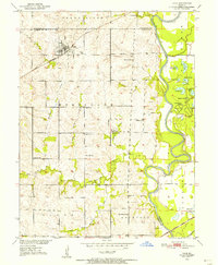
 1950 Coloma1952 Print · USGSThe rural landscape of Carroll County is captured here in the early fifties, showing a community structured around small schools and high prairie mounds. Researchers can find old landmarks like Coloma, the Locust Sch, and the unique triplet of Tater Hill, Long Tater Hill, and Round Tater Hill.3 unique versions available
 - 1950 Map of Plymouth, 1952 Print
 1950 Plymouth1952 Print · USGSNorthwestern Missouri was a landscape of small school districts and country churches at the mid-century. Genealogists can locate family-named landmarks like Rea Sch and Hanks Sch, or trace the community centers of Plymouth and Mt Tabor Ch.3 unique versions available
 - 1950 Map of Hale, 1956 Print
 1950 Hale1956 Print · USGSCarroll County was a landscape of river-bend lakes and rural schoolhouses in the mid-twentieth century. Genealogists can trace family footprints through sites like Elizabeth Cemetery or Hazel Hill School, while exploring the oxbows of the Grand River.2 unique versions available
 - 1950 Map of Dover, 1977 Print
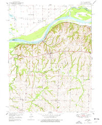 1950 Dover1977 Print · USGSLafayette County river life and rural education are preserved here in the early 1950s, showing a landscape shaped by the Missouri River and the rail line. Researchers can trace family roots through numerous local landmarks like Dover Station, Page City School, and Baltimore Island.2 unique versions available
 - 1951 Map of Dover
 1951 Dover1951 Print · USGSThe bluffs of Lafayette County overlook the Missouri River bottomlands during the early 1950s. Genealogists and local historians can trace a dense network of rural schools like Dawson School and Page City School alongside the Missouri Pacific rail line.2 unique versions available
 - 1951 Map of Hale
 1951 Hale1951 Print · USGSNorthwestern Missouri farming life and river management are preserved here in the early fifties. Genealogists can locate family landmarks like Elizabeth Cem, Winfrey Cem, and numerous rural schools including Battsville Sch.
 - 1951 Map of Bosworth, 1952 Print
 1951 Bosworth1952 Print · USGSBosworth and the rural townships of Carroll County are captured here at the start of the 1950s. Researchers can trace the legacy of early Missouri education and rail life through sites like West Fairview Sch, Mt Carmel Ch, and the ATCHISON TOPEKA AND SANTA FE line.4 unique versions available
 - 1951 Map of Miami, 1952 Print
 1951 Miami1952 Print · USGSSaline and Carroll Counties meet along the Missouri River in the early fifties, showing a landscape of river-bottom rail lines and upland farming. Genealogists can trace family footprints at Burruss Sch, Harmony Ch, and the rural community of Sharon.2 unique versions available
 - 1951 Map of Brunswick West, 1952 Print
 1951 Brunswick West1952 Print · USGSThe river bottomlands of Chariton and Carroll Counties are captured here in the early 1950s, showing a landscape defined by the winding Missouri River. Genealogists and researchers can locate several rural schools such as Smith Sch and local burial sites like Allega Cem.4 unique versions available
 - 1951 Map of Miami Station, 1952 Print
 1951 Miami Station1952 Print · USGSCarroll and Saline counties sit divided by the winding Missouri River in the early fifties, showcasing a landscape of protected bottomlands and hilltop farmsteads. Researchers can trace rural life through family burial sites like Adkins Cem and vanished landmarks such as Miami Station and White Rock Sch.2 unique versions available
 - 1951 Map of Utica, 1952 Print
 1951 Utica1952 Print · USGSLivingston and Carroll counties are mapped here in the early fifties, showing a landscape defined by the Grand River and thriving rail corridors. Researchers can trace dozens of rural school sites like McCleary Sch and family-named landmarks from Bunch Hollow to Tater Hill.
 - 1951 Map of Carrollton East, 1952 Print
 1951 Carrollton East1952 Print · USGSCarroll County at mid-century reveals a landscape defined by the winding Missouri River and a dense network of country schools. Researchers can trace the dual rail lines of the Wabash and Atchison Topeka and Santa Fe near Wakenda and Dietrich Sch.4 unique versions available
 - 1951 Map of Brunswick East, 1952 Print
 1951 Brunswick East1952 Print · USGSChariton County, Missouri, is captured in the early fifties as the riverfront economy and rural school system underwent significant shifts. Genealogists can trace family landmarks and defunct rural districts like Warden Sch and Prairie Chapel Cem along the Wabash line.3 unique versions available
 - 1951 Map of Hale, 1952 Print
 1951 Hale1952 Print · USGSNorth-central Missouri's river lowlands are captured here in the early fifties, showing the area around Hale and the Grand River floodplain. Researchers can trace defunct rural infrastructure like Hazel Green Sch and the Sumner Bridge crossing.3 unique versions available
 - 1951 Map of Standish, 1952 Print
 1951 Standish1952 Print · USGSCarroll County was undergoing significant rural changes during the early fifties as old schoolhouses closed and the railroad remained a vital corridor. Genealogists can locate family landmarks like Van Horn Ch, St Marys Cem, and several former school sites such as North Baker Sch.3 unique versions available
 - 1951 Map of Waverly, 1952 Print
 1951 Waverly1952 Print · USGSThe Missouri River bluffs and the settlement of Waverly are captured here in the early fifties, showing the river-and-rail economy before modern highway expansion. Researchers can find numerous rural landmarks, from Three Groves Ch to local schools like Hazel Hill Sch and Brown Sch.4 unique versions available
Showing maps 1-25 of 133
Top cities of Carroll County
- Carrollton historical maps
- Norborne historical maps
- Hale historical maps
- Wakenda historical maps
- Bosworth historical maps
- Bogard historical maps
See more
Frequently asked questions
- What are the different types of historical maps available for Carroll County?
- What is the oldest map of Carroll County?
- Where can I purchase historical maps of Carroll County for my home or office?
- Where can I download high-res historical maps of Carroll County?
- Are there historical topographic maps available for Carroll County?
- Is there historical aerial imagery available for Carroll County?
- Where are historical maps of Carroll County sourced from?