Old Maps of Ivy, Missouri for Academic Research
Study the evolution of Ivy with 12 high-resolution historic maps. Whether you're teaching, researching, or modeling changes in land use, these maps provide essential visual documentation of urban, environmental, and geographic change.
- Analyze long-term change: Track patterns in development, transportation, and natural features.
- Ideal for environmental or urban studies: Support academic projects with primary historical map data.
- Use in the classroom or lab: Educators and researchers rely on these maps to bring historical context to life.
These maps are a powerful tool for teaching, research, and visualizing how Ivy has changed over the decades.
Ivy, MO maps
(12)- 1886 Map of Stockton
 1886 Stockton1886 Print · USGSSouthwest Missouri in the mid-1880s was a landscape of river-bottom farms and emerging rail towns along the Kansas City Clinton and Springfield R. R. Trace vanished post offices and local landmarks like Johnson's Mill, Dunnegan Springs, and the early streets of Stockton.3 unique versions available
 - 1939 Map of Caplinger Mills, 1941 Print
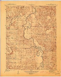
 1939 Caplinger Mills1941 Print · USGSThe Sac River valley in Cedar County was a landscape of small schools and family cemeteries just before the Second World War. Researchers can locate family landmarks like Leila Store, the Old Union Ch, and the many rural schools including Spring Valley Sch.4 unique versions available
 - 1941 Map of Caplinger Mills
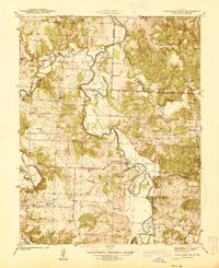
 1941 Caplinger Mills1941 Print · USGSThe rural landscape of Cedar County and St. Clair County is meticulously detailed in the early 1940s, centered on the winding Sac River. Researchers can trace the heritage of local families through landmarks like Caplinger Mills, Old Union Ch, and numerous country schools such as Flatrock Sch.
 - 1954 Map of Springfield
 1954 Springfield1954 Print · USGSThe Missouri Ozarks are captured here during the post-war era, showing the expansion of Springfield and the surrounding river valleys. Genealogists and historians can trace local landmarks like Mount Comfort Cemetery and the Fort Leonard Wood military grounds.6 unique versions available
 - 1958 Map of Springfield
 1958 Springfield1958 Print · USGSThe Missouri Ozarks are captured during the mid-century era of growth, centered on the bustling hub of Springfield. Genealogists and historians can trace family roots through numerous landmarks like Ebenezer Church, Stockton Cem, and the various county courthouses.
 - 1959 Map of Springfield
 1959 Springfield1959 Print · USGSThe Missouri Ozarks are captured here during a decade of postwar growth and increasing highway connectivity. Researchers can trace the legacy of the St Louis-San Francisco RR and locate early sites in Springfield, Lebanon, and Mountain Grove.
 - 1984 Map of Bolivar
 1984 Bolivar1984 Print · USGSWestern Missouri in the mid-eighties shows a landscape shaped by large-scale water management and rail commerce. Genealogists and historians can trace the development of towns like Bolivar and El Dorado Springs alongside the massive Stockton Lake.
 - 1991 Map of Caplinger Mills
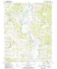 1991 Caplinger Mills1991 Print · USGSCedar County life in the early nineties centers on the winding Sac River and the community at Caplinger Mills. Local researchers can trace family landmarks like Leila Store, Hackleman Cem, and several rural churches including Mt Zion Ch.
 - 2011 Map of Caplinger Mills, 2011 Print
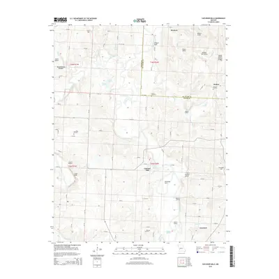
 2011 Caplinger Mills2011 Print · USGSCovers Ivy, including Rookins, Blackjack, and other nearby areas
 - 2015 Map of Caplinger Mills, 2015 Print
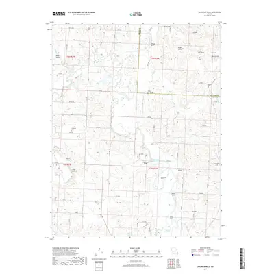
 2015 Caplinger Mills2015 Print · USGSCovers Ivy, including Rookins, Blackjack, and other nearby areas
 - 2017 Map of Caplinger Mills, 2017 Print
 2017 Caplinger Mills2017 Print · USGSCovers Ivy, including Rookins, Blackjack, and other nearby areas
 - 2021 Map of Caplinger Mills, 2021 Print
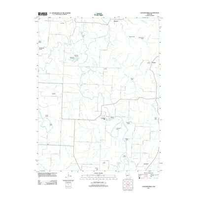
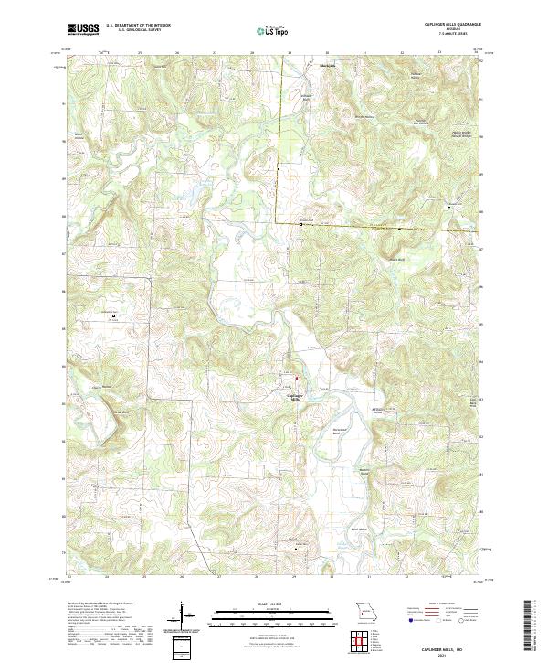 2021 Caplinger Mills2021 Print · USGSThe Cedar and St. Clair County borderlands are captured here in the early 2020s, centered on the riverfront community of Caplinger Mills. Researchers can trace the local landscape through landmarks like Hackleman Cem, Masters Island, and the Haynie Branch Natural Bridges.
End of results
Showing maps 1-12 of 12
Top cities near Ivy
- El Dorado Springs historical maps
- Stockton historical maps
- Jerico Springs historical maps
- Collins historical maps
- Roscoe historical maps
- Umber View Heights historical maps
See more
Frequently asked questions
- What are the different types of historical maps available for Ivy?
- What is the oldest map of Ivy?
- Where can I purchase historical maps of Ivy for my home or office?
- Where can I download high-res historical maps of Ivy?
- Are there historical topographic maps available for Ivy?
- Is there historical aerial imagery available for Ivy?
- Where are historical maps of Ivy sourced from?