1980s Maps of Earnestville, Missouri
Explore 2 historic maps of Earnestville from the 1980s. These maps offer a rare glimpse into what life looked like during the 1980s — showing old roads, neighborhoods, homes, and landmarks that have changed or disappeared over time.
Whether you're researching your family's past, planning a metal detecting trip, or studying how Earnestville's landscape evolved across the 1980s, these high-resolution maps are a powerful tool for exploring the history of this region.
- Focus on a specific era: All maps on this page are from the 1980s, giving you a focused view of this time period.
- See what’s changed: Compare century-old streets, trails, and buildings to today's modern landscape using overlays and satellite layers.
- Research with precision: Use these maps for genealogy, historical research, land use analysis, or educational projects.
- View, download, or print: Maps are fully viewable online in high resolution, and can be downloaded or printed for your own records.
Start exploring Earnestville's history through authentic maps from the 1980s. This is your window into the past.
Earnestville, MO maps
(2)- 1982 Map of Long Lane, 1983 Print
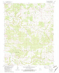 1982 Long Lane1983 Print · USGSDallas County, Missouri, is captured here in the early eighties, showcasing a rural landscape of winding creek beds and family-run farms. Genealogists and local historians can trace connections to Long Lane and Earnestville or locate family sites at Hill Cem and Harris Cem.
 - 1982 Map of Lebanon, 1983 Print
 1982 Lebanon1983 Print · USGSThe Missouri Ozarks are captured in the early eighties as Interstate 44 and the St Louis-San Francisco rail line link growing towns with the Fort Leonard Wood Military Reservation. Genealogists and historians can trace family-named sites like Flatwood Church and old post offices at Sleeper and Nebo.
End of results
Showing maps 1-2 of 2
Top cities near Earnestville
- Lebanon historical maps
- Marshfield historical maps
- Buffalo historical maps
- Conway historical maps
- Niangua historical maps
- Phillipsburg historical maps
See more
Frequently asked questions
- What are the different types of historical maps available for Earnestville?
- What is the oldest map of Earnestville?
- Where can I purchase historical maps of Earnestville for my home or office?
- Where can I download high-res historical maps of Earnestville?
- Are there historical topographic maps available for Earnestville?
- Is there historical aerial imagery available for Earnestville?
- Where are historical maps of Earnestville sourced from?