Old Maps of Long Lane, Missouri for Academic Research
Study the evolution of Long Lane with 11 high-resolution historic maps. Whether you're teaching, researching, or modeling changes in land use, these maps provide essential visual documentation of urban, environmental, and geographic change.
- Analyze long-term change: Track patterns in development, transportation, and natural features.
- Ideal for environmental or urban studies: Support academic projects with primary historical map data.
- Use in the classroom or lab: Educators and researchers rely on these maps to bring historical context to life.
These maps are a powerful tool for teaching, research, and visualizing how Long Lane has changed over the decades.
Long Lane, MO maps
(11)- 1939 Map of Long Lane, 1966 Print
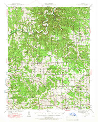 1939 Long Lane1966 Print · USGSDallas and Laclede Counties were defined by the winding Niangua River and the rural rail economy in the late 1930s. Genealogists can find numerous family-named landmarks like Williams Cem and isolated schools such as Blackfoot Sch.
 - 1942 Map of Long Lane
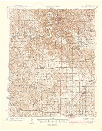 1942 Long Lane1942 Print · USGSThe Ozark plateau comes alive in the early 1940s, showing a land defined by the winding Niangua River and the rural townships of Wilson and Union. Researchers can trace dozens of country schoolhouses like Lonesome Hill Sch and Loudon Smoke Sch or locate ancestors near Shanks Cem.3 unique versions available
 - 1954 Map of Springfield
 1954 Springfield1954 Print · USGSThe Missouri Ozarks are captured here during the post-war era, showing the expansion of Springfield and the surrounding river valleys. Genealogists and historians can trace local landmarks like Mount Comfort Cemetery and the Fort Leonard Wood military grounds.6 unique versions available
 - 1958 Map of Springfield
 1958 Springfield1958 Print · USGSThe Missouri Ozarks are captured during the mid-century era of growth, centered on the bustling hub of Springfield. Genealogists and historians can trace family roots through numerous landmarks like Ebenezer Church, Stockton Cem, and the various county courthouses.
 - 1959 Map of Springfield
 1959 Springfield1959 Print · USGSThe Missouri Ozarks are captured here during a decade of postwar growth and increasing highway connectivity. Researchers can trace the legacy of the St Louis-San Francisco RR and locate early sites in Springfield, Lebanon, and Mountain Grove.
 - 1982 Map of Long Lane, 1983 Print
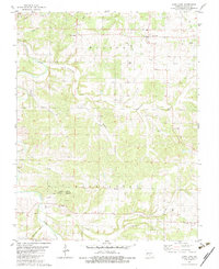 1982 Long Lane1983 Print · USGSDallas County, Missouri, is captured here in the early eighties, showcasing a rural landscape of winding creek beds and family-run farms. Genealogists and local historians can trace connections to Long Lane and Earnestville or locate family sites at Hill Cem and Harris Cem.
 - 1982 Map of Lebanon, 1983 Print
 1982 Lebanon1983 Print · USGSThe Missouri Ozarks are captured in the early eighties as Interstate 44 and the St Louis-San Francisco rail line link growing towns with the Fort Leonard Wood Military Reservation. Genealogists and historians can trace family-named sites like Flatwood Church and old post offices at Sleeper and Nebo.
 - 2011 Map of Long Lane, 2011 Print
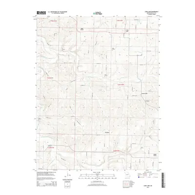
 2011 Long Lane2011 Print · USGSCovers Long Lane, including Wall Street, Shady Grove, and other nearby areas
 - 2015 Map of Long Lane, 2015 Print
 2015 Long Lane2015 Print · USGSCovers Long Lane, including Wall Street, Shady Grove, and other nearby areas
 - 2017 Map of Long Lane, 2017 Print
 2017 Long Lane2017 Print · USGSCovers Long Lane, including Wall Street, Shady Grove, and other nearby areas
 - 2021 Map of Long Lane, 2021 Print
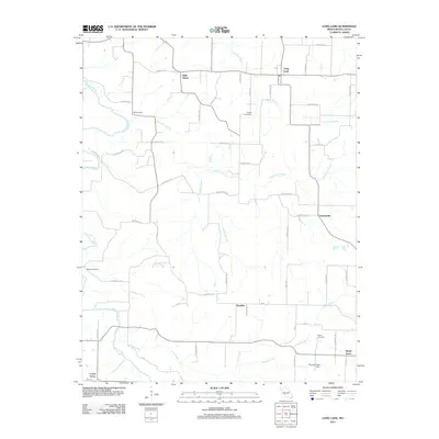
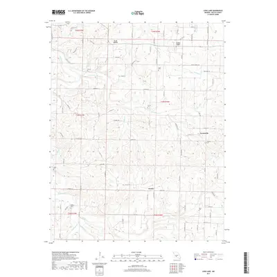
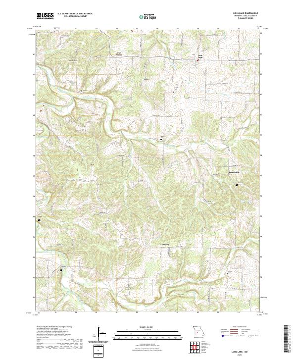 2021 Long Lane2021 Print · USGSDallas County, Missouri, is shown here in the early 2020s, featuring a landscape of creek valleys and upland ridges. Local historians can trace family ties at Hill Cem, Liberty Cem, and Harmony Cem or locate the rural centers of Long Lane and Earnestville.
End of results
Showing maps 1-11 of 11
Top cities near Long Lane
- Lebanon historical maps
- Buffalo historical maps
- Fair Grove historical maps
- Conway historical maps
- Niangua historical maps
- Phillipsburg historical maps
See more
Frequently asked questions
- What are the different types of historical maps available for Long Lane?
- What is the oldest map of Long Lane?
- Where can I purchase historical maps of Long Lane for my home or office?
- Where can I download high-res historical maps of Long Lane?
- Are there historical topographic maps available for Long Lane?
- Is there historical aerial imagery available for Long Lane?
- Where are historical maps of Long Lane sourced from?