1920s Maps of Polk Township, Missouri
Explore 6 historic maps of Polk Township from the 1920s. These maps offer a rare glimpse into what life looked like during the 1920s — showing old roads, neighborhoods, homes, and landmarks that have changed or disappeared over time.
Whether you're researching your family's past, planning a metal detecting trip, or studying how Polk Township's landscape evolved across the 1920s, these high-resolution maps are a powerful tool for exploring the history of this region.
- Focus on a specific era: All maps on this page are from the 1920s, giving you a focused view of this time period.
- See what’s changed: Compare century-old streets, trails, and buildings to today's modern landscape using overlays and satellite layers.
- Research with precision: Use these maps for genealogy, historical research, land use analysis, or educational projects.
- View, download, or print: Maps are fully viewable online in high resolution, and can be downloaded or printed for your own records.
Start exploring Polk Township's history through authentic maps from the 1920s. This is your window into the past.
Polk Township, MO maps
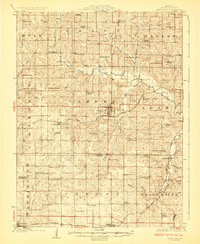
(6)- 1923 Map of Clarksdale, 1963 Print
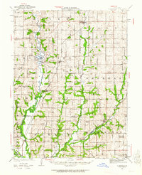 1923 Clarksdale1963 Print · USGSNorthwest Missouri's agricultural heartland is captured here in the 1920s, when small rail towns and country schools defined the rural landscape. Trace the old rail lines of the CHICAGO ROCK ISLAND AND PACIFIC RR or locate family landmarks like Bedford Chapel and Frogge School.3 unique versions available
 - 1923 Map of Maysville, 1966 Print
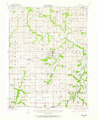 1923 Maysville1966 Print · USGSDeKalb County at the start of the twenties was a landscape of thriving rural school districts and bustling rail towns. Genealogists can locate family landmarks like Butler Cemetery or trace community life at Marvin Chapel and Fairmount School.
 - 1925 Map of Clarksdale
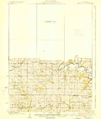
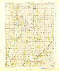 1925 Clarksdale1925 Print · USGSNorthwest Missouri's river valleys and rail lines are captured here in the mid-1920s at the height of its rural schoolhouse era. Genealogists and historians can trace dozens of family-named landmarks like Bowen Cemetery, Fountain Blue School, and the unique Wire Bridge.2 unique versions available
 - 1925 Map of Stanberry
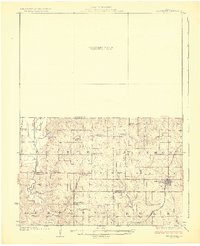 1925 Stanberry1925 Print · USGSNorthwest Missouri in the mid-1920s is captured here at a height of rural community life before the consolidation of rural districts. Genealogists can locate dozens of localized landmarks like Bachelor Hall School, Flag Springs, and the Chicago Burlington and Quincy railroad line.3 unique versions available
 - 1925 Map of Maysville
 1925 Maysville1925 Print · USGSDeKalb County is shown in the mid-1920s as a thriving patchwork of rural school districts and rail-connected towns. Genealogists and local historians can trace family roots through dozens of named landmarks like Hedge School, Marvin Chapel, and Amity Cemetery.2 unique versions available
 - 1925 Map of Darlington
 1925 Darlington1925 Print · USGSGentry and DeKalb counties come alive in the mid-1920s, showing a landscape of small farmsteads and rural schoolhouses. Genealogists can trace family roots through landmarks like Mt Tabor Church, Ford City, and the uniquely named Rattlesnake School.3 unique versions available
End of results
Showing maps 1-6 of 6
Top cities near Polk Township
- Saint Joseph historical maps
- Stanberry historical maps
- Maysville historical maps
- King City historical maps
- Union Star historical maps
- Clarksdale historical maps
See more
Top neighborhoods of Polk Township
Frequently asked questions
- What are the different types of historical maps available for Polk Township?
- What is the oldest map of Polk Township?
- Where can I purchase historical maps of Polk Township for my home or office?
- Where can I download high-res historical maps of Polk Township?
- Are there historical topographic maps available for Polk Township?
- Is there historical aerial imagery available for Polk Township?
- Where are historical maps of Polk Township sourced from?