1900s (20th Century) Maps of Gray Summit, Missouri
Explore 14 historic maps of Gray Summit from the 1900s (20th Century). These maps offer a rare glimpse into what life looked like during the 1900s — showing old roads, neighborhoods, homes, and landmarks that have changed or disappeared over time.
Whether you're researching your family's past, planning a metal detecting trip, or studying how Gray Summit's landscape evolved across the 1900s, these high-resolution maps are a powerful tool for exploring the history of this region.
- Focus on a specific era: All maps on this page are from the 1900s, giving you a focused view of this time period.
- See what’s changed: Compare century-old streets, trails, and buildings to today's modern landscape using overlays and satellite layers.
- Research with precision: Use these maps for genealogy, historical research, land use analysis, or educational projects.
- View, download, or print: Maps are fully viewable online in high resolution, and can be downloaded or printed for your own records.
Start exploring Gray Summit's history through authentic maps from the 1900s. This is your window into the past.
Gray Summit, MO maps
(14)- 1901 Map of De Soto
 1901 De Soto1901 Print · USGSJefferson and Franklin Counties at the turn of the century show a landscape defined by industrial milling and river fords. Genealogists can trace early homesteads near Hillsboro or industrial sites like Vulcan Mine and Byrnes Mill.5 unique versions available
 - 1903 Map of O'Fallon
 1903 O'Fallon1903 Print · USGSSt. Charles County at the turn of the century is a labyrinth of river islands and rail lines at the confluence of the Missouri and Mississippi. Researchers can trace old river landings like Cap Au Gris Landing and family-named settlements from Moscow Mills to New Melle.5 unique versions available
 - 1947 Map of St. Clair, 1950 Print
 1947 St. Clair1950 Print · USGSFranklin County at the dawn of the fifties shows a landscape shaped by the winding Meramec River and a busy network of major railroads. Genealogists and local historians can locate early landmarks like Purina Farm, the Virginia Mines (Abandoned), and the Brush Creek Cem.3 unique versions available
 - 1948 Map of Augusta, 1963 Print
 1948 Augusta1963 Print · USGSEastern Missouri river country at mid-century shows a landscape of small farming hamlets and essential riverside industries. Genealogists and historians can locate rural landmarks like Emmaus Sanitarium, the Tavern Rock Quarry, and numerous local schools such as Wide Awake Sch.2 unique versions available
 - 1949 Map of Saint Louis
 1949 Saint Louis1949 Print · USGSGreater St. Louis and its surrounding river valleys are captured here just after the war, showing the metropolitan core and the rural Ozark fringe. Researchers can trace the sprawling rail network of the Wabash RR or locate landmarks like Meramec Caverns Airport and Scott Air Force Base.2 unique versions available
 - 1949 Map of Augusta
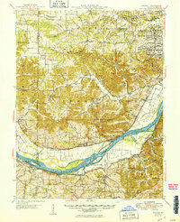 1949 Augusta1949 Print · USGSMid-century St. Charles and Franklin Counties are seen here along the Missouri River as the post-war rural landscape began to shift. Genealogists and local historians can trace family locations through numerous rural schoolhouses like Wide Awake Sch, or locate industrial sites like the Weldon Spring Ordnance Works.2 unique versions available
 - 1950 Map of St. Clair
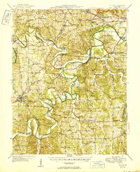 1950 St. Clair1950 Print · USGSFranklin County's winding river valleys and ridge-top settlements are captured here in the mid-twentieth century. Genealogists and local historians can trace family locations near Virginia Mines, the Henry Shaw Arboretum, and numerous rural schools like Ten Tiney Bluff Sch.
 - 1962 Map of St. Louis
 1962 St. Louis1962 Print · USGSThe mid-century gateway to the west shows the metropolitan expansion of St Louis alongside its critical river confluences. Genealogists and historians can trace the rail corridors of the Missouri Pacific RR and settlements from Fulton to De Soto.
 - 1963 Map of St. Louis, 1970 Print
 1963 St. Louis1970 Print · USGSSt. Louis and its surrounding river valleys are captured here during the peak of mid-century suburban expansion and industrial activity. Trace the historic rail routes of the Norfolk and Western Ry or locate the St Louis Ordnance Plant and early stretches of US Highway 66.4 unique versions available
 - 1966 Map of St. Louis
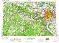 1966 St. Louis1966 Print · USGSThe St. Louis metropolitan area and its surrounding river valleys are captured here during the mid-sixties era of suburban growth and industrial strength. Genealogists and historians can trace the foundations of local communities through sites like Old Pioneer Cem, Parks College, and the Jefferson Barracks Military Reservation.
 - 1969 Map of Gray Summit, 1971 Print
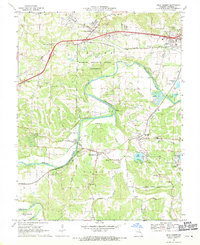 1969 Gray Summit1971 Print · USGSThe Meramec River valley comes alive in the late sixties as a hub of rail transit and horticulture. Trace family roots at Old St Bridgets Cem or explore the vast Missouri Botanical Garden Arboretum and the rail junction at Pacific.
 - 1972 Map of Labadie, 1973 Print
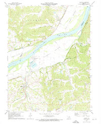 1972 Labadie1973 Print · USGSThe Missouri River bend at Franklin and St. Charles counties is shown here in the early seventies, dominated by rail lines and river industry. Researchers can find old settlements like Klondike, trace the Missouri Pacific railroad, and locate landmarks like Tavern Rock Cave.2 unique versions available
 - 1985 Map of St Louis
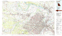 1985 St Louis1985 Print · USGSThe St. Louis metropolitan area and its river confluences are captured here during a period of significant suburban expansion in the 1980s. Genealogists and historians can trace the development of older neighborhoods and landmarks like Jefferson Barracks, Cahokia Mounds State Park, and Washington University.3 unique versions available
 - 1985 Map of Festus, 1987 Print
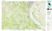 1985 Festus1987 Print · USGSThe Mississippi River corridor and Ozark foothills appear here in the mid-1980s, documenting a landscape of industrial river towns and forest preserves. Trace the development of Festus, Crystal City, and De Soto or locate sites like Mastodon State Park.
End of results
Showing maps 1-14 of 14
Top cities near Gray Summit
- O'Fallon historical maps
- Chesterfield historical maps
- Wildwood historical maps
- Ballwin historical maps
- Washington historical maps
- Union historical maps
See more
Frequently asked questions
- What are the different types of historical maps available for Gray Summit?
- What is the oldest map of Gray Summit?
- Where can I purchase historical maps of Gray Summit for my home or office?
- Where can I download high-res historical maps of Gray Summit?
- Are there historical topographic maps available for Gray Summit?
- Is there historical aerial imagery available for Gray Summit?
- Where are historical maps of Gray Summit sourced from?