2020s Maps of Gasconade County, Missouri
Explore 20 historic maps of Gasconade County from the 2020s. These maps offer a rare glimpse into what life looked like during the 2020s — showing old roads, neighborhoods, homes, and landmarks that have changed or disappeared over time.
Whether you're researching your family's past, planning a metal detecting trip, or studying how Gasconade County's landscape evolved across the 2020s, these high-resolution maps are a powerful tool for exploring the history of this region.
- Focus on a specific era: All maps on this page are from the 2020s, giving you a focused view of this time period.
- See what’s changed: Compare century-old streets, trails, and buildings to today's modern landscape using overlays and satellite layers.
- Research with precision: Use these maps for genealogy, historical research, land use analysis, or educational projects.
- View, download, or print: Maps are fully viewable online in high resolution, and can be downloaded or printed for your own records.
Start exploring Gasconade County's history through authentic maps from the 2020s. This is your window into the past.
Gasconade County, MO maps
(20)- 2021 Map of Goerlisch Ridge, 2021 Print
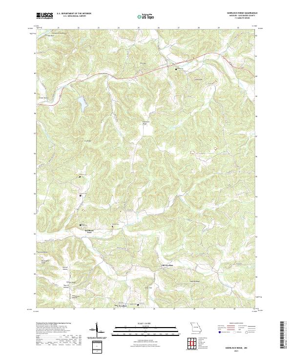 2021 Goerlisch Ridge2021 Print · USGSThe interior of Gasconade County is documented here during the early twenty-first century, showing a landscape of deep hollows and high ridges. Researchers can locate many family burial sites like Laubert Cem and Advent Cem or trace the old crossing at Suelthaus Ford.
 - 2021 Map of Gasconade, 2021 Print
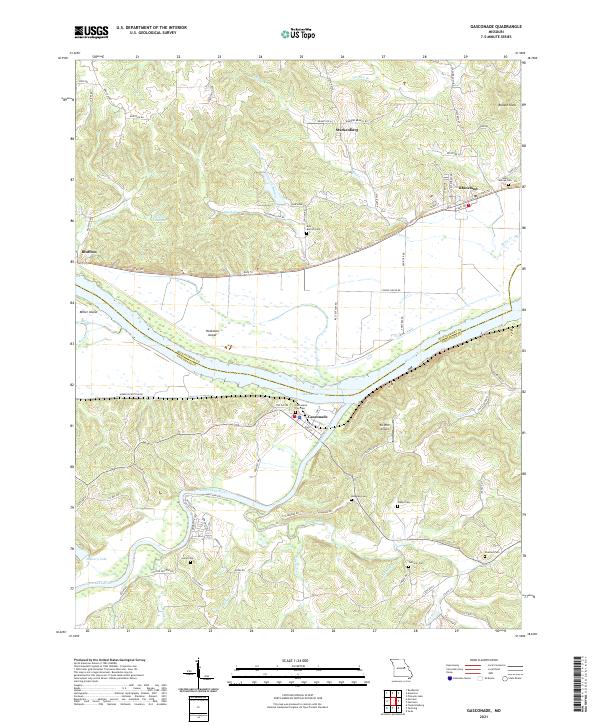 2021 Gasconade2021 Print · USGSGasconade and the Missouri River confluence are captured here in the early twenty-first century. Genealogists can locate several family burial sites like Saint Marcus Cem and Lucas Cem, or trace the winding path of the Katy Trl.
 - 2021 Map of Strain, 2021 Print
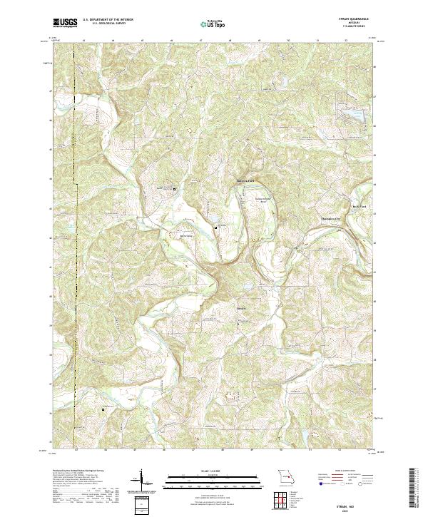 2021 Strain2021 Print · USGSThe Bourbeuse River valley in Franklin County remains a rural landscape defined by its historic river crossings and small settlements. Genealogists can locate several family burial sites, including Lockhart Cem and McCallister Cem, alongside the community at Strain.
 - 2021 Map of Redbird, 2021 Print
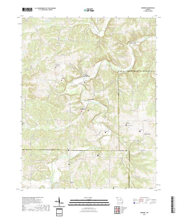 2021 Redbird2021 Print · USGSThe rural borderlands of Gasconade, Crawford, and Phelps counties are documented here as they appeared in the early 2020s. Researchers can locate numerous family burial sites and river crossings like Arthur Spring Ford, Jake Prairie, and the LeDuc United Methodist Church Cem.
 - 2021 Map of Pershing, 2021 Print
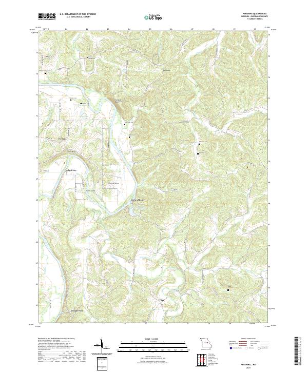 2021 Pershing2021 Print · USGSGasconade County in the early twenty-first century remains defined by its deep river bends and high ridge settlements. Genealogists and local historians can trace family burial sites like Keller Cem and locate historical river crossings at Feigler Ferry or Krueger Ford.
 - 2021 Map of Morrison, 2021 Print
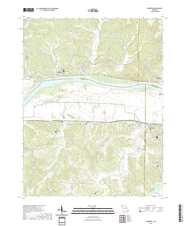 2021 Morrison2021 Print · USGSMorrison and the Missouri River bottoms appear in this modern survey of the Gasconade and Callaway county borders. Genealogists can trace numerous local burial sites like Assumption Catholic Cem and Ferguson Cem near the banks of Baileys Cr.
 - 2021 Map of Hermann, 2021 Print
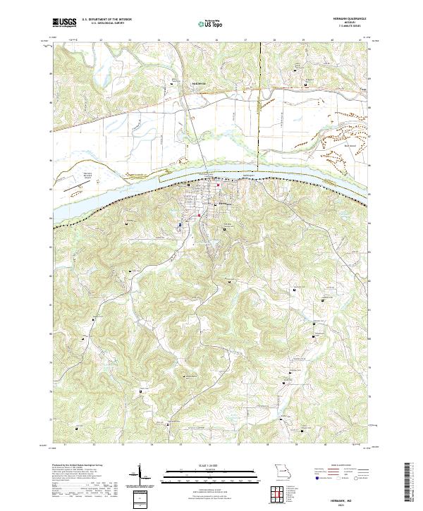 2021 Hermann2021 Print · USGSMissouri's Rhineland comes to life in this detailed view of Hermann and the Missouri River valley during the early twenty-first century. Genealogists and local historians can trace family roots through an exceptional number of burial sites, including Halle Talbot Cem, Poeschel Cem, and Loutre Island Church Cem.
 - 2021 Map of Swiss, 2021 Print
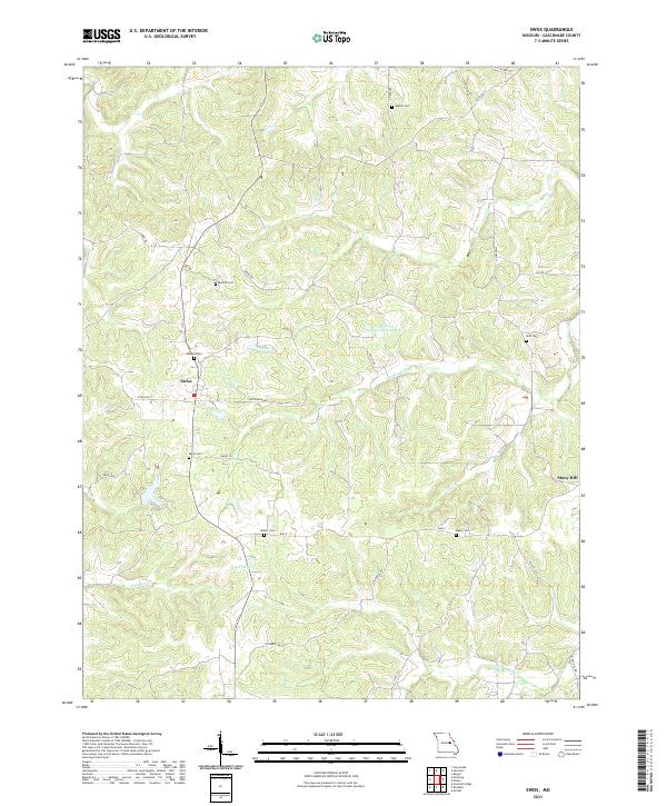 2021 Swiss2021 Print · USGSGasconade County settlement in the 2020s is defined by small villages and generational family lands. Genealogists can locate numerous burial sites like Sanders Cem, Kahle Cem, and Roth Cem near the town of Swiss.
 - 2021 Map of Oak Hill, 2021 Print
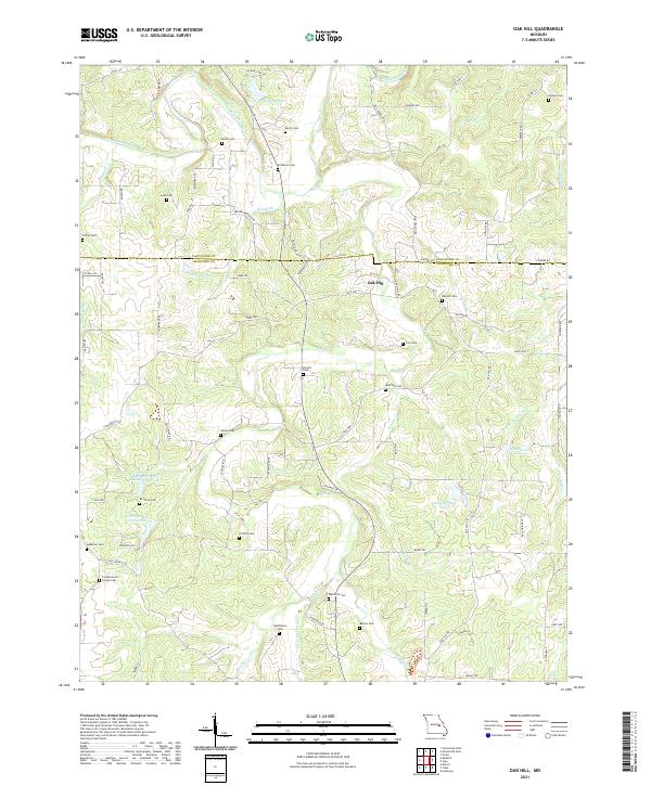 2021 Oak Hill2021 Print · USGSCrawford County's rural landscape is captured here in the early twenty-first century, centered on the community of Oak Hill. Researchers can locate numerous family burial sites across the hills, including Pinnell Cem, Schannon Cem, and the Frederickson Family Cem.
 - 2021 Map of Berger, 2021 Print
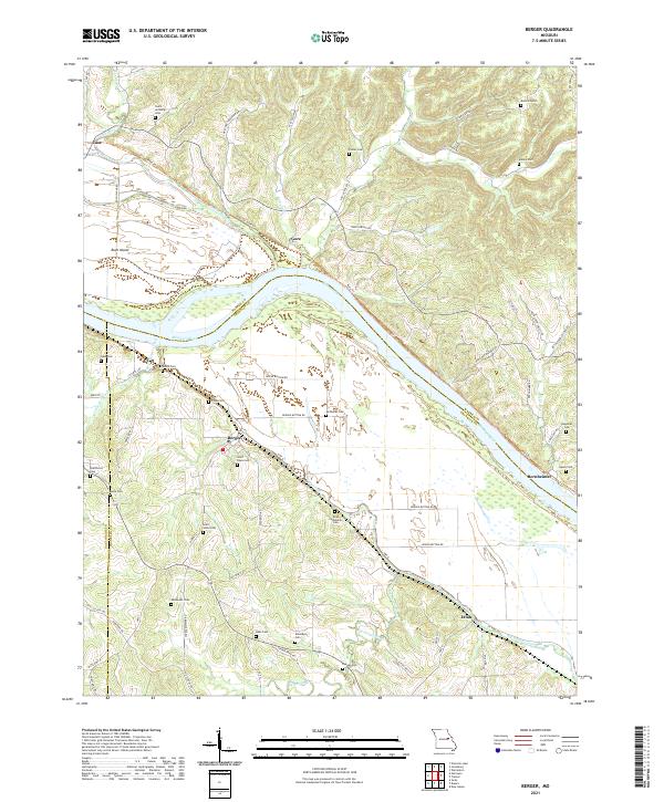 2021 Berger2021 Print · USGSThe river bluffs of Franklin County come into sharp focus in this recent survey of Berger and the winding Missouri River valley. Genealogists and local historians can trace family land and burial sites at Saint Pauls Cem, Finks Cem, and Etlah.
 - 2021 Map of Cooper Hill, 2021 Print
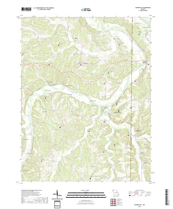 2021 Cooper Hill2021 Print · USGSOsage and Gasconade counties are defined by the winding river valley and rugged ridge systems in this recent 2021 study. Genealogists and local historians can trace family roots through numerous remote burial grounds like Haynes Cem and Mount Sterling Cem.
 - 2021 Map of Owensville East, 2021 Print
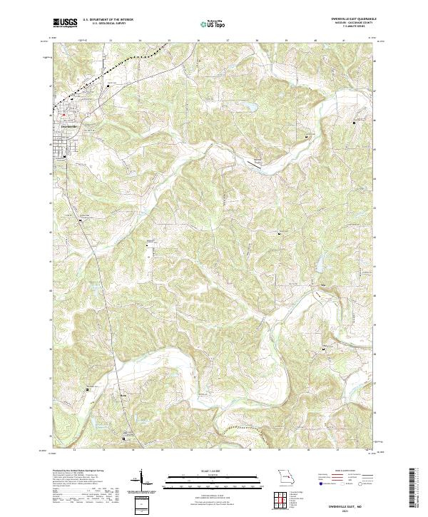 2021 Owensville East2021 Print · USGSGasconade County settlement patterns are preserved here in the early twenty-first century as agricultural lands surround the growth of Owensville. Genealogists can trace family names at the Bohemian Catholic Cem, Warren Cem, and the rural crossroads of Tea.
 - 2021 Map of Owensville West, 2021 Print
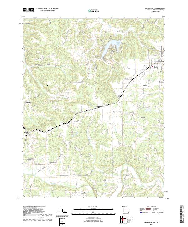 2021 Owensville West2021 Print · USGSGasconade County at the start of the 2020s shows a landscape of established townships and rural cemetery sites. Researchers can trace family roots at Saint Michael Cem or explore the transition from Old Bland to the newer town of Bland.
 - 2021 Map of Belle, 2021 Print
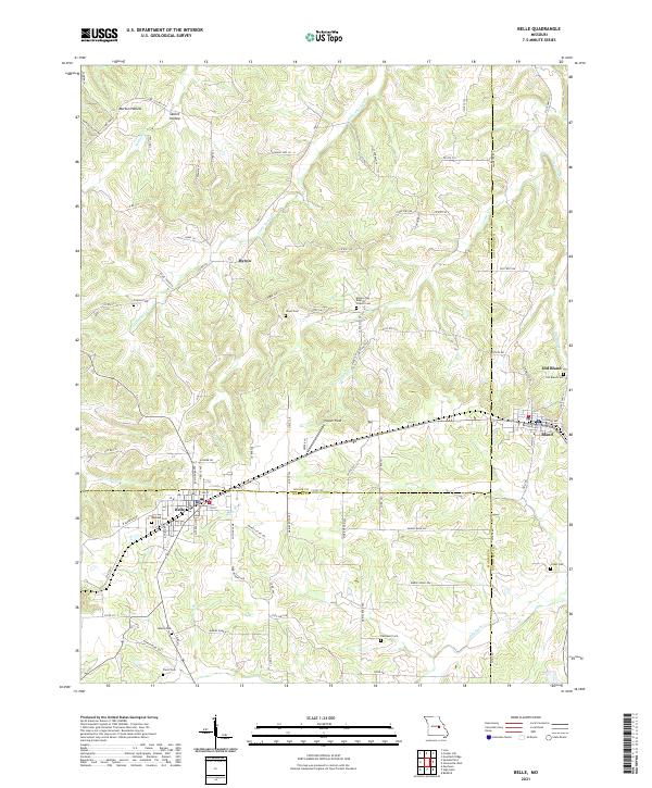 2021 Belle2021 Print · USGSThe tri-county borderlands of Maries, Osage, and Gasconade counties are documented here in the early twenty-first century. Genealogists and local historians can trace family roots through numerous remote burial grounds including Backues Cem, Liberty Cem, and Crider Cem.
 - 2021 Map of Dissen, 2021 Print
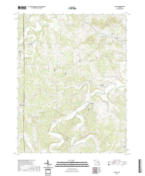 2021 Dissen2021 Print · USGSFranklin and Gasconade counties are documented here in the early 2020s, showing the enduring rural character of central Missouri. Genealogists can locate family burial sites like Detmold Cem and Meyers Cem or trace the settlements of Kohl City and Dissen.
 - 2021 Map of Argo, 2021 Print
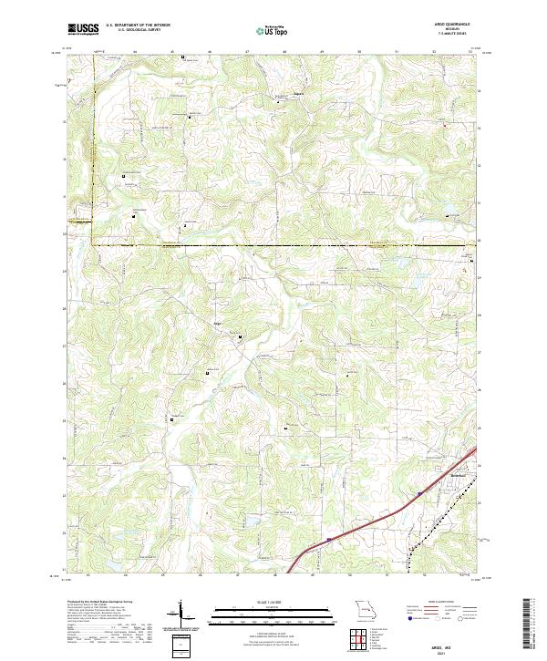 2021 Argo2021 Print · USGSThe rural borderlands of Crawford and Franklin counties are captured here in the early twenty-first century. Genealogists can trace family lines through numerous sites like Old Japan Cem, Walker Cem, and the settlements of Japan and Argo.
 - 2021 Map of Gerald, 2021 Print
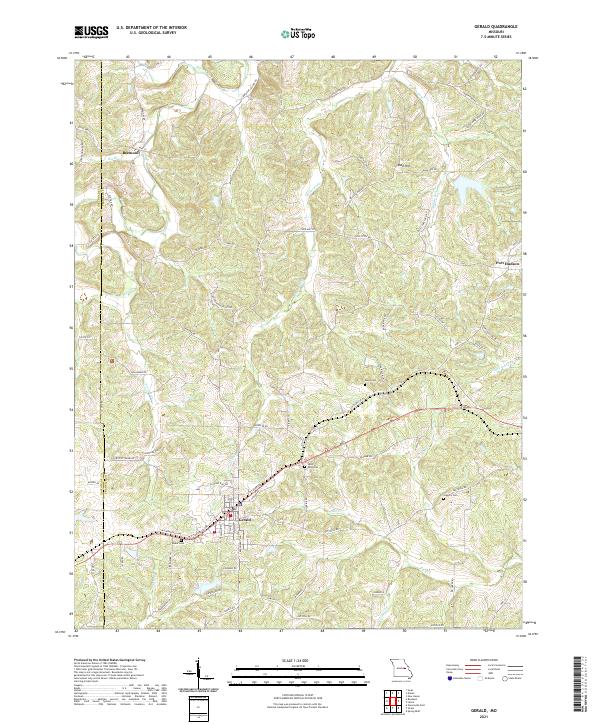 2021 Gerald2021 Print · USGSThe Franklin and Gasconade County line area comes into focus here during the early twenty-first century. Researchers can trace rural lineages through numerous local sites like Boeuf Cem and the small settlements of Beemont and Port Hudson.
 - 2021 Map of Rosebud, 2021 Print
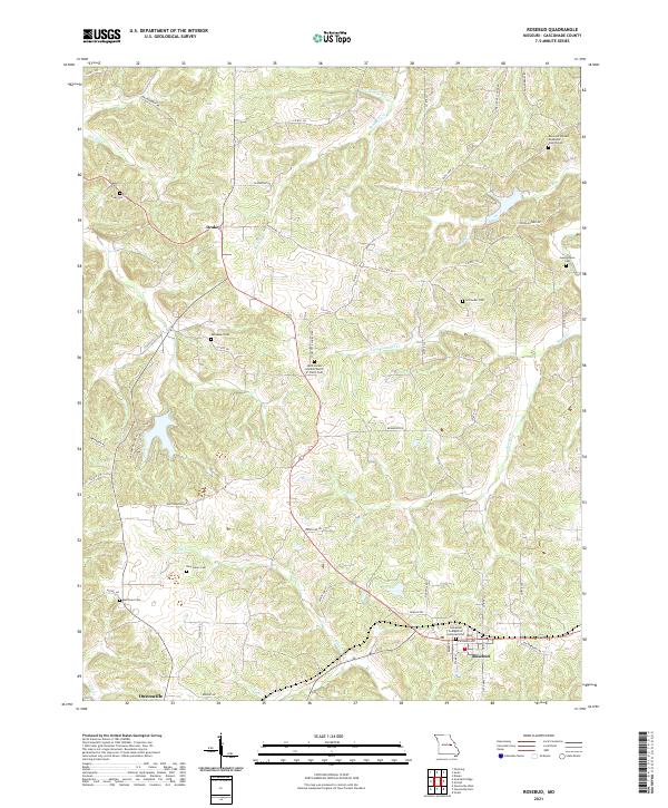 2021 Rosebud2021 Print · USGSGasconade County settlement patterns are on full display in this modern survey of the Missouri countryside. Researchers can trace local history through a high density of rural burial sites, including Zoar Cem, New Salem Cem, and the Georgetown Cem.
 - 2021 Map of High Gate, 2021 Print
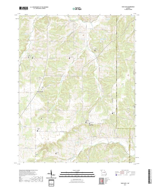 2021 High Gate2021 Print · USGSMaries County near the Gasconade and Phelps borders is shown in the early 2020s as a region defined by its small prairie settlements and family-named landmarks. Researchers can trace dozens of local burial sites like Walker Family Cem and Skaggs Chapel Cem along Lanes Fork.
 - 2021 Map of Fredericksburg, 2021 Print
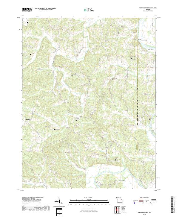 2021 Fredericksburg2021 Print · USGSThe Osage and Gasconade county borderlands are defined by the winding Gasconade River in this modern survey. Genealogists can trace family heritage through local burial sites like Hancock Cem and Baileys Creek Cem or the rural settlements of Fredericksburg and Aud.
End of results
Showing maps 1-20 of 20
Top cities of Gasconade County
- Hermann historical maps
- Owensville historical maps
- Rosebud historical maps
- Gasconade historical maps
- Morrison historical maps
Frequently asked questions
- What are the different types of historical maps available for Gasconade County?
- What is the oldest map of Gasconade County?
- Where can I purchase historical maps of Gasconade County for my home or office?
- Where can I download high-res historical maps of Gasconade County?
- Are there historical topographic maps available for Gasconade County?
- Is there historical aerial imagery available for Gasconade County?
- Where are historical maps of Gasconade County sourced from?