1980s Maps of Miller Township, Missouri
Explore 7 historic maps of Miller Township from the 1980s. These maps offer a rare glimpse into what life looked like during the 1980s — showing old roads, neighborhoods, homes, and landmarks that have changed or disappeared over time.
Whether you're researching your family's past, planning a metal detecting trip, or studying how Miller Township's landscape evolved across the 1980s, these high-resolution maps are a powerful tool for exploring the history of this region.
- Focus on a specific era: All maps on this page are from the 1980s, giving you a focused view of this time period.
- See what’s changed: Compare century-old streets, trails, and buildings to today's modern landscape using overlays and satellite layers.
- Research with precision: Use these maps for genealogy, historical research, land use analysis, or educational projects.
- View, download, or print: Maps are fully viewable online in high resolution, and can be downloaded or printed for your own records.
Start exploring Miller Township's history through authentic maps from the 1980s. This is your window into the past.
Miller Township, MO maps
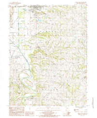
(7)- 1984 Map of Matkins, 1985 Print
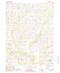 1984 Matkins1985 Print · USGSHarrison County in the early eighties is captured here in a time of established rural life and family farming. Genealogists can trace property locations near Matkins or follow family landmarks along Sampson Creek, Goose Creek, and White Oak Creek.
 - 1984 Map of Pattonsburg, 1985 Print
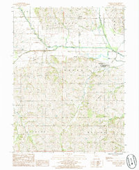
 1984 Pattonsburg1985 Print · USGSNorthwest Missouri's river-bottom landscapes and rural rail history come alive in this mid-eighties survey of the Daviess County region. Researchers can trace the path of the Old Railroad Grade and explore the winding banks of the Grand River near Pattonsburg.
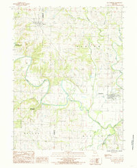
 - 1985 Map of Ford City
 1985 Ford City1985 Print · USGSGentry and De Kalb Counties are shown in the mid-1980s, documenting a landscape of rural townships and winding creek valleys. Genealogists and local historians can trace the Railroad Grade near Ford City and locate local landmarks like the QUARRY and Cem.
 - 1985 Map of Berlin
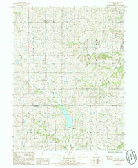
 1985 Berlin1985 Print · USGSGentry and De Kalb Counties in the mid-1980s are defined by the winding course of the Grand River and its many wooded tributaries. Researchers can locate the small community of Berlin, the riverside Andy Denton Public Access, and the winding North Fork Lost Creek.
 - 1985 Map of Albany South
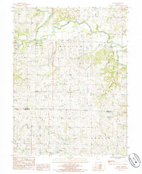
 1985 Albany South1985 Print · USGSGentry County in the mid-eighties shows a landscape defined by the winding Grand River and rural crossroads. Researchers can trace the layout of small communities like Gentryville, Evona, and Whitten, or locate specific landmarks like the Lee Lake dam.
 - 1985 Map of Darlington, 1986 Print
 1985 Darlington1986 Print · USGSGentry County in the 1980s shows a landscape of river-bottom farming and small-town Missouri life. Genealogists and local historians can trace the Old RR Grade through Darlington or locate family plots near Mc Curry and the local Cem.
 - 1986 Map of Maryville
 1986 Maryville1986 Print · USGSNorthwest Missouri's agricultural heartland is documented here in the mid-1980s, from the campus at Northwest Missouri State University to the Grand River valley. Genealogists can trace family footprints across dozens of local burial grounds like Alanthus Grove Cem and Brooklyn Cem.2 unique versions available
End of results
Showing maps 1-7 of 7
Top cities near Miller Township
- Albany historical maps
- Stanberry historical maps
- Maysville historical maps
- King City historical maps
- New Hampton historical maps
- Pattonsburg historical maps
See more
Top neighborhoods of Miller Township
Frequently asked questions
- What are the different types of historical maps available for Miller Township?
- What is the oldest map of Miller Township?
- Where can I purchase historical maps of Miller Township for my home or office?
- Where can I download high-res historical maps of Miller Township?
- Are there historical topographic maps available for Miller Township?
- Is there historical aerial imagery available for Miller Township?
- Where are historical maps of Miller Township sourced from?