2020s Maps of Howard County, Missouri
Explore 18 historic maps of Howard County from the 2020s. These maps offer a rare glimpse into what life looked like during the 2020s — showing old roads, neighborhoods, homes, and landmarks that have changed or disappeared over time.
Whether you're researching your family's past, planning a metal detecting trip, or studying how Howard County's landscape evolved across the 2020s, these high-resolution maps are a powerful tool for exploring the history of this region.
- Focus on a specific era: All maps on this page are from the 2020s, giving you a focused view of this time period.
- See what’s changed: Compare century-old streets, trails, and buildings to today's modern landscape using overlays and satellite layers.
- Research with precision: Use these maps for genealogy, historical research, land use analysis, or educational projects.
- View, download, or print: Maps are fully viewable online in high resolution, and can be downloaded or printed for your own records.
Start exploring Howard County's history through authentic maps from the 2020s. This is your window into the past.
Howard County, MO maps
(18)- 2021 Map of New Franklin, 2021 Print
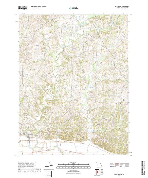 2021 New Franklin2021 Print · USGSHoward County, Missouri, at the modern decade shows a landscape shaped by the Missouri River's tributaries. Genealogists and hikers can trace the Katy Trl near New Franklin or locate rural burial grounds like Robinson Cem and Drake Campbell Cem.
 - 2021 Map of Hilldale, 2021 Print
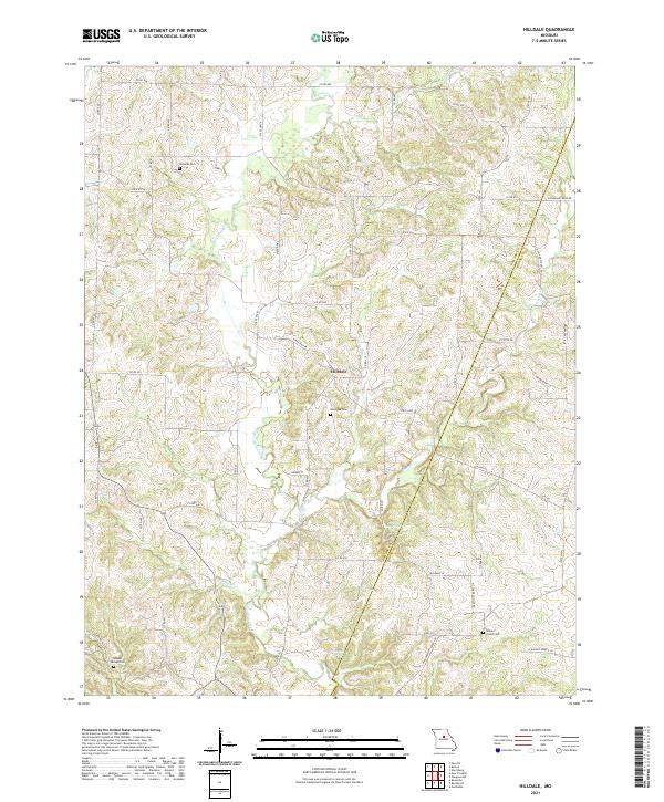 2021 Hilldale2021 Print · USGSThe borderlands of Howard and Boone counties are captured here in the early 2020s, showing a landscape shaped by the winding Moniteau Creek. Genealogists and local historians can locate several family burial grounds like Ricketts Cem or trace unique natural landmarks such as U S Salt Springs.
 - 2021 Map of Franklin, 2021 Print
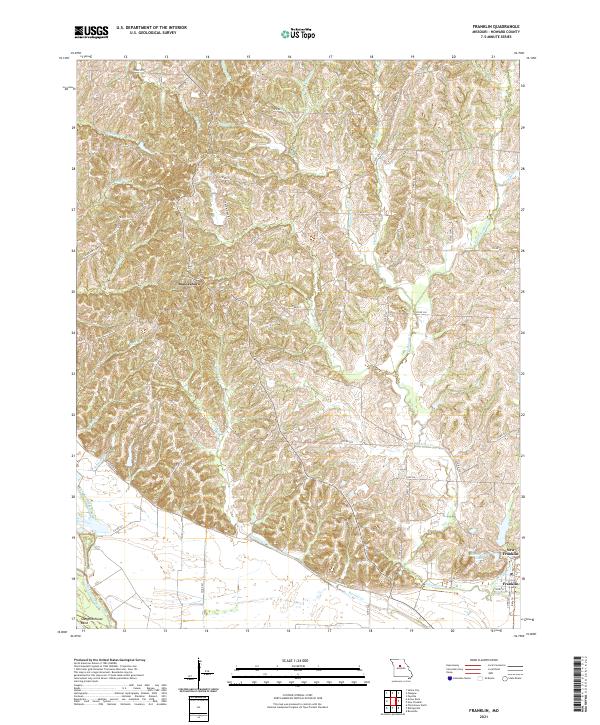 2021 Franklin2021 Print · USGSHoward County comes into focus in this recent survey of the Missouri River valley and its upland settlements. Genealogists and historians can trace the relationship between Boonesboro, New Franklin, and river landmarks like Slaughterhouse Bend.
 - 2021 Map of Harrisburg, 2021 Print
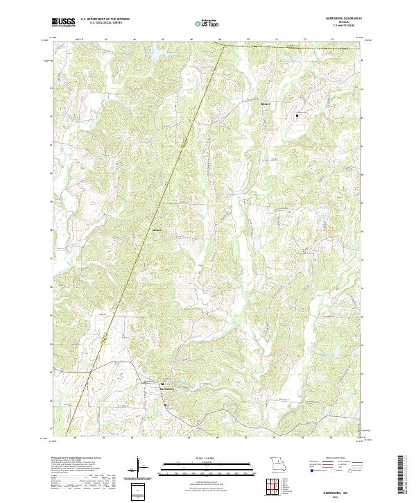 2021 Harrisburg2021 Print · USGSHarrisburg and the surrounding Boone County countryside appear here in contemporary detail during the early 2020s. Researchers can trace local lineage and property at the Harrisburg Cem and Robison Cem or follow the paths of Perche Cr and Coon Cr.
 - 2021 Map of Armstrong, 2021 Print
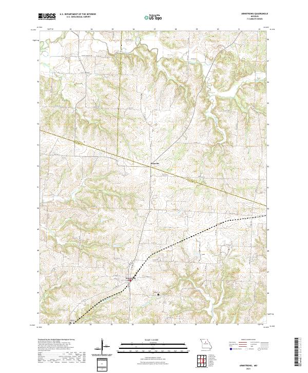 2021 Armstrong2021 Print · USGSThe rural borderlands of Chariton, Randolph, and Howard counties are captured in this recent survey. Local historians can trace the roads and waterways connecting Armstrong and Roanoke, or locate family burial sites at Wesley Cem and Walnut Hill Cem.
 - 2021 Map of Sturgeon SW, 2021 Print
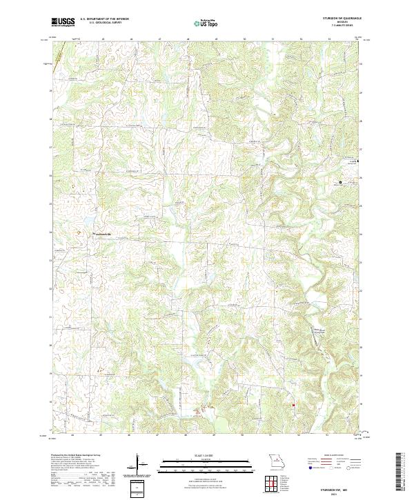 2021 Sturgeon SW2021 Print · USGSBoone County's rural heartland is captured in this survey, showing the agricultural community of Woodlandville and its surrounding creek systems. Genealogists can locate family landmarks like Dripping Spring Cem or trace the namesake N Evert School Rd.
 - 2021 Map of Renick, 2021 Print
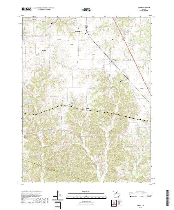 2021 Renick2021 Print · USGSThe Randolph and Howard County line comes alive in this 2020s study of the Missouri countryside between Moberly and Renick. Genealogists and researchers can pinpoint ancestral sites at Anderson Cem, Sandy Hook Cem, and the Hess-McKeown Airport.
 - 2021 Map of Saline City, 2021 Print
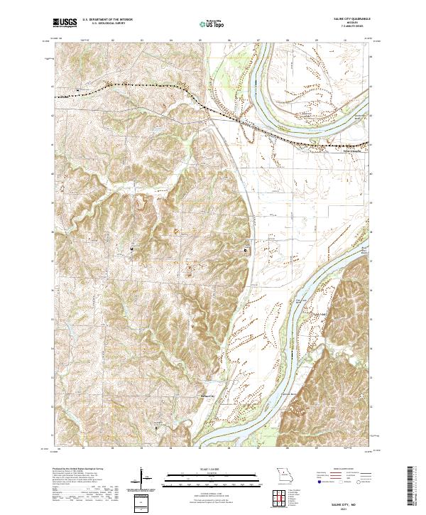 2021 Saline City2021 Print · USGSThe Missouri River meanders through Saline and Howard counties in this recent survey of the Missouri heartland. Genealogists can locate family burial sites at Sappington Grove Cem and Fish Creek Cem or trace the rural roads connecting Saline City and Gilliam.
 - 2021 Map of Glasgow, 2021 Print
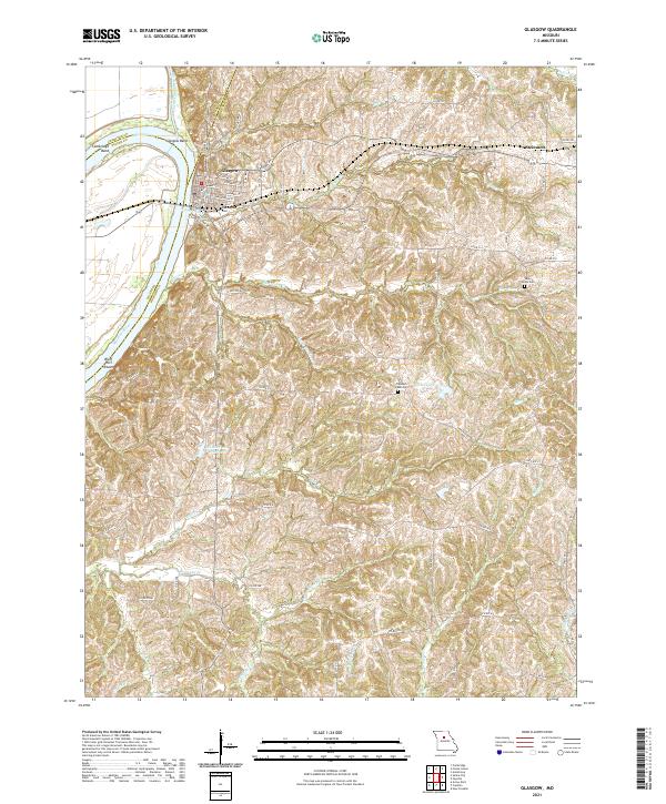 2021 Glasgow2021 Print · USGSThe Missouri River bluffs and the riverfront town of Glasgow are captured here in the early 2020s. Genealogists can locate several local burial grounds including Washington Cem and Sugar Grove Cem alongside landmarks like Glasgow Bend.
 - 2021 Map of Arrow Rock, 2021 Print
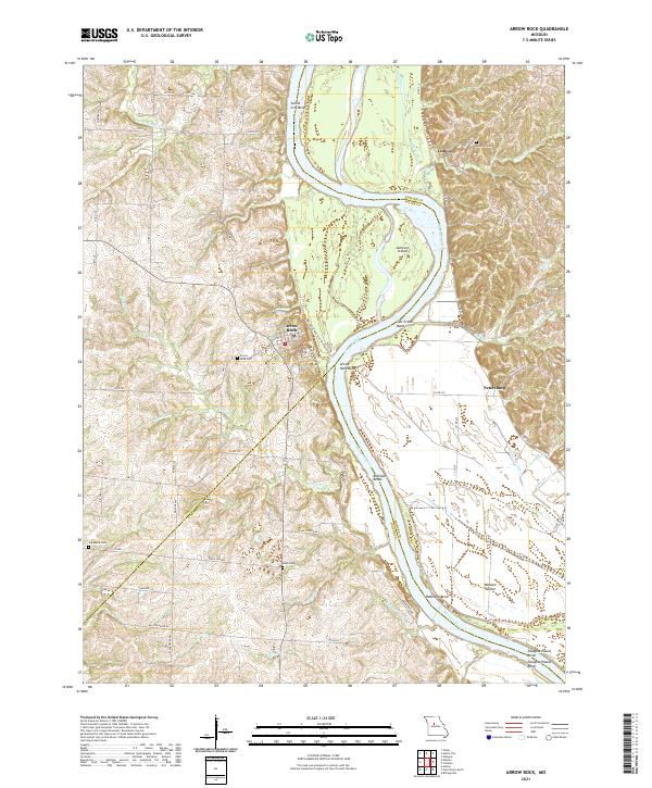 2021 Arrow Rock2021 Print · USGSThe Missouri River bluffs and bottomlands are surveyed here in 2021, showing the area as it remains today. Genealogists and historians can trace routes like the Lewis And Clark Trail of Discovery Trl and locate Arrow Rock Cem or Lisbon.
 - 2021 Map of Fayette, 2021 Print
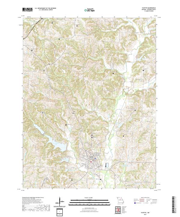 2021 Fayette2021 Print · USGSFayette and the surrounding Howard County countryside are shown here in the early 2020s, centered on the historic courthouse and university campus. Researchers can locate numerous family burial grounds like Shifflett Cem and Patterson Cem or trace the waters of Bonne Femme Cr.
 - 2021 Map of Burton, 2021 Print
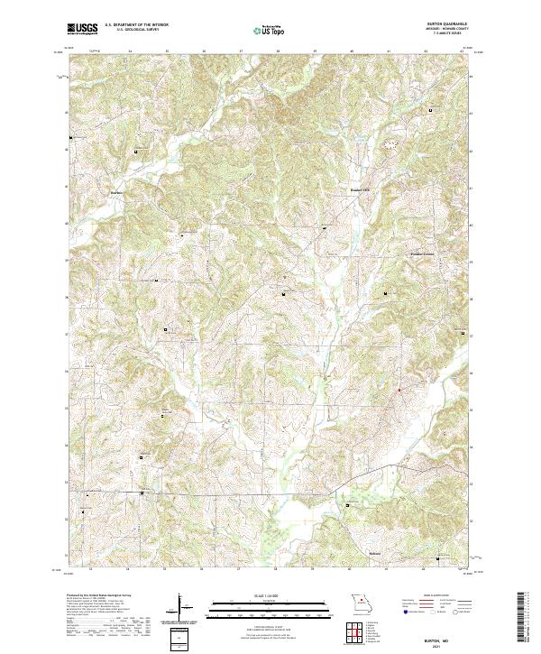 2021 Burton2021 Print · USGSHoward County's rural landscape is captured here in the early twenty-first century, showcasing a region defined by its creek valleys and quiet crossroads. Genealogists can trace family names across numerous sites like Mount Nebo Cem, Freedom Cem, and Jackson Cem.
 - 2021 Map of Forest Green, 2021 Print
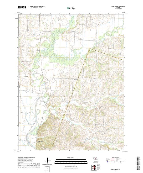 2021 Forest Green2021 Print · USGSChariton County's river bottoms come into focus in the early 2020s, showing the intricate wetlands and oxbows formed by the Little Chariton River. Genealogists and local historians can trace small settlements like Forest Green and Shannondale or locate family sites like Heryford Cem and Price Cem.
 - 2021 Map of Higbee, 2021 Print
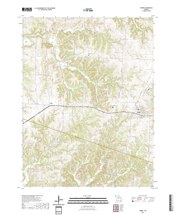 2021 Higbee2021 Print · USGSThe Randolph and Howard County borderlands come into focus in this recent survey of central Missouri. Researchers can trace rural lineages through markers like Bagby Cem or explore the water network around Higbee and the City of Higbee Reservoir.
 - 2021 Map of Billingsville, 2021 Print
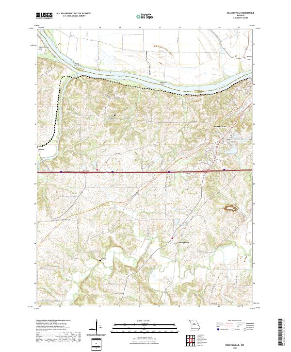 2021 Billingsville2021 Print · USGSThe Missouri River floodplain and the rolling hills of Cooper County are captured here in the early twenty-first century. Genealogists and local historians can locate the West Boonville Evangelical Church Cem, trace the Katy Trl, and explore the river bends near Boonville.
 - 2021 Map of Pilot Grove North, 2021 Print
 2021 Pilot Grove North2021 Print · USGSCooper County's river valleys and rural settlements are preserved here in the early twenty-first century. Genealogists and local historians can trace the locations of Old Lamine Cem and Saint Martins Cem, or explore the area around Chouteau Springs and Dicks Bridge.
 - 2021 Map of Rocheport, 2021 Print
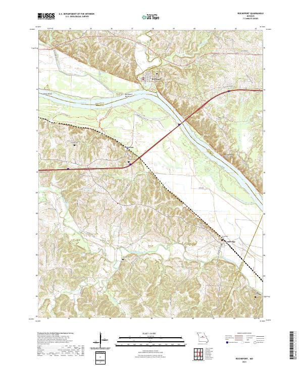 2021 Rocheport2021 Print · USGSThe Missouri riverfront and the bluffs of Boone and Cooper counties are shown here in the early twenty-first century. Genealogists and hikers can trace the Katy Trl past historic Rocheport or locate family sites like Clayton Cem and Wooldridge.
 - 2021 Map of Boonville, 2021 Print
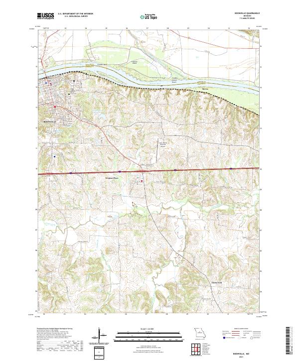 2021 Boonville2021 Print · USGSBoonville and the Missouri River bluffs appear here in the early twenty-first century, showing the intersection of riverfront history and modern transport. Genealogists and local historians can trace the Cooper County Courthouse, Walnut Grove Cem, and small outlying locales like Clarks Fork.
End of results
Showing maps 1-18 of 18
Top cities of Howard County
- Fayette historical maps
- New Franklin historical maps
- Glasgow historical maps
- Armstrong historical maps
- Franklin historical maps
Frequently asked questions
- What are the different types of historical maps available for Howard County?
- What is the oldest map of Howard County?
- Where can I purchase historical maps of Howard County for my home or office?
- Where can I download high-res historical maps of Howard County?
- Are there historical topographic maps available for Howard County?
- Is there historical aerial imagery available for Howard County?
- Where are historical maps of Howard County sourced from?