Old Maps of Howard County, Missouri for Academic Research
Study the evolution of Howard County with 106 high-resolution historic maps. Whether you're teaching, researching, or modeling changes in land use, these maps provide essential visual documentation of urban, environmental, and geographic change.
- Analyze long-term change: Track patterns in development, transportation, and natural features.
- Ideal for environmental or urban studies: Support academic projects with primary historical map data.
- Use in the classroom or lab: Educators and researchers rely on these maps to bring historical context to life.
These maps are a powerful tool for teaching, research, and visualizing how Howard County has changed over the decades.
Howard County, MO maps
(106)- 1888 Map of Boonville
 1888 Boonville1888 Print · USGSCentral Missouri comes to life in the late nineteenth century as the river economy of Boonville meets the iron rails of the Missouri Pacific Railroad. Genealogists and historians can trace old community centers like Latham Store, Chouteau Springs, and the townships of Richland and Saline.5 unique versions available
 - 1890 Map of Moberly
 1890 Moberly1890 Print · USGSMid-Missouri at the close of the frontier era was a landscape defined by the iron rails of the Wabash and Chicago & Alton lines. Genealogists can trace early homesteads and rail stops from Moberly to Centralia, and find rural communities like Middle Grove or Dripping Spring.6 unique versions available
 - 1890 Map of Glasgow
 1890 Glasgow1890 Print · USGSCentral Missouri in the late nineteenth century was a bustling intersection of river traffic and new rail lines. Genealogists and historians can trace family roots through riverfront towns like Arrow Rock and Glasgow, or locate rural sites like Jackman Mills and Whites Store.5 unique versions available
 - 1917 Map of Sturgeon
 1917 Sturgeon1917 Print · USGSMid-Missouri rural life is captured here in the years before the First World War, centered on the Sturgeon rail connection. Researchers can trace ancestral farmsteads through dozens of local landmarks like Indian Mound, Stephens, and the many country schoolhouses like Wade School.3 unique versions available
 - 1947 Map of Glasgow
 1947 Glasgow1947 Print · USGSThe Missouri River bottomlands in the mid-1940s reveal a landscape of shifting channels and established river towns. You can trace early settlement patterns through numerous rural landmarks like Sappington Cem, Boonesboro, and Farmers High Sch.2 unique versions available
 - 1947 Map of Jefferson City, 1949 Print
 1947 Jefferson City1949 Print · USGSCentral Missouri and the northern Ozarks come into focus in this late 1940s survey of the river-and-rail landscape. Genealogists and historians can trace the growth of Jefferson City and Sedalia or locate family roots near Bagnell Dam and the Lake of the Ozarks.
 - 1952 Map of Rocheport, 1953 Print
 1952 Rocheport1953 Print · USGSThe river bluffs of Boone and Cooper County come alive in the early fifties, showing the vital junctions of the Missouri River and two major rail lines. Researchers can trace the layout of Rocheport, locate family sites like Gooch Mill, or find old rural landmarks like Highland Sch and Copp Chapel.4 unique versions available
 - 1952 Map of Boonville, 1953 Print
 1952 Boonville1953 Print · USGSBoonville and the Missouri River valley are captured here in the early fifties during a period of shifting rural school populations. Researchers can trace institutional footprints like the Kemper Military Sch or find family history at Walnut Grove Cem and Clarks Fork.3 unique versions available
 - 1952 Map of New Franklin, 1953 Print
 1952 New Franklin1953 Print · USGSHoward County's rail-and-river landscape comes alive in the early fifties, showing the transition from traditional rural schooling to a modernized infrastructure. Genealogists can trace family landmarks like Mt Zion Ch and schools including Spanish Needles Sch and Gray Sch.2 unique versions available
 - 1952 Map of Hilldale, 1953 Print
 1952 Hilldale1953 Print · USGSThe rural borderlands of Howard and Boone counties are captured here in the early fifties, showing a landscape defined by winding creeks and a dense network of country schools. Researchers can trace local heritage through sites like Moniteau Chapel, Ricketts Cem, and the Union Sch house.2 unique versions available
 - 1953 Map of Moberly
 1953 Moberly1953 Print · USGSMid-century north-central Missouri is documented here as a bustling intersection of river commerce and heavy rail. Researchers can trace historic family-named landmarks and transport hubs from the Missouri River corridor to the rail yards of Moberly, Chillicothe, and Macon.
 - 1953 Map of Fayette, 1954 Print
 1953 Fayette1954 Print · USGSMid-century Howard County centered on the educational and cultural hub of Fayette. Local historians can trace a landscape of country schoolhouses and numerous family burial grounds like Walnut Ridge Cem and Pritchett Cem.3 unique versions available
 - 1953 Map of Billingsville, 1954 Print
 1953 Billingsville1954 Print · USGSMid-century Cooper County revolves around the convergence of the Missouri and Lamine rivers and a busy rail network. Genealogists can trace family footprints at Pheasant Hill Cem or locate rural landmarks like Billingsville Sch and Lamine.3 unique versions available
 - 1953 Map of Pilot Grove North, 1954 Print
 1953 Pilot Grove North1954 Print · USGSMid-century Cooper County centers on the convergence of the Lamine and Blackwater rivers during a time of rural transition. Genealogists can trace family sites like the Herndon Cem, St Martin Cem, and the now-abandoned Chouteau Sch (Abandoned).2 unique versions available
 - 1953 Map of Burton, 1954 Print
 1953 Burton1954 Print · USGSMid-century Howard County is defined here by its network of rural schools and the Missouri Kansas and Texas rail line. Genealogists and local historians can trace family roots through numerous sites like the County Infirmary Cem, Log Chapel, and Punkin Center.3 unique versions available
 - 1953 Map of Renick, 1955 Print
 1953 Renick1955 Print · USGSMid-Missouri prairie life and rail history are captured here in the early fifties, centered on the Renick area. Researchers can trace genealogical sites like Hamilton Cem and the Wilson Sch, or follow the Wabash rail line through Harkes.3 unique versions available
 - 1953 Map of Higbee, 1955 Print
 1953 Higbee1955 Print · USGSHigbee served as a busy railroad junction in the 1950s where two major lines intersected amidst the coal-bearing hills of Randolph County. Researchers can trace the industrial landscape through the Strip Mine and Mine Dump or locate family roots at Mt Ararat Ch and Bagby Cem.2 unique versions available
 - 1953 Map of Armstrong, 1955 Print
 1953 Armstrong1955 Print · USGSHoward and Randolph counties come alive in the mid-1950s as the rail-driven economy of the Missouri interior is captured in fine detail. Genealogists can trace family footprints at Wesley Chapel Cem, Sharon Sch, and the busy rail hub of Armstrong.2 unique versions available
 - 1954 Map of Jefferson City
 1954 Jefferson City1954 Print · USGSCentral Missouri in the early postwar years showcases a landscape defined by the winding Lake of the Ozarks and the state capital at Jefferson City. Researchers can trace the mid-century rail networks of the Missouri Pacific RR and locate rural communities like Tuscumbia, St Elizabeth, and St Anthony.2 unique versions available
 - 1954 Map of Moberly, 1969 Print
 1954 Moberly1969 Print · USGSMid-century Missouri is captured here during a period of transition for its river towns and rail hubs. Genealogists and historians can trace the paths of the Wabash railroad through Moberly or explore the riverside layout of Lexington and Brunswick.3 unique versions available
 - 1955 Map of Jefferson City, 1967 Print
 1955 Jefferson City1967 Print · USGSCentral Missouri in the mid-fifties is defined by the winding Missouri River and the expanding reach of Lake of the Ozarks. Researchers can trace the rail corridors of the Missouri Pacific or locate the early footprint of Whiteman AFB and Jefferson City.4 unique versions available
 - 1956 Map of Forest Green, 1957 Print
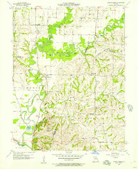 1956 Forest Green1957 Print · USGSMid-century Chariton County is defined here by the winding Little Chariton River and its sprawling network of rural schools and family cemeteries. Genealogists can trace sites like Lewis Mill, Nordmeyer Sch, and Marian Hill Ch.2 unique versions available
 - 1957 Map of Moberly
 1957 Moberly1957 Print · USGSNorth-central Missouri in the late nineteen-forties and fifties remains a landscape defined by its great rivers and a dense network of steam and diesel rail lines. Genealogists and historians can trace the paths of the Wabash RR and Santa Fe RR through historic junctions like Moberly, Brookfield, and Macon.
 - 1958 Map of Jefferson City
 1958 Jefferson City1958 Print · USGSCentral Missouri in the late fifties shows a region transforming through the growth of Whiteman Air Force Base and the Lake of the Ozarks. Researchers can trace rail lines like the Missouri Pacific or find family roots at Enloe Cemetery and Mount Pleasant Cem.
 - 1959 Map of Jefferson City
 1959 Jefferson City1959 Print · USGSCentral Missouri is captured during the mid-fifties as the river economy and rail networks like the Missouri Pacific met the rise of the automobile. Local researchers can trace family landmarks and rural infrastructure from the Lake of the Ozarks up to Providence Cemetery and Knob Noster State Park.
Showing maps 1-25 of 106
Top cities of Howard County
- Fayette historical maps
- New Franklin historical maps
- Glasgow historical maps
- Armstrong historical maps
- Franklin historical maps
Frequently asked questions
- What are the different types of historical maps available for Howard County?
- What is the oldest map of Howard County?
- Where can I purchase historical maps of Howard County for my home or office?
- Where can I download high-res historical maps of Howard County?
- Are there historical topographic maps available for Howard County?
- Is there historical aerial imagery available for Howard County?
- Where are historical maps of Howard County sourced from?