1940s Maps of Hutton Valley, Missouri
Explore 2 historic maps of Hutton Valley from the 1940s. These maps offer a rare glimpse into what life looked like during the 1940s — showing old roads, neighborhoods, homes, and landmarks that have changed or disappeared over time.
Whether you're researching your family's past, planning a metal detecting trip, or studying how Hutton Valley's landscape evolved across the 1940s, these high-resolution maps are a powerful tool for exploring the history of this region.
- Focus on a specific era: All maps on this page are from the 1940s, giving you a focused view of this time period.
- See what’s changed: Compare century-old streets, trails, and buildings to today's modern landscape using overlays and satellite layers.
- Research with precision: Use these maps for genealogy, historical research, land use analysis, or educational projects.
- View, download, or print: Maps are fully viewable online in high resolution, and can be downloaded or printed for your own records.
Start exploring Hutton Valley's history through authentic maps from the 1940s. This is your window into the past.
Hutton Valley, MO maps
(2)- 1945 Map of Willow Springs, 1954 Print
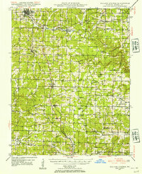 1945 Willow Springs1954 Print · USGSThis Howell County survey captured the Missouri Ozarks at mid-century, when the railroad still linked small farming towns. Researchers can trace rural school locations like College Hill Sch and cemeteries such as Lone Pine Cem and Rowe Cem.3 unique versions available
 - 1948 Map of Willow Springs
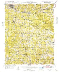 1948 Willow Springs1948 Print · USGSHowell County's post-war landscape comes alive through this mid-century survey of the Ozark Plateau. Researchers can trace family history through dozens of rural landmarks, from Sky Haven Airport and Trask to the Simms Valley Sch and Walkers Chapel.
End of results
Showing maps 1-2 of 2
Top cities near Hutton Valley
- West Plains historical maps
- Mountain View historical maps
- Cabool historical maps
- Willow Springs historical maps
- Summersville historical maps
- Sargent historical maps
Frequently asked questions
- What are the different types of historical maps available for Hutton Valley?
- What is the oldest map of Hutton Valley?
- Where can I purchase historical maps of Hutton Valley for my home or office?
- Where can I download high-res historical maps of Hutton Valley?
- Are there historical topographic maps available for Hutton Valley?
- Is there historical aerial imagery available for Hutton Valley?
- Where are historical maps of Hutton Valley sourced from?