Old Maps of Hutton Valley, Missouri for Metal Detecting
Plan your next treasure hunt with 13 historic maps of Hutton Valley. Find old homesites, ghost towns, trails, and gathering spots that may be lost to time — perfect for identifying promising metal detecting locations.
- Locate forgotten sites: Uncover places like long-lost settlements, abandoned rail lines, or gathering spots.
- Plan better hunts: Use map overlays combined with LiDAR or satellite views to narrow in on historically rich areas.
- Made for detectorists: Thousands of hobbyists use these maps to discover relics, coins, and hidden history.
Use these historic maps to boost your research and find new opportunities beneath the surface of Hutton Valley.
Hutton Valley, MO maps
(13)- 1945 Map of Willow Springs, 1954 Print
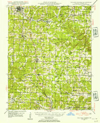 1945 Willow Springs1954 Print · USGSThis Howell County survey captured the Missouri Ozarks at mid-century, when the railroad still linked small farming towns. Researchers can trace rural school locations like College Hill Sch and cemeteries such as Lone Pine Cem and Rowe Cem.3 unique versions available
 - 1948 Map of Willow Springs
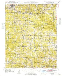 1948 Willow Springs1948 Print · USGSHowell County's post-war landscape comes alive through this mid-century survey of the Ozark Plateau. Researchers can trace family history through dozens of rural landmarks, from Sky Haven Airport and Trask to the Simms Valley Sch and Walkers Chapel.
 - 1957 Map of Poplar Bluff, 1968 Print
 1957 Poplar Bluff1968 Print · USGSThe Missouri-Arkansas border region is captured here as the timber and rail industries shaped the Ozark foothills. Genealogists and historians can trace the Missouri Pacific Railroad through river towns like Pocahontas, Greenville, and Van Buren.3 unique versions available
 - 1959 Map of Poplar Bluff
 1959 Poplar Bluff1959 Print · USGSThe Missouri Ozarks and Arkansas borderlands meet in this late 1950s study of the region's diverse terrain and rail-fed towns. Researchers can trace the path of the Missouri Pacific Railroad through Poplar Bluff or locate smaller settlements like Birch Tree and Myrtle.
 - 1960 Map of Poplar Bluff
 1960 Poplar Bluff1960 Print · USGSSoutheast Missouri and Northeast Arkansas are captured here during the post-war era, showing the transition from the Ozark highlands to the Delta. Genealogists and historians can trace rail corridors like the St. Louis Southwestern RR and remote settlements such as Birch Tree and Warm Springs.
 - 1976 Map of Willow Springs NW, 1977 Print
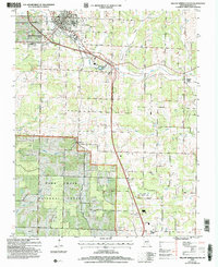
 1976 Willow Springs NW1977 Print · USGSHowell County's rural landscape is captured in the mid-1970s, showing the transition of farmland and Ozark woods near Willow Springs. Genealogists and local historians can trace the exact footprints of homes and fields around Hutton Valley and Burnham.
 - 1984 Map of West Plains
 1984 West Plains1984 Print · USGSThe Missouri Ozarks are mapped here in the mid-1980s, centered on the regional hub of West Plains and the river corridors of the Eleven Point River. Trace the old rail lines and timber towns of Willow Springs, Mountain View, and Birch Tree through the Mark Twain National Forest.2 unique versions available
 - 1986 Map of Willow Springs South
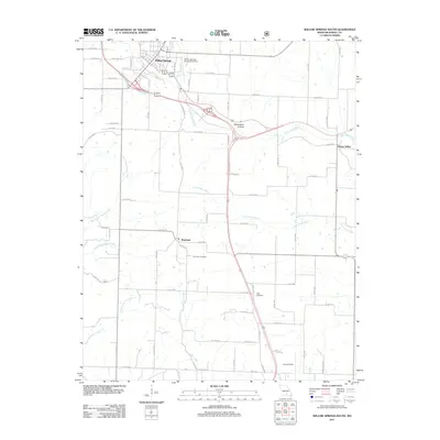
 1986 Willow Springs South1986 Print · USGSHowell County's Ozark landscape is documented here in the mid-1980s, showcasing the expansion of Willow Springs into the surrounding timberlands. Researchers can find the old Iron Mine, the Drive-In Theatre, and the rural community of Burnham.
 - 2004 Map of Willow Springs South, 2006 Print
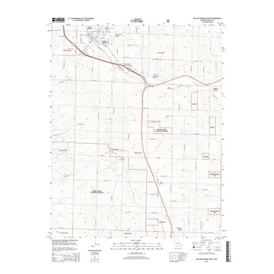
 2004 Willow Springs South2006 Print · USGSHowell County at the start of the millennium shows a landscape where Ozark timberland meets the infrastructure of Willow Springs. Researchers can trace old rural communities like Hutton Valley or locate local landmarks like the Iron Mine and White Church.
 - 2011 Map of Willow Springs South, 2011 Print
 2011 Willow Springs South2011 Print · USGSCovers Hutton Valley, including Willow Springs, Burnham, and other nearby areas
 - 2015 Map of Willow Springs South, 2015 Print
 2015 Willow Springs South2015 Print · USGSCovers Hutton Valley, including Willow Springs, Burnham, and other nearby areas
 - 2017 Map of Willow Springs South, 2017 Print
 2017 Willow Springs South2017 Print · USGSCovers Hutton Valley, including Willow Springs, Burnham, and other nearby areas
 - 2021 Map of Willow Springs South, 2021 Print
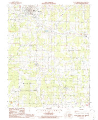
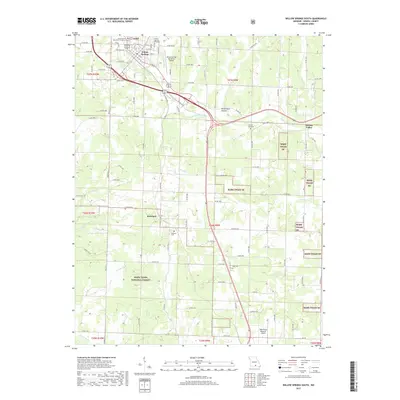
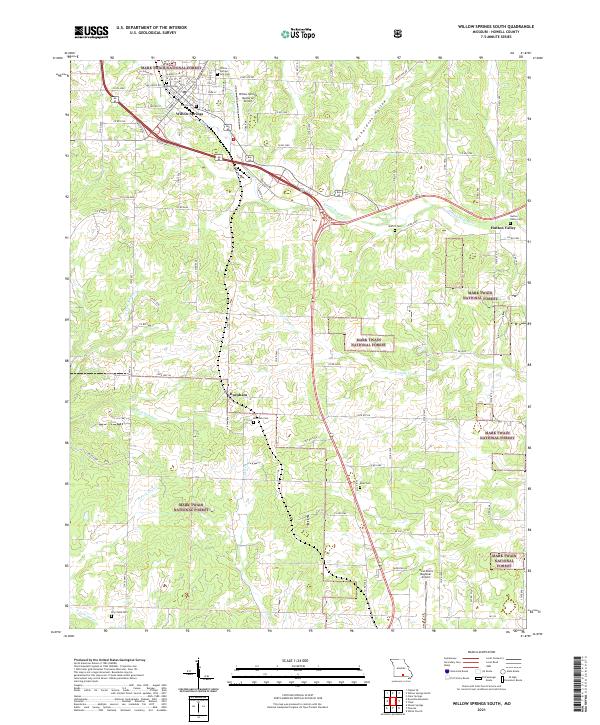 2021 Willow Springs South2021 Print · USGSWillow Springs and the neighboring Ozark highlands are captured here during a period of modern growth within the Mark Twain National Forest. Researchers can trace old family burial sites like Burnham Cem and Epps Cem or locate the historic Hutton Valley community.
End of results
Showing maps 1-13 of 13
Top cities near Hutton Valley
- West Plains historical maps
- Mountain View historical maps
- Cabool historical maps
- Willow Springs historical maps
- Summersville historical maps
- Sargent historical maps
Frequently asked questions
- What are the different types of historical maps available for Hutton Valley?
- What is the oldest map of Hutton Valley?
- Where can I purchase historical maps of Hutton Valley for my home or office?
- Where can I download high-res historical maps of Hutton Valley?
- Are there historical topographic maps available for Hutton Valley?
- Is there historical aerial imagery available for Hutton Valley?
- Where are historical maps of Hutton Valley sourced from?