2000s (21st Century) Maps of Killarney Shores, Missouri
Explore 5 historic maps of Killarney Shores from the 2000s (21st Century). These maps offer a rare glimpse into what life looked like during the 2000s — showing old roads, neighborhoods, homes, and landmarks that have changed or disappeared over time.
Whether you're researching your family's past, planning a metal detecting trip, or studying how Killarney Shores's landscape evolved across the 2000s, these high-resolution maps are a powerful tool for exploring the history of this region.
- Focus on a specific era: All maps on this page are from the 2000s, giving you a focused view of this time period.
- See what’s changed: Compare century-old streets, trails, and buildings to today's modern landscape using overlays and satellite layers.
- Research with precision: Use these maps for genealogy, historical research, land use analysis, or educational projects.
- View, download, or print: Maps are fully viewable online in high resolution, and can be downloaded or printed for your own records.
Start exploring Killarney Shores's history through authentic maps from the 2000s. This is your window into the past.
Killarney Shores, MO maps
(5)- 2000 Map of Lake Killarney, 2003 Print
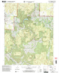 2000 Lake Killarney2003 Print · USGSThe Iron County hill country at the start of the millennium is captured here, showing the gateway to the St. Francois Mountains. Researchers can locate numerous family burial grounds like Royer Cem and Sutton Cem, or trace the development of Killarney Shores and the Arcadia Valley Golf Club.
 - 2011 Map of Lake Killarney, 2011 Print
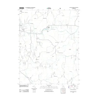 2011 Lake Killarney2011 Print · USGSCovers Killarney Shores, including Ironton, Arcadia, and other nearby areas
 - 2015 Map of Lake Killarney, 2015 Print
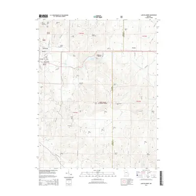 2015 Lake Killarney2015 Print · USGSCovers Killarney Shores, including Ironton, Arcadia, and other nearby areas
 - 2017 Map of Lake Killarney, 2017 Print
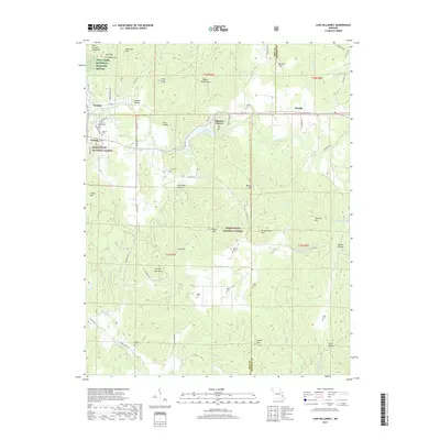 2017 Lake Killarney2017 Print · USGSCovers Killarney Shores, including Ironton, Arcadia, and other nearby areas
 - 2021 Map of Lake Killarney, 2021 Print
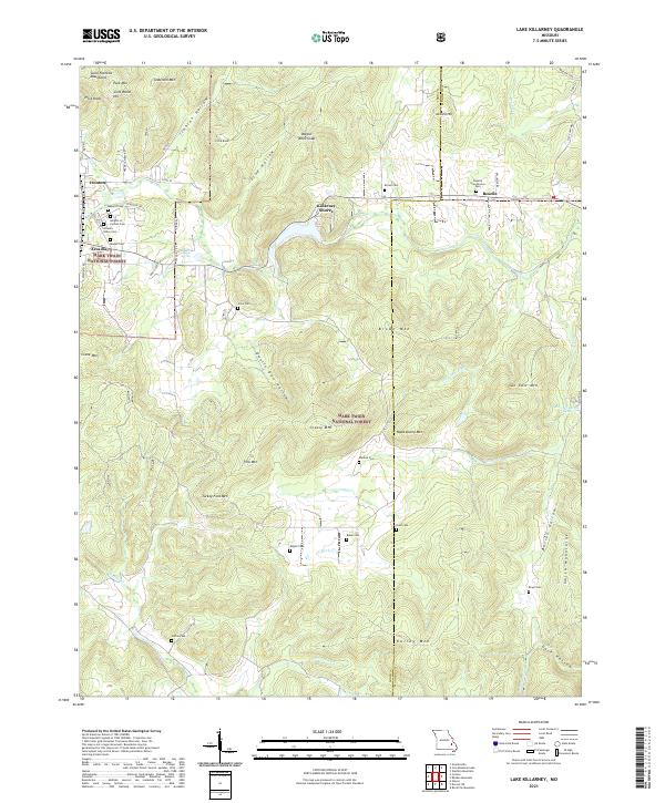 2021 Lake Killarney2021 Print · USGSThe Saint Francois Mountains of the Missouri Ozarks come alive on this recent survey of the Ironton and Arcadia area. Genealogists can trace family names across a dozen burial sites like Roselle Graniteview Cem and Sutton Cem, or locate landmarks such as Sunny Slope Spring and Wagon Wheel Gap.
End of results
Showing maps 1-5 of 5
Top cities near Killarney Shores
- Farmington historical maps
- Park Hills historical maps
- Bismarck historical maps
- Ironton historical maps
- Doe Run historical maps
- Iron Mountain Lake historical maps
See more
Frequently asked questions
- What are the different types of historical maps available for Killarney Shores?
- What is the oldest map of Killarney Shores?
- Where can I purchase historical maps of Killarney Shores for my home or office?
- Where can I download high-res historical maps of Killarney Shores?
- Are there historical topographic maps available for Killarney Shores?
- Is there historical aerial imagery available for Killarney Shores?
- Where are historical maps of Killarney Shores sourced from?