Old Maps of Raytown, Missouri for Genealogy
Trace your family roots with 35 historic maps of Raytown. These high-res maps reveal old neighborhoods, homesites, landmarks, and streets — helping you uncover where your ancestors lived and how the area evolved over time.
- Explore historic neighborhoods: Identify where your relatives may have lived in the 1800s or 1900s.
- Compare maps over time: Trace the changes in streets, buildings, and landmarks for multi-generational research.
- Perfect for genealogy & ancestry research: Used by family historians and researchers to map out lineage and migration.
These maps are an incredible resource for exploring your personal connection to Raytown's past.
Raytown, MO maps
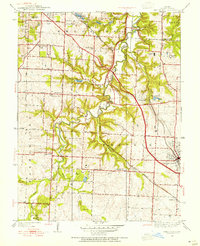
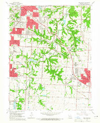
(35)- 1887 Map of Harrisonville
 1887 Harrisonville1887 Print · USGSMissouri's western borderlands are seen here during the rail boom of the late nineteenth century. Genealogists and historians can trace the early development of Harrisonville and Lees Summit, alongside smaller settlements like Lone Jack, Peculiar, and Garden City.
 - 1892 Map of Harrisonville, 1902 Print
 1892 Harrisonville1902 Print · USGSWestern Missouri comes into focus during the late nineteenth-century rail boom as new townships and post offices began to dot the prairie. Trace the development of early rail hubs like Harrisonville and Pleasant Hill or locate old community centers such as Chapel Hill and Daugherty (Eight Mile P. O.).2 unique versions available
 - 1894 Map of Harrisonville
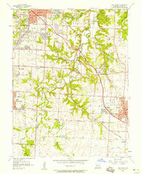
 1894 Harrisonville1894 Print · USGSCass and Jackson counties come to life in the 1890s as a burgeoning rail network links remote prairie outposts. Genealogists can trace early homesteads and mail stops like Daugherty (Eight Mile P. O.), Peculiar, and Lone Jack.
 - 1894 Map of Independence
 1894 Independence1894 Print · USGSThe river valley and rail corridors of western Missouri are captured in detail during the late nineteenth century. Researchers can trace the early layouts of Liberty and Independence alongside lost river features like Liberty Landing and Cooley Lake.5 unique versions available
 - 1934 Map of Independence
 1934 Independence1934 Print · USGSIn Jackson County during the mid-1930s, the landscape around Independence shows a bustling network of river commerce and early highways. Researchers can trace the heritage of local institutions like the Jackson County Girls Home and historic sites such as Mt Washington Cem.2 unique versions available
 - 1934 Map of Lees Summit
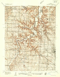 1934 Lees Summit1934 Print · USGSJackson County during the mid-1930s is a landscape of winding river valleys and rural school districts centered around the growing hub of Lees Summit. Genealogists and historians can trace the locations of the Floral Hills Cemetery, early aviation at Richards Landing Field, and local stops like South Lee Sta.
 - 1939 Map of Lees Summit
 1939 Lees Summit1939 Print · USGSJackson County in the late 1930s shows a landscape of rail-driven settlements and scattered country schools. Genealogists can locate family landmarks along the Chicago Rock Island and Pacific railroad, from Knobtown to the early streets of Lees Summit.3 unique versions available
 - 1940 Map of Independence
 1940 Independence1940 Print · USGSIndependence and its eastern suburbs are shown here in the mid-1930s, caught between the industrial Missouri River bend and the rural ridges of Jackson County. Genealogists can trace family landmarks like Woodlawn Cemetery, the Sanitarium, and rural schools like Whiteoak Sch.2 unique versions available
 - 1947 Map of Lawrence, 1954 Print
 1947 Lawrence1954 Print · USGSEastern Kansas and western Missouri thrive in the late 1940s, showing a landscape defined by major river valleys and a dense railway network. Genealogists can trace family settlements from Lawrence to Greenwood and locate landmarks like Olathe Navy and Lake Lotawana.
 - 1949 Map of Lees Summit, 1954 Print
 1949 Lees Summit1954 Print · USGSJackson County landscape at the midpoint of the century shows a unique era of river-valley farming and early aviation. Genealogists can trace family footprints near Stony Point Sch, Basonia Ch, and the old County Home.
 - 1950 Map of Kansas City
 1950 Kansas City1950 Print · USGSMid-century Kansas and Missouri are captured here during a period of industrial growth and shifting transportation. Genealogists and historians can trace rail lines like the Wabash RR or locate ancestral homes near the Potawatomi Indian Reservation and Horton.
 - 1950 Map of Lawrence
 1950 Lawrence1950 Print · USGSMid-century Kansas and Missouri come alive in this map of the river-valley corridors just as the interstate era was beginning. Researchers can trace the legacy of major rail lines like the Union Pacific RR and locate ancestral roots in towns from Lawrence to Harrisonville.
 - 1954 Map of Kansas City
 1954 Kansas City1954 Print · USGSThe Missouri-Kansas borderlands flourished in the post-war era as river commerce and rail networks converged at the Missouri River. Genealogists and historians can trace the foundations of Kansas City and smaller rural hubs like Hiawatha or Sabetha.
 - 1956 Map of Kansas City, 1967 Print
 1956 Kansas City1967 Print · USGSThe Kansas-Missouri border region thrived during the mid-fifties, centered on the growing metropolitan cores and the busy river valleys. Researchers can trace the layout of significant government sites like Fort Leavenworth and the Lake City Army Ammunition Plant.4 unique versions available
 - 1956 Map of Lawrence, 1967 Print
 1956 Lawrence1967 Print · USGSEastern Kansas and the Missouri border country are captured here during the mid-century transition to the interstate era. Genealogists and local historians can trace family-named terrain like Summers Mound and the footprint of Sunflower Ordnance Works near Baldwin City.4 unique versions available
 - 1957 Map of Independence, 1958 Print
 1957 Independence1958 Print · USGSIndependence and the eastern edge of Kansas City are shown here at a peak of mid-century development. Researchers can locate hundreds of local landmarks, from the Harry S Truman Memorial Library to the sprawling Oil Refinery and the Washington Cemetery.
 - 1957 Map of Lees Summit, 1958 Print
 1957 Lees Summit1958 Print · USGSJackson County during the mid-fifties shows the suburban expansion of Kansas City toward the established community of Lees Summit. Genealogists and local historians can trace rural roots through the Flannery Cemetery, Basonia Church, and the many schools like Truman School that served these growing neighborhoods.
 - 1960 Map of Kansas City
 1960 Kansas City1960 Print · USGSMid-century Kansas and Missouri meet at the river forks, showing a sprawling rail-and-river economy during the 1950s growth era. Genealogists and researchers can trace tribal lands like the Kickapoo Indian Reservation or follow the early interstate corridors through Saint Joseph and Independence.3 unique versions available
 - 1961 Map of Lawrence
 1961 Lawrence1961 Print · USGSThe Kansas-Missouri borderland shows its mid-century transition from a rail-dependent agricultural region to a suburbanizing landscape. Genealogists can trace family footprints through numerous Cem sites and distinctive terrain landmarks like Graves Mound and Summers Mound.
 - 1964 Map of Independence, 1965 Print
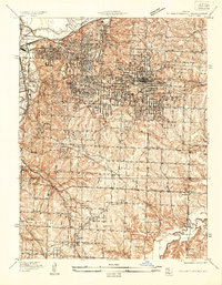
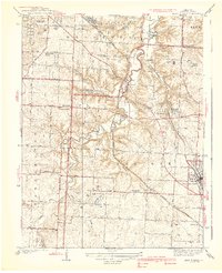
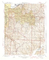
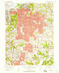
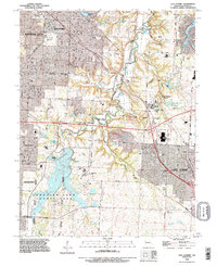
 1964 Independence1965 Print · USGSMid-century Jackson County is captured here as the suburbs of Independence and Raytown expanded along the rail lines. Genealogists and historians can locate dozens of local schools and landmarks like Mt Washington Cemetery and the Drumm Institute.4 unique versions available
 - 1964 Map of Lees Summit, 1965 Print
 1964 Lees Summit1965 Print · USGSJackson County is shown at a moment of transition in the 1960s as suburban growth reaches toward the rural Little Blue River valley. Genealogists and local historians can trace family plots in Floral Hills Cemetery or locate old community hubs like Knobtown and South Lee.4 unique versions available
 - 1983 Map of Kansas City
 1983 Kansas City1983 Print · USGSThe Missouri-Kansas borderlands reached a peak of suburban and industrial connectivity by the early eighties. Researchers can trace established neighborhoods and major landmarks like the Fort Leavenworth Military Reservation, Swope Park, and the U.S. Army Ammunition Plant.
 - 1983 Map of Olathe, 1984 Print
 1983 Olathe1984 Print · USGSThe Kansas-Missouri borderlands hum with suburban growth and historic transit routes in the early eighties. Researchers can trace the Santa Fe Trail across a landscape featuring Richards-Gebaur Air Force Base and Hillsdale Lake.
 - 1990 Map of Lees Summit, 1995 Print
 1990 Lees Summit1995 Print · USGSThe rapid growth of the Kansas City metropolitan area is captured in the mid-nineties as major suburban centers expanded. Genealogists and local researchers can trace family plots at Floral Hills Cemetery or explore the unique campus of Unity Village and Longview Lake.
 - 1990 Map of Independence, 1995 Print
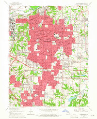
 1990 Independence1995 Print · USGSGreater Kansas City and Independence are shown in the final decade of the century, illustrating a landscape defined by heavy rail and major sporting venues. Genealogists can trace family plots across Mt Washington Cemetery or locate landmarks like the Truman Library and Drumm Institute.
Showing maps 1-25 of 35
Top cities near Raytown
- Kansas City historical maps
- Overland Park historical maps
- Kansas City historical maps
- Independence historical maps
- Lee's Summit historical maps
- Blue Springs historical maps
See more
Frequently asked questions
- What are the different types of historical maps available for Raytown?
- What is the oldest map of Raytown?
- Where can I purchase historical maps of Raytown for my home or office?
- Where can I download high-res historical maps of Raytown?
- Are there historical topographic maps available for Raytown?
- Is there historical aerial imagery available for Raytown?
- Where are historical maps of Raytown sourced from?