Old Maps of Holden, Missouri for Hiking & Exploration
Hike through history with 27 historic maps of Holden. Explore old trails, ghost towns, and forgotten backroads — perfect for outdoor adventurers and local explorers.
- Rediscover forgotten places: Map out old mining camps, roads, and footpaths that no longer exist on modern maps.
- Layer with modern tools: Combine with LiDAR or satellite views to plan hikes through historical terrain.
- Made for exploration: Popular among hikers, overlanders, and local history lovers.
Use these maps to find adventure and explore the hidden past of Holden.
Holden, MO maps
(27)- 1885 Map of Warrensburg, 1954 Print
 1885 Warrensburg1954 Print · USGSJohnson County and the surrounding Missouri prairie are captured here during the 1880s as the railroad era transformed the region. Researchers can trace the early footprints of settlements like Warrensburg, identify historic mines at Carbon Hill, and locate old landmarks like Iron Spring and Normal school.
 - 1887 Map of Harrisonville
 1887 Harrisonville1887 Print · USGSMissouri's western borderlands are seen here during the rail boom of the late nineteenth century. Genealogists and historians can trace the early development of Harrisonville and Lees Summit, alongside smaller settlements like Lone Jack, Peculiar, and Garden City.
 - 1887 Map of Warrensburg
 1887 Warrensburg1887 Print · USGSMissouri's central plains are captured here in the mid-1880s, documenting the vital rail corridor through Warrensburg and Knob Noster. Genealogists can trace early homesteads near Carbon Hill, Chilhowee, or the Iron Spring during a period of rapid agricultural growth.
 - 1892 Map of Harrisonville, 1902 Print
 1892 Harrisonville1902 Print · USGSWestern Missouri comes into focus during the late nineteenth-century rail boom as new townships and post offices began to dot the prairie. Trace the development of early rail hubs like Harrisonville and Pleasant Hill or locate old community centers such as Chapel Hill and Daugherty (Eight Mile P. O.).2 unique versions available
 - 1894 Map of Harrisonville
 1894 Harrisonville1894 Print · USGSCass and Jackson counties come to life in the 1890s as a burgeoning rail network links remote prairie outposts. Genealogists can trace early homesteads and mail stops like Daugherty (Eight Mile P. O.), Peculiar, and Lone Jack.
 - 1894 Map of Warrensburg
 1894 Warrensburg1894 Print · USGSJohnson County was a burgeoning rail and coal hub in the 1890s, anchored by the growth of Warrensburg. Researchers can trace old family sites and transport routes through vanished mining points like Carbon Hill and rural stops such as Cornelia and Iron Spring.5 unique versions available
 - 1947 Map of Jefferson City, 1949 Print
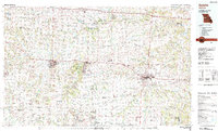
 1947 Jefferson City1949 Print · USGSCentral Missouri and the northern Ozarks come into focus in this late 1940s survey of the river-and-rail landscape. Genealogists and historians can trace the growth of Jefferson City and Sedalia or locate family roots near Bagnell Dam and the Lake of the Ozarks.
 - 1947 Map of Lawrence, 1954 Print
 1947 Lawrence1954 Print · USGSEastern Kansas and western Missouri thrive in the late 1940s, showing a landscape defined by major river valleys and a dense railway network. Genealogists can trace family settlements from Lawrence to Greenwood and locate landmarks like Olathe Navy and Lake Lotawana.
 - 1950 Map of Lawrence
 1950 Lawrence1950 Print · USGSMid-century Kansas and Missouri come alive in this map of the river-valley corridors just as the interstate era was beginning. Researchers can trace the legacy of major rail lines like the Union Pacific RR and locate ancestral roots in towns from Lawrence to Harrisonville.
 - 1954 Map of Jefferson City
 1954 Jefferson City1954 Print · USGSCentral Missouri in the early postwar years showcases a landscape defined by the winding Lake of the Ozarks and the state capital at Jefferson City. Researchers can trace the mid-century rail networks of the Missouri Pacific RR and locate rural communities like Tuscumbia, St Elizabeth, and St Anthony.2 unique versions available
 - 1954 Map of Kingsville, 1955 Print
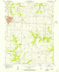
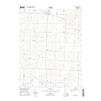
 1954 Kingsville1955 Print · USGSRailroad development in western Johnson County reached its peak in the mid-fifties, centering on the junction of five different lines. Genealogists and rail historians can trace local family landmarks like Rose Hill Cem, Stout Sch, and the small settlement of Latour.2 unique versions available
 - 1954 Map of Holden, 1955 Print
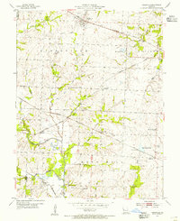
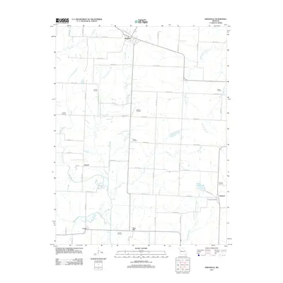
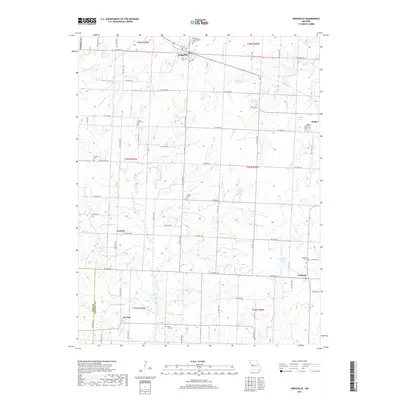
 1954 Holden1955 Print · USGSMid-century Johnson County is defined by its rail connectivity and dispersed farming communities. Family historians can trace the foundations of Holden and Magnolia, or locate rural sites like Fairview Cem and the Pleasant Shade Sch (Abandoned).
 - 1955 Map of Jefferson City, 1967 Print
 1955 Jefferson City1967 Print · USGSCentral Missouri in the mid-fifties is defined by the winding Missouri River and the expanding reach of Lake of the Ozarks. Researchers can trace the rail corridors of the Missouri Pacific or locate the early footprint of Whiteman AFB and Jefferson City.4 unique versions available
 - 1956 Map of Lawrence, 1967 Print
 1956 Lawrence1967 Print · USGSEastern Kansas and the Missouri border country are captured here during the mid-century transition to the interstate era. Genealogists and local historians can trace family-named terrain like Summers Mound and the footprint of Sunflower Ordnance Works near Baldwin City.4 unique versions available
 - 1958 Map of Jefferson City
 1958 Jefferson City1958 Print · USGSCentral Missouri in the late fifties shows a region transforming through the growth of Whiteman Air Force Base and the Lake of the Ozarks. Researchers can trace rail lines like the Missouri Pacific or find family roots at Enloe Cemetery and Mount Pleasant Cem.
 - 1959 Map of Jefferson City
 1959 Jefferson City1959 Print · USGSCentral Missouri is captured during the mid-fifties as the river economy and rail networks like the Missouri Pacific met the rise of the automobile. Local researchers can trace family landmarks and rural infrastructure from the Lake of the Ozarks up to Providence Cemetery and Knob Noster State Park.
 - 1961 Map of Lawrence
 1961 Lawrence1961 Print · USGSThe Kansas-Missouri borderland shows its mid-century transition from a rail-dependent agricultural region to a suburbanizing landscape. Genealogists can trace family footprints through numerous Cem sites and distinctive terrain landmarks like Graves Mound and Summers Mound.
 - 1983 Map of Sedalia
 1983 Sedalia1983 Print · USGSWest Central Missouri's landscape in the early eighties shows a dense network of rail towns and riverside communities along the Blackwater River. Genealogists and historians can trace the development of Warrensburg and Sedalia near Whiteman Air Force Base and Knob Noster State Park.
 - 1983 Map of Olathe, 1984 Print
 1983 Olathe1984 Print · USGSThe Kansas-Missouri borderlands hum with suburban growth and historic transit routes in the early eighties. Researchers can trace the Santa Fe Trail across a landscape featuring Richards-Gebaur Air Force Base and Hillsdale Lake.
 - 2011 Map of Holden, 2011 Print
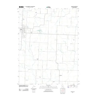 2011 Holden2011 Print · USGSCovers Holden, including Magnolia, Johnson County, and other nearby areas
 - 2011 Map of Kingsville, 2011 Print
 2011 Kingsville2011 Print · USGSCovers Holden, including Kingsville, Medford, and other nearby areas
 - 2014 Map of Kingsville, 2014 Print
 2014 Kingsville2014 Print · USGSCovers Holden, including Kingsville, Medford, and other nearby areas
 - 2014 Map of Holden, 2014 Print
 2014 Holden2014 Print · USGSCovers Holden, including Magnolia, Johnson County, and other nearby areas
 - 2017 Map of Holden, 2017 Print
 2017 Holden2017 Print · USGSCovers Holden, including Magnolia, Johnson County, and other nearby areas
 - 2017 Map of Kingsville, 2017 Print
 2017 Kingsville2017 Print · USGSCovers Holden, including Kingsville, Medford, and other nearby areas
Showing maps 1-25 of 27
Top cities near Holden
- Lake Lotawana historical maps
- Garden City historical maps
- Lone Jack historical maps
- Creighton historical maps
- Chilhowee historical maps
- Kingsville historical maps
See more
Frequently asked questions
- What are the different types of historical maps available for Holden?
- What is the oldest map of Holden?
- Where can I purchase historical maps of Holden for my home or office?
- Where can I download high-res historical maps of Holden?
- Are there historical topographic maps available for Holden?
- Is there historical aerial imagery available for Holden?
- Where are historical maps of Holden sourced from?