Old Maps of Ira, Missouri for Academic Research
Study the evolution of Ira with 11 high-resolution historic maps. Whether you're teaching, researching, or modeling changes in land use, these maps provide essential visual documentation of urban, environmental, and geographic change.
- Analyze long-term change: Track patterns in development, transportation, and natural features.
- Ideal for environmental or urban studies: Support academic projects with primary historical map data.
- Use in the classroom or lab: Educators and researchers rely on these maps to bring historical context to life.
These maps are a powerful tool for teaching, research, and visualizing how Ira has changed over the decades.
Ira, MO maps
(11)- 1934 Map of Macks Creek
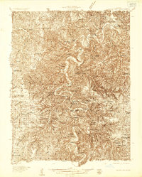 1934 Macks Creek1934 Print · USGSIn the central Ozarks during the 1930s, the rugged river valleys supported a landscape of isolated homesteads and country schoolhouses. Genealogists can locate family landmarks like Laughlin Cem, Johnston Castle, and the Tunnel Dam along the Niangua River.4 unique versions available
 - 1939 Map of Macks Creek
 1939 Macks Creek1939 Print · USGSThe Niangua River valley in the late 1930s reveals a landscape of river crossings and early Ozark tourism. Researchers can trace ancestral locations through numerous rural school sites like Barkley Sch or find landmarks like Hahatonka Castle and Tunnel Dam.2 unique versions available
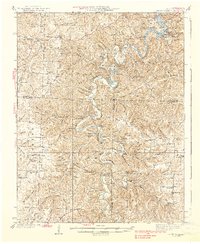
 - 1954 Map of Springfield
 1954 Springfield1954 Print · USGSThe Missouri Ozarks are captured here during the post-war era, showing the expansion of Springfield and the surrounding river valleys. Genealogists and historians can trace local landmarks like Mount Comfort Cemetery and the Fort Leonard Wood military grounds.6 unique versions available
 - 1958 Map of Springfield
 1958 Springfield1958 Print · USGSThe Missouri Ozarks are captured during the mid-century era of growth, centered on the bustling hub of Springfield. Genealogists and historians can trace family roots through numerous landmarks like Ebenezer Church, Stockton Cem, and the various county courthouses.
 - 1959 Map of Springfield
 1959 Springfield1959 Print · USGSThe Missouri Ozarks are captured here during a decade of postwar growth and increasing highway connectivity. Researchers can trace the legacy of the St Louis-San Francisco RR and locate early sites in Springfield, Lebanon, and Mountain Grove.
 - 1982 Map of Eldridge West, 1983 Print
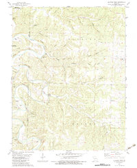 1982 Eldridge West1983 Print · USGSLaclede and Dallas counties appear as a network of deep-cut hollows and river bluffs in the early 1980s. Researchers can trace family lines and old homestead sites at Ballard Cem, Guthrie Cem, and the quiet crossing at Ira.
 - 1982 Map of Lebanon, 1983 Print
 1982 Lebanon1983 Print · USGSThe Missouri Ozarks are captured in the early eighties as Interstate 44 and the St Louis-San Francisco rail line link growing towns with the Fort Leonard Wood Military Reservation. Genealogists and historians can trace family-named sites like Flatwood Church and old post offices at Sleeper and Nebo.
 - 2012 Map of Eldridge West, 2012 Print
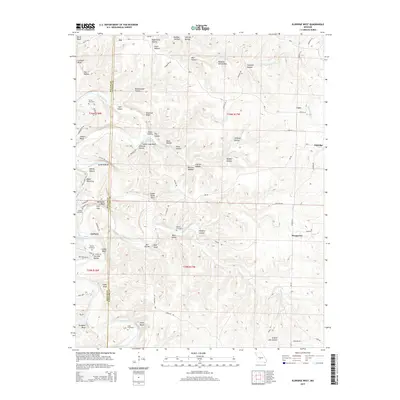
 2012 Eldridge West2012 Print · USGSCovers Ira, including Corkery, Case, and other nearby areas
 - 2015 Map of Eldridge West, 2015 Print
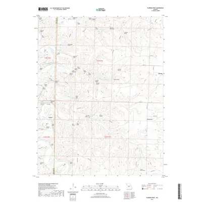
 2015 Eldridge West2015 Print · USGSCovers Ira, including Corkery, Case, and other nearby areas
 - 2017 Map of Eldridge West, 2017 Print
 2017 Eldridge West2017 Print · USGSCovers Ira, including Corkery, Case, and other nearby areas
 - 2021 Map of Eldridge West, 2021 Print
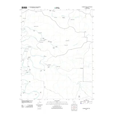
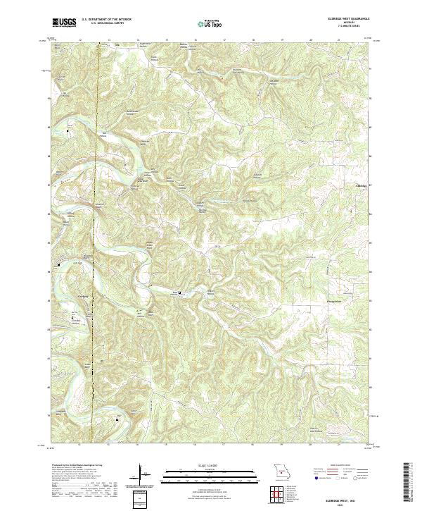 2021 Eldridge West2021 Print · USGSThe border of Laclede and Dallas counties comes alive in the early twenty-first century, showcasing a landscape of deep river hollows and family homesteads. Researchers can trace ancestral connections at Turner Cem and Guthrie Cem or locate old community centers like Corkery and Ira.
End of results
Showing maps 1-11 of 11
Top cities near Ira
- Lebanon historical maps
- Osage Beach historical maps
- Camdenton historical maps
- Buffalo historical maps
- Linn Creek historical maps
- Macks Creek historical maps
See more
Frequently asked questions
- What are the different types of historical maps available for Ira?
- What is the oldest map of Ira?
- Where can I purchase historical maps of Ira for my home or office?
- Where can I download high-res historical maps of Ira?
- Are there historical topographic maps available for Ira?
- Is there historical aerial imagery available for Ira?
- Where are historical maps of Ira sourced from?