Old Maps of La Grange, Missouri for Academic Research
Study the evolution of La Grange with 20 high-resolution historic maps. Whether you're teaching, researching, or modeling changes in land use, these maps provide essential visual documentation of urban, environmental, and geographic change.
- Analyze long-term change: Track patterns in development, transportation, and natural features.
- Ideal for environmental or urban studies: Support academic projects with primary historical map data.
- Use in the classroom or lab: Educators and researchers rely on these maps to bring historical context to life.
These maps are a powerful tool for teaching, research, and visualizing how La Grange has changed over the decades.
La Grange, MO maps
(20)- 1903 Map of Kahoka
 1903 Kahoka1903 Print · USGSNortheast Missouri at the turn of the century shows a landscape defined by the convergence of major rivers and competing rail lines. Genealogists can trace family roots in early centers like Kahoka and Monticello, or locate riverfront crossings at St. Francisville and Canton.3 unique versions available
 - 1946 Map of Mendon, 1958 Print
 1946 Mendon1958 Print · USGSThe fertile bottomlands of Adams County are seen here in the mid-1940s, as massive drainage projects reshaped the Mississippi River's eastern bank. Genealogists can locate family names and sites through numerous rural landmarks like Wesley Chapel Cem, Gentry Sch, and the Canton Ferry.
 - 1948 Map of Mendon
 1948 Mendon1948 Print · USGSUpper Adams County in the late 1940s reveals a landscape defined by Mississippi River engineering and tight-knit rural communities. Researchers can trace ancestral locations at New Providence Cem, several dozen one-room schoolhouses like Golden Sch, and the winding Bear Creek drainage.2 unique versions available
 - 1950 Map of La Grange, 1959 Print
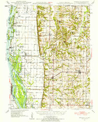
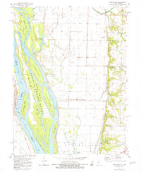
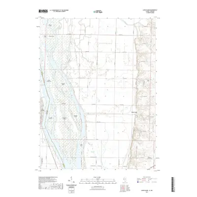
 1950 La Grange1959 Print · USGSLewis County river towns and rural townships thrive along the Mississippi in the early fifties. Genealogists can trace family roots through numerous country schools like Pink Prairie Sch and the Marks Memorial Cem near La Grange.2 unique versions available
 - 1951 Map of La Grange
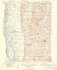
 1951 La Grange1951 Print · USGSLewis County's riverfront and rolling uplands are captured here in the early 1950s as rail and river commerce centered on Canton and La Grange. Genealogists and researchers can trace numerous rural landmarks, from Wyaconda Ch to a high density of country schools like Sunnyside Sch and Porter Sch.
 - 1958 Map of Burlington, 1968 Print
 1958 Burlington1968 Print · USGSThe tri-state river country of Iowa, Illinois, and Missouri is captured here in the mid-fifties, dominated by the Mississippi River and major rail lines. Genealogists and historians can trace the development of river towns like Keokuk or locate the sprawling Iowa Army Ammunition Plant.4 unique versions available
 - 1961 Map of Burlington
 1961 Burlington1961 Print · USGSThe tri-state borderlands along the Mississippi River are captured here during the late fifties and early sixties, showing the vital river-and-rail economy of Iowa, Illinois, and Missouri. Genealogists and historians can trace the development of major hubs like Galesburg and Macomb alongside landmark sites such as the Iowa Ordnance Plant and the historic river town of Nauvoo.
 - 1963 Map of Burlington
 1963 Burlington1963 Print · USGSThe tri-state river country of the Mississippi and Illinois valleys comes alive in this mid-century survey. Genealogists and historians can trace the industrial and academic growth of the region, from the Iowa Ordnance Plant to campuses like Knox College and Western Illinois University.
 - 1981 Map of Long Island
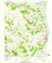
 1981 Long Island1981 Print · USGSThe Mississippi River valley near the Illinois-Missouri border is captured here in the early 1980s. Historians and researchers can trace the riverfront at La Grange and explore the natural geography of the National Mark Twain Wildlife Refuge.
 - 1986 Map of Keokuk
 1986 Keokuk1986 Print · USGSThe tri-state junction of Iowa, Illinois, and Missouri comes alive in the mid-eighties as a hub of river commerce and rail transit. Researchers can trace family roots through Moss Ridge Cemetery or study industrial landmarks like the Keokuk Dam and Lock and Dam No 19.2 unique versions available
 - 1990 Map of Burlington
 1990 Burlington1990 Print · USGSThe tri-state confluence of Iowa, Illinois, and Missouri is mapped here at the end of the twentieth century. Genealogists and historians can trace the riverfront heritage of Burlington, Keokuk, and Fort Madison, or locate sites like the Battle of Athens State Historic Site.2 unique versions available
 - 2012 Map of La Grange, 2012 Print
 2012 La Grange2012 Print · USGSCovers La Grange, including Canton, Weber, and other nearby areas
 - 2012 Map of Long Island, 2012 Print
 2012 Long Island2012 Print · USGSCovers La Grange, including Ursa, Rock Creek, and other nearby areas
 - 2015 Map of La Grange, 2015 Print
 2015 La Grange2015 Print · USGSCovers La Grange, including Canton, Weber, and other nearby areas
 - 2015 Map of Long Island, 2015 Print
 2015 Long Island2015 Print · USGSCovers La Grange, including Ursa, Rock Creek, and other nearby areas
 - 2017 Map of La Grange, 2017 Print
 2017 La Grange2017 Print · USGSCovers La Grange, including Canton, Weber, and other nearby areas
 - 2018 Map of Long Island, 2018 Print
 2018 Long Island2018 Print · USGSCovers La Grange, including Ursa, Rock Creek, and other nearby areas
 - 2021 Map of Long Island, 2021 Print
 2021 Long Island2021 Print · USGSCovers La Grange, including Ursa, Rock Creek, and other nearby areas
 - 2021 Map of La Grange, 2021 Print
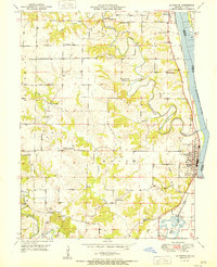
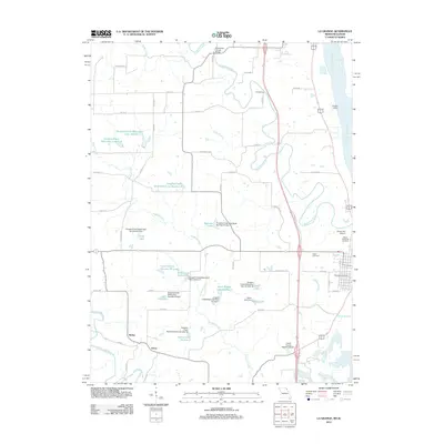
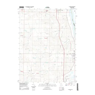
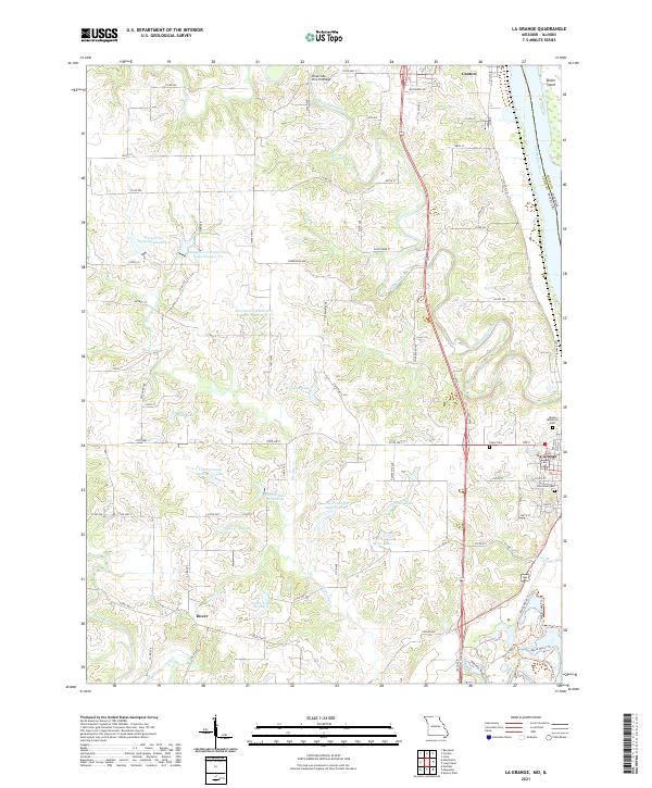 2021 La Grange2021 Print · USGSThe Mississippi River and BNSF Railway corridor shape these riverfront communities in the early twenty-first century. Researchers can trace family history through sites like Riverview Cem, the rural Dover settlement, and the landmark Wyaconda Church Bridge.
 - 2024 Map of Long Island, 2024 Print
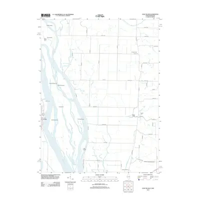
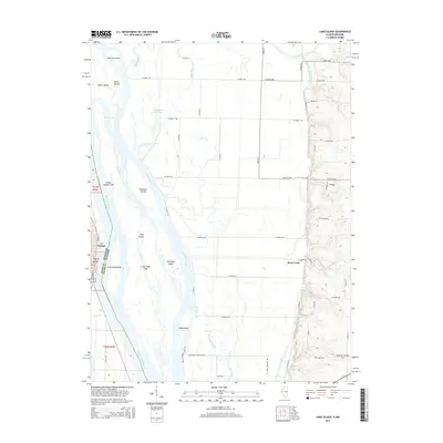
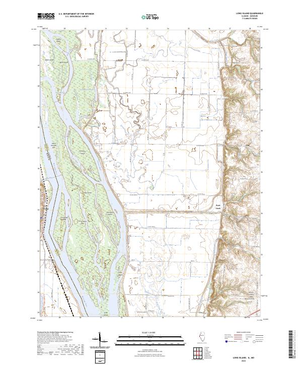 2024 Long Island2024 Print · USGSThe Mississippi River floodplain comes alive in this contemporary survey of the Illinois-Missouri borderlands. Researchers can trace the intricate river geography surrounding Long Island or locate specific river-access points like Blickhan Landing Area and the town of Ursa.
End of results
Showing maps 1-20 of 20
Top cities near La Grange
- Quincy historical maps
- Canton historical maps
- Mendon historical maps
- Ursa historical maps
- Ewing historical maps
- Lima historical maps
See more
Frequently asked questions
- What are the different types of historical maps available for La Grange?
- What is the oldest map of La Grange?
- Where can I purchase historical maps of La Grange for my home or office?
- Where can I download high-res historical maps of La Grange?
- Are there historical topographic maps available for La Grange?
- Is there historical aerial imagery available for La Grange?
- Where are historical maps of La Grange sourced from?