2020s Maps of Maries County, Missouri
Explore 15 historic maps of Maries County from the 2020s. These maps offer a rare glimpse into what life looked like during the 2020s — showing old roads, neighborhoods, homes, and landmarks that have changed or disappeared over time.
Whether you're researching your family's past, planning a metal detecting trip, or studying how Maries County's landscape evolved across the 2020s, these high-resolution maps are a powerful tool for exploring the history of this region.
- Focus on a specific era: All maps on this page are from the 2020s, giving you a focused view of this time period.
- See what’s changed: Compare century-old streets, trails, and buildings to today's modern landscape using overlays and satellite layers.
- Research with precision: Use these maps for genealogy, historical research, land use analysis, or educational projects.
- View, download, or print: Maps are fully viewable online in high resolution, and can be downloaded or printed for your own records.
Start exploring Maries County's history through authentic maps from the 2020s. This is your window into the past.
Maries County, MO maps
(15)- 2021 Map of Nagogami Lodge, 2021 Print
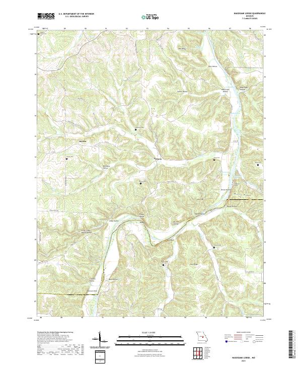 2021 Nagogami Lodge2021 Print · USGSMaries and Phelps counties come alive in this recent survey, showcasing a landscape defined by the winding Gasconade River. Researchers can trace old family burial grounds like the Granny Baker Graveyard and locate geological landmarks such as Clifty Creek Natural Bridge.
 - 2021 Map of Paydown, 2021 Print
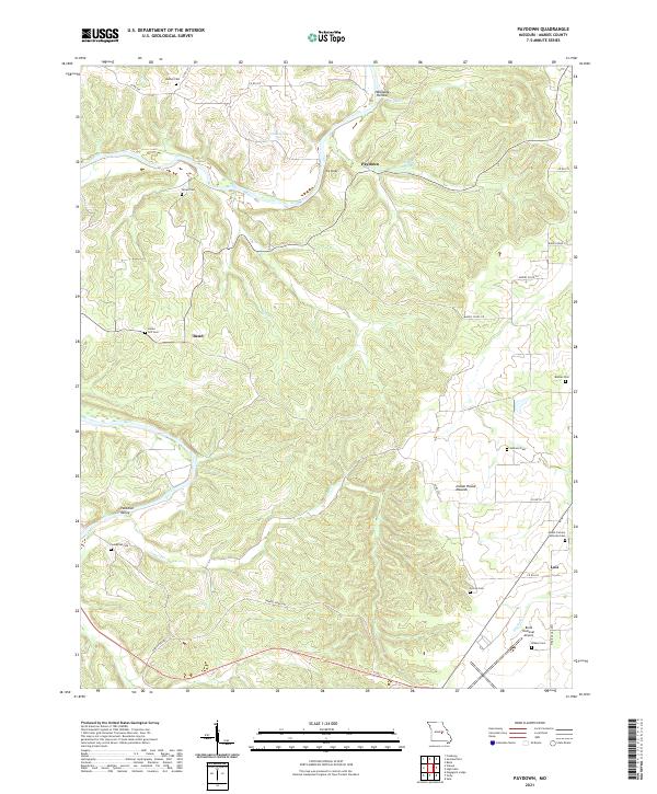 2021 Paydown2021 Print · USGSMaries County's winding creek valleys and high ridges are documented here during the early twenty-first century. Genealogists can locate several family burial grounds including Union Hill Cem and Johnson Cem, or explore the area around Lois and Paydown.
 - 2021 Map of Freeburg, 2021 Print
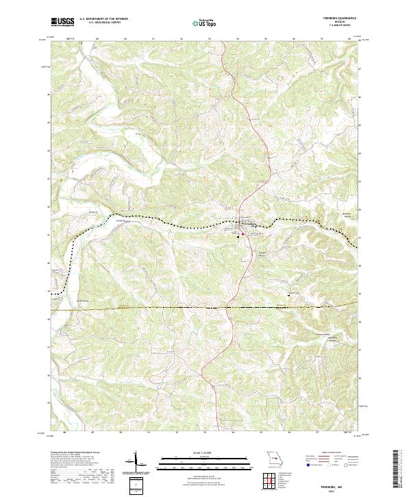 2021 Freeburg2021 Print · USGSOsage and Maries counties appear in this recent survey of the Missouri interior, centered on the community of Freeburg. Local history researchers can trace family landmarks and burial sites like Holy Family Cem or follow the winding course of the Maries River.
 - 2021 Map of Summerfield, 2021 Print
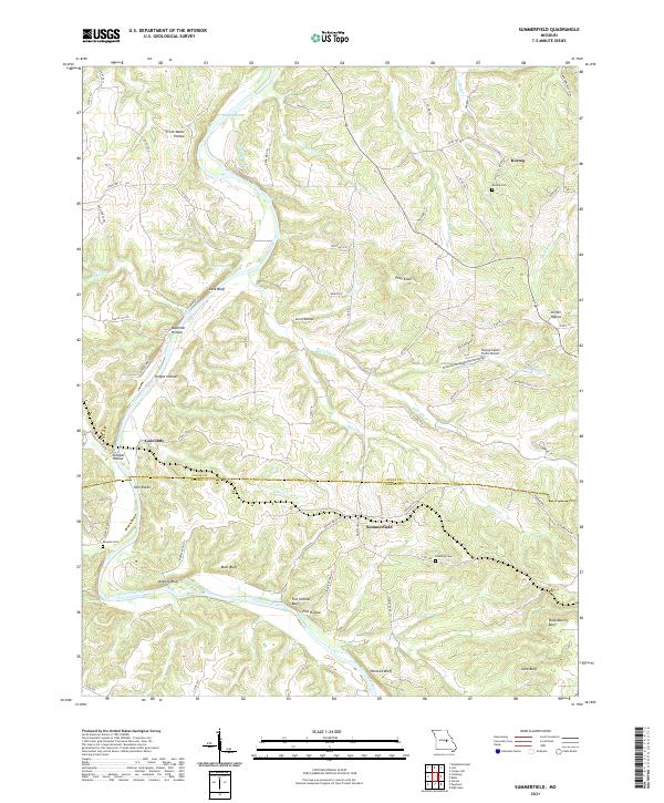 2021 Summerfield2021 Print · USGSOsage and Maries counties appear as a network of river bluffs and rural settlements in this 2021 survey. Researchers can locate family heritage sites like Koenig Cem and Branson Cem or trace the winding path of the Gasconade River past Fish Hollow Bluff.
 - 2021 Map of Vienna, 2021 Print
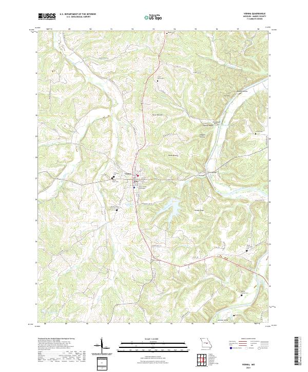 2021 Vienna2021 Print · USGSMaries County near the confluence of the Gasconade and Maries Rivers comes into focus in this contemporary survey of the Ozark foothills. Genealogists and local historians can locate many family and community landmarks, including the Maries County Poor Farm Cem, Visitation Cem, and the central Maries County Courthouse.
 - 2021 Map of Safe, 2021 Print
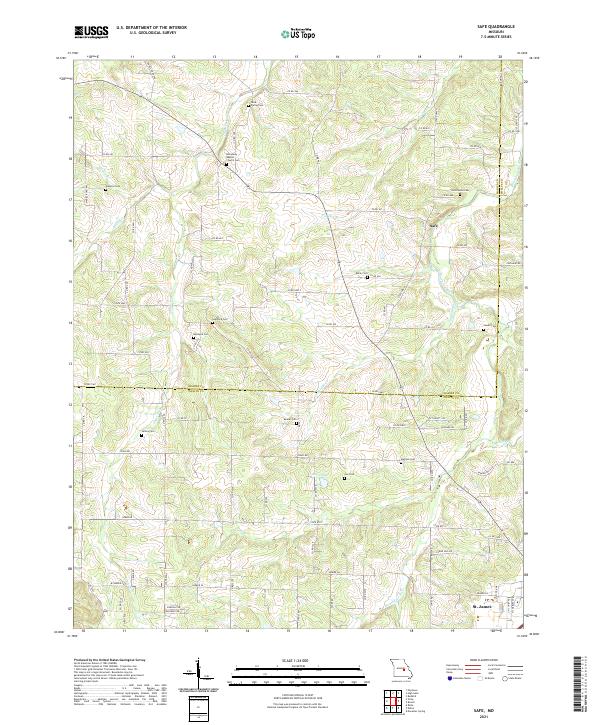 2021 Safe2021 Print · USGSThe Maries and Phelps County border comes alive in the early twenty-first century, showing a landscape of river-bend farms and rural crossroads. Genealogists can trace family lines through numerous burial sites like Rock Spring Cemetery and Beeler Cemetery along the Bourbeuse River.
 - 2021 Map of Belle, 2021 Print
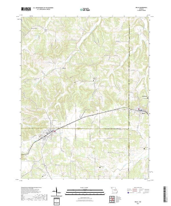 2021 Belle2021 Print · USGSThe tri-county borderlands of Maries, Osage, and Gasconade counties are documented here in the early twenty-first century. Genealogists and local historians can trace family roots through numerous remote burial grounds including Backues Cem, Liberty Cem, and Crider Cem.
 - 2021 Map of Vichy, 2021 Print
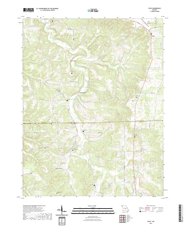 2021 Vichy2021 Print · USGSThe hill country of the Maries and Phelps county line is captured here in the early twenty-first century. Genealogists can trace family heritage through numerous remote sites like Tennison Cem, Miller Cem, and the Hazzard Farm Burials.
 - 2021 Map of High Gate, 2021 Print
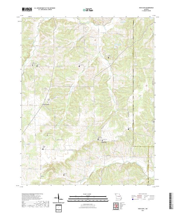 2021 High Gate2021 Print · USGSMaries County near the Gasconade and Phelps borders is shown in the early 2020s as a region defined by its small prairie settlements and family-named landmarks. Researchers can trace dozens of local burial sites like Walker Family Cem and Skaggs Chapel Cem along Lanes Fork.
 - 2021 Map of Argyle, 2021 Print
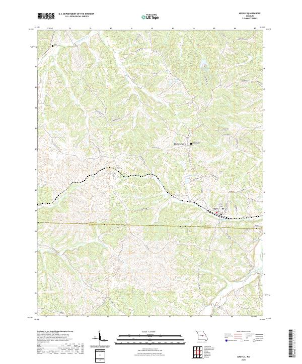 2021 Argyle2021 Print · USGSOsage and Maries counties meet in this Missouri landscape at the start of the 2020s, centered on the communities of Argyle and Koeltztown. Genealogists and historians can trace local family landmarks and infrastructure like the Burd Family Cem and Tunnel Number 2.
 - 2021 Map of Brinktown, 2021 Print
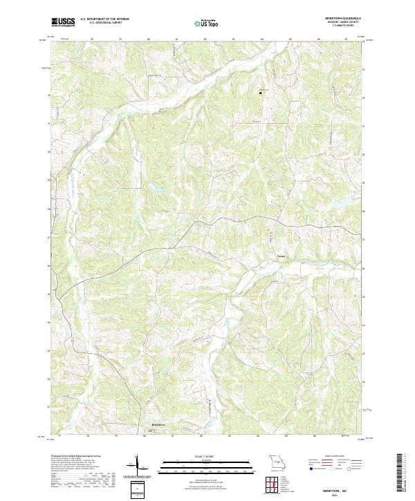 2021 Brinktown2021 Print · USGSMaries County in the early twenty-first century remains a landscape of river valleys and rural crossroads. Local historians and genealogists can trace family footprints near Brinktown, Venus, and the Guardian Angel Cem.
 - 2021 Map of Meta, 2021 Print
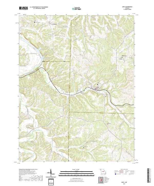 2021 Meta2021 Print · USGSOsage and Miller counties are shown here in the early 2020s, a landscape defined by the winding Osage River and rural ridge settlements. Genealogists can locate family-named sites like Thompson Cem or trace old routes such as Scheuer Ferry Rd and Old St Thomas Rd.
 - 2021 Map of Big Bend, 2021 Print
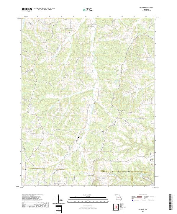 2021 Big Bend2021 Print · USGSThe northern reaches of Dixon and the winding Maries River valley come to life in this contemporary study of rural Missouri. Local historians can trace family burial sites like Fairview Cem and Dodd Cem or follow the terrain through Clifty Hollow.
 - 2021 Map of Van Cleve, 2021 Print
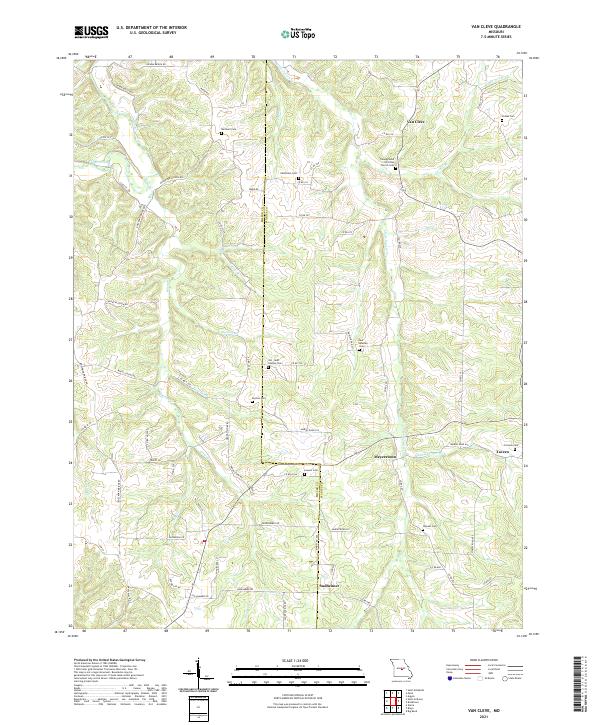 2021 Van Cleve2021 Print · USGSThe Miller and Maries county line comes alive in this contemporary survey of Missouri's creek-carved interior. Researchers can trace numerous family burial sites like Pendleton Cem or Duncan Cem and locate small communities such as Sudheimer and Van Cleve.
 - 2021 Map of Brays, 2021 Print
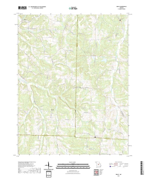 2021 Brays2021 Print · USGSSettled creek valleys and family cemeteries define this rural Missouri landscape where Miller and Maries counties meet. Researchers can trace local roots through Atwell and Brays, locating Freedom and Washington Cem near the banks of the Little Maries River.
End of results
Showing maps 1-15 of 15
Top cities of Maries County
Frequently asked questions
- What are the different types of historical maps available for Maries County?
- What is the oldest map of Maries County?
- Where can I purchase historical maps of Maries County for my home or office?
- Where can I download high-res historical maps of Maries County?
- Are there historical topographic maps available for Maries County?
- Is there historical aerial imagery available for Maries County?
- Where are historical maps of Maries County sourced from?