Old Maps of Monett, Missouri for Academic Research
Study the evolution of Monett with 23 high-resolution historic maps. Whether you're teaching, researching, or modeling changes in land use, these maps provide essential visual documentation of urban, environmental, and geographic change.
- Analyze long-term change: Track patterns in development, transportation, and natural features.
- Ideal for environmental or urban studies: Support academic projects with primary historical map data.
- Use in the classroom or lab: Educators and researchers rely on these maps to bring historical context to life.
These maps are a powerful tool for teaching, research, and visualizing how Monett has changed over the decades.
Monett, MO maps
(23)- 1943 Map of Ritchey
 1943 Ritchey1943 Print · USGSSouthwest Missouri during the war years shows a landscape of busy railroads and emerging military sites. Genealogists can trace family roots through numerous local landmarks like Odd Fellows Cem, Dungy Mine, and rural centers such as Stark City.2 unique versions available
 - 1943 Map of Monett
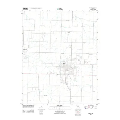
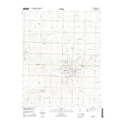
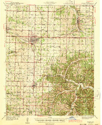 1943 Monett1943 Print · USGSCrossing the Barry and Lawrence County line during the mid-forties, this map reveals the vital railroad hub at Monett and its surrounding farmsteads. Genealogists can trace family names through landmarks like Red Mill, Arnold Chapel, and the Cox Cem.3 unique versions available
 - 1945 Map of Harrison
 1945 Harrison1945 Print · USGSThe Ozark and Boston Mountains straddle the Missouri-Arkansas border during the mid-forties, showing a landscape of forest ridges and river valleys. Genealogists and historians can trace rail-connected towns like Monett and West Plains or early lake developments at Bull Shoals Res and Norfork Lake.
 - 1949 Map of Harrison
 1949 Harrison1949 Print · USGSThe Ozark highlands of northern Arkansas and southern Missouri are shown just after the war, when the White River still followed its original course. Genealogists and historians can trace rail lines like the Missouri & Arkansas RR and locate rural hubs like Harrison, Eureka Springs, and Mountain Home.
 - 1954 Map of Harrison
 1954 Harrison1954 Print · USGSThe Ozarks and Boston Mountains meet during a period of massive river engineering in the mid-fifties. Researchers can trace the early shorelines of Bull Shoals Lake and Table Rock Reservoir or locate inland towns like Berryville and Harrison.
 - 1954 Map of Tulsa
 1954 Tulsa1954 Print · USGSNortheast Oklahoma and the Ozark border are shown here during a period of massive industrial and infrastructure growth. Researchers can trace the legacy of the Tri-State Mining District and the development of major reservoirs like Grand Lake O' The Cherokees.2 unique versions available
 - 1958 Map of Tulsa, 1968 Print
 1958 Tulsa1968 Print · USGSNortheast Oklahoma and the Ozark borderlands are captured here during a massive era of reservoir construction and highway expansion. Researchers can trace the mid-century footprints of Tulsa, the sprawling Lake O' the Cherokees, and historical sites like Pea Ridge National Military Park.3 unique versions available
 - 1958 Map of Harrison, 1973 Print
 1958 Harrison1973 Print · USGSThe Ozark and Boston Mountains appear in this mid-century survey as the great White River impoundments were reshaping the region. Researchers can trace the rail lines of the St Louis-San Francisco Ry and locate early settlements like Berryville and Gainesville.
 - 1963 Map of Tulsa
 1963 Tulsa1963 Print · USGSThe Oklahoma and Arkansas borderlands are shown here in the early sixties, a time of massive reservoir construction and heavy mining. Genealogists can trace family roots through settlements like Nowata, Pryor, and Jay, or locate historical zinc and lead mines and coal mines.
 - 1964 Map of Harrison
 1964 Harrison1964 Print · USGSThe Ozark and Boston Mountains of Arkansas and Missouri are captured here in the mid-sixties, showing the rugged highlands before extensive modern development. Genealogists and historians can trace family-named peaks like Gaither Mountain and follow the St Louis-San Francisco RR through Monett and Purdy.
 - 1972 Map of Monett, 1973 Print
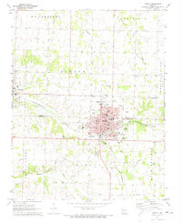 1972 Monett1973 Print · USGSMonett and Pierce City sit at a critical rail junction in the early seventies, marking a landscape defined by small-town industry and traditional community centers. Genealogists can locate family landmarks like Waldensian Church, St Marys Cemetery, and Liberty Church Cemetery.
 - 1972 Map of Pierce City, 1973 Print
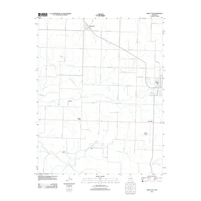
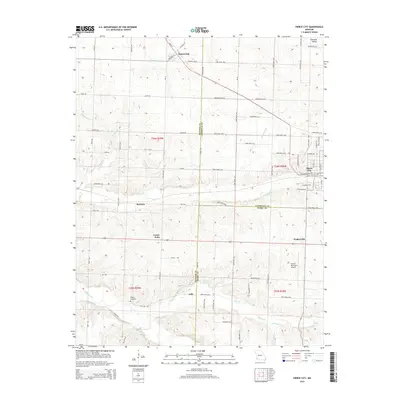
 1972 Pierce City1973 Print · USGSThe rail-and-creek landscape of Southwest Missouri comes to life in the early seventies, showing the area as the railroad era matured. Genealogists and historians can trace families near Pierce City, Yonkerville, and the rural Berwick Ch.
 - 1985 Map of Table Rock Lake
 1985 Table Rock Lake1985 Print · USGSSouthwest Missouri in the mid-1980s shows a landscape transformed by the waters of the White River and its reservoirs. Genealogists and local historians can trace the intricate shorelines of Table Rock Lake, locate rural crossroads like Jenkins and Madry, and explore the grounds of Roaring River State Park.
 - 1985 Map of Harrison
 1985 Harrison1985 Print · USGSThe Ozark highlands and the White River valley are seen here in the mid-1980s, showcasing a region defined by its massive reservoirs and protected wilderness. You can trace the rugged corridors of the Missouri & North Arkansas RR or locate historic settlements like Eureka Springs and Jasper.
 - 1986 Map of Neosho
 1986 Neosho1986 Print · USGSThe tri-state border region comes alive in the mid-eighties as a landscape of mining heritage and river valleys. Researchers can trace the rail lines of the Kansas City Southern Ry and locate rural landmarks like Gibson Cem and Peoria.2 unique versions available
 - 2012 Map of Monett, 2012 Print
 2012 Monett2012 Print · USGSCovers Monett, including Pierce City, Lawrence County, and other nearby areas
 - 2012 Map of Pierce City, 2012 Print
 2012 Pierce City2012 Print · USGSCovers Monett, including Pierce City, Wentworth, and other nearby areas
 - 2015 Map of Monett, 2015 Print
 2015 Monett2015 Print · USGSCovers Monett, including Pierce City, Lawrence County, and other nearby areas
 - 2015 Map of Pierce City, 2015 Print
 2015 Pierce City2015 Print · USGSCovers Monett, including Pierce City, Wentworth, and other nearby areas
 - 2017 Map of Monett, 2017 Print
 2017 Monett2017 Print · USGSCovers Monett, including Pierce City, Lawrence County, and other nearby areas
 - 2017 Map of Pierce City, 2017 Print
 2017 Pierce City2017 Print · USGSCovers Monett, including Pierce City, Wentworth, and other nearby areas
 - 2021 Map of Pierce City, 2021 Print
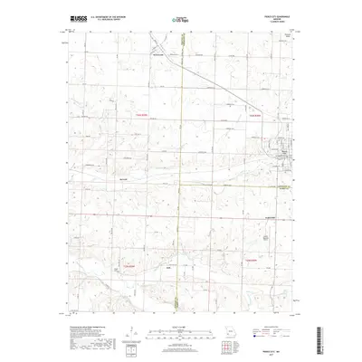
 2021 Pierce City2021 Print · USGSPierce City and its neighboring Ozark border towns are shown here in the modern era as they navigate a landscape of agriculture and aviation. Genealogists and local researchers can trace family landmarks like Wright Cem or find the small communities of Berwick, Jolly, and Yonkerville.
 - 2021 Map of Monett, 2021 Print
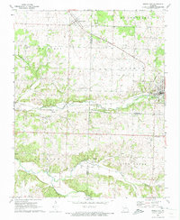
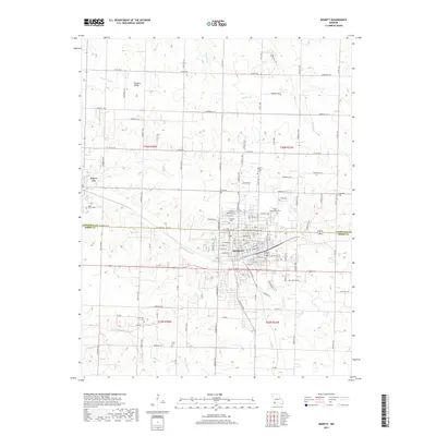
 2021 Monett2021 Print · USGSMonett and Pierce City are shown at the turn of the decade, revealing a densely settled landscape along the Lawrence and Barry County line. Genealogists can locate family sites at Mount Calvary Cem, New Site Cem, or Carlin Cem along Hudson Cr.
End of results
Showing maps 1-23 of 23
Top cities near Monett
- Aurora historical maps
- Mount Vernon historical maps
- Cassville historical maps
- Pierce City historical maps
- Sarcoxie historical maps
- Purdy historical maps
See more
Top neighborhoods of Monett
Frequently asked questions
- What are the different types of historical maps available for Monett?
- What is the oldest map of Monett?
- Where can I purchase historical maps of Monett for my home or office?
- Where can I download high-res historical maps of Monett?
- Are there historical topographic maps available for Monett?
- Is there historical aerial imagery available for Monett?
- Where are historical maps of Monett sourced from?