2020s Maps of Monett, Missouri
Explore 2 historic maps of Monett from the 2020s. These maps offer a rare glimpse into what life looked like during the 2020s — showing old roads, neighborhoods, homes, and landmarks that have changed or disappeared over time.
Whether you're researching your family's past, planning a metal detecting trip, or studying how Monett's landscape evolved across the 2020s, these high-resolution maps are a powerful tool for exploring the history of this region.
- Focus on a specific era: All maps on this page are from the 2020s, giving you a focused view of this time period.
- See what’s changed: Compare century-old streets, trails, and buildings to today's modern landscape using overlays and satellite layers.
- Research with precision: Use these maps for genealogy, historical research, land use analysis, or educational projects.
- View, download, or print: Maps are fully viewable online in high resolution, and can be downloaded or printed for your own records.
Start exploring Monett's history through authentic maps from the 2020s. This is your window into the past.
Monett, MO maps
(2)- 2021 Map of Pierce City, 2021 Print
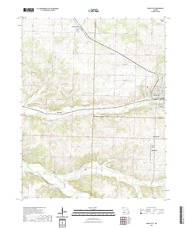 2021 Pierce City2021 Print · USGSPierce City and its neighboring Ozark border towns are shown here in the modern era as they navigate a landscape of agriculture and aviation. Genealogists and local researchers can trace family landmarks like Wright Cem or find the small communities of Berwick, Jolly, and Yonkerville.
 - 2021 Map of Monett, 2021 Print
 2021 Monett2021 Print · USGSMonett and Pierce City are shown at the turn of the decade, revealing a densely settled landscape along the Lawrence and Barry County line. Genealogists can locate family sites at Mount Calvary Cem, New Site Cem, or Carlin Cem along Hudson Cr.
End of results
Showing maps 1-2 of 2
Top cities near Monett
- Aurora historical maps
- Mount Vernon historical maps
- Cassville historical maps
- Pierce City historical maps
- Sarcoxie historical maps
- Purdy historical maps
See more
Top neighborhoods of Monett
Frequently asked questions
- What are the different types of historical maps available for Monett?
- What is the oldest map of Monett?
- Where can I purchase historical maps of Monett for my home or office?
- Where can I download high-res historical maps of Monett?
- Are there historical topographic maps available for Monett?
- Is there historical aerial imagery available for Monett?
- Where are historical maps of Monett sourced from?