1940s Maps of Huddleston, Missouri
Explore 2 historic maps of Huddleston from the 1940s. These maps offer a rare glimpse into what life looked like during the 1940s — showing old roads, neighborhoods, homes, and landmarks that have changed or disappeared over time.
Whether you're researching your family's past, planning a metal detecting trip, or studying how Huddleston's landscape evolved across the 1940s, these high-resolution maps are a powerful tool for exploring the history of this region.
- Focus on a specific era: All maps on this page are from the 1940s, giving you a focused view of this time period.
- See what’s changed: Compare century-old streets, trails, and buildings to today's modern landscape using overlays and satellite layers.
- Research with precision: Use these maps for genealogy, historical research, land use analysis, or educational projects.
- View, download, or print: Maps are fully viewable online in high resolution, and can be downloaded or printed for your own records.
Start exploring Huddleston's history through authentic maps from the 1940s. This is your window into the past.
Huddleston, MO maps
(2)- 1944 Map of Couch, 1960 Print
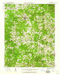 1944 Couch1960 Print · USGSThe Missouri Ozarks and the Arkansas borderlands appear in mid-century detail during the 1940s, highlighting the remote settlement of Oregon County. Genealogists can trace family footprints through numerous rural landmarks like Smyrna Ch, Couch Sch, and Hollis Cem.2 unique versions available
 - 1946 Map of Couch
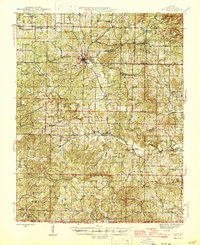 1946 Couch1946 Print · USGSOregon County is captured mid-century near the Arkansas border as the rural community network of one-room schools and country churches remained intact. Genealogists can locate family landmarks like Hollow Cem, Nebo Sch, and the settlements of Couch and Myrtle.2 unique versions available
End of results
Showing maps 1-2 of 2
Top cities near Huddleston
Frequently asked questions
- What are the different types of historical maps available for Huddleston?
- What is the oldest map of Huddleston?
- Where can I purchase historical maps of Huddleston for my home or office?
- Where can I download high-res historical maps of Huddleston?
- Are there historical topographic maps available for Huddleston?
- Is there historical aerial imagery available for Huddleston?
- Where are historical maps of Huddleston sourced from?