Old Maps of Fredericksburg, Missouri for Genealogy
Trace your family roots with 14 historic maps of Fredericksburg. These high-res maps reveal old neighborhoods, homesites, landmarks, and streets — helping you uncover where your ancestors lived and how the area evolved over time.
- Explore historic neighborhoods: Identify where your relatives may have lived in the 1800s or 1900s.
- Compare maps over time: Trace the changes in streets, buildings, and landmarks for multi-generational research.
- Perfect for genealogy & ancestry research: Used by family historians and researchers to map out lineage and migration.
These maps are an incredible resource for exploring your personal connection to Fredericksburg's past.
Fredericksburg, MO maps
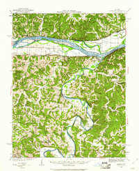
(14)- 1890 Map of Fulton
 1890 Fulton1890 Print · USGSMid-Missouri river life and railroad expansion come into focus in this late nineteenth-century survey. Genealogists and historians can trace old township lines and early river towns like Chamois, Danville, and the bustling county seat at Fulton.5 unique versions available
 - 1935 Map of Morrison
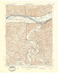
 1935 Morrison1935 Print · USGSThe confluence of the Missouri and Gasconade rivers comes to life in the mid-1930s, showing a world of river-town commerce and rural homesteads. Trace ancestral roots at Townley Cem, find old river crossings like Feiglers Ferry, or locate the Mint Hill PO.
 - 1942 Map of Morrison, 1961 Print
 1942 Morrison1961 Print · USGSThe river valleys of mid-Missouri are captured here in the 1940s, highlighting the vital rail and ferry networks of the era. Genealogists can locate family landmarks such as Wittenbach Cem, rural schools like Mud Creek Sch, and the historic Starkenburg community.2 unique versions available
 - 1945 Map of Morrison
 1945 Morrison1945 Print · USGSThe river valleys of central Missouri were still deeply tied to the water in the mid-1940s, as shown by this survey of the Missouri and Gasconade confluence. Genealogists can trace family roots through numerous country schools like Best Sch and river crossings such as Brown Shanty Ferry.2 unique versions available
 - 1949 Map of Saint Louis
 1949 Saint Louis1949 Print · USGSGreater St. Louis and its surrounding river valleys are captured here just after the war, showing the metropolitan core and the rural Ozark fringe. Researchers can trace the sprawling rail network of the Wabash RR or locate landmarks like Meramec Caverns Airport and Scott Air Force Base.2 unique versions available
 - 1962 Map of St. Louis
 1962 St. Louis1962 Print · USGSThe mid-century gateway to the west shows the metropolitan expansion of St Louis alongside its critical river confluences. Genealogists and historians can trace the rail corridors of the Missouri Pacific RR and settlements from Fulton to De Soto.
 - 1963 Map of St. Louis, 1970 Print
 1963 St. Louis1970 Print · USGSSt. Louis and its surrounding river valleys are captured here during the peak of mid-century suburban expansion and industrial activity. Trace the historic rail routes of the Norfolk and Western Ry or locate the St Louis Ordnance Plant and early stretches of US Highway 66.4 unique versions available
 - 1966 Map of St. Louis
 1966 St. Louis1966 Print · USGSThe St. Louis metropolitan area and its surrounding river valleys are captured here during the mid-sixties era of suburban growth and industrial strength. Genealogists and historians can trace the foundations of local communities through sites like Old Pioneer Cem, Parks College, and the Jefferson Barracks Military Reservation.
 - 1974 Map of Fredericksburg, 1976 Print
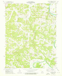 1974 Fredericksburg1976 Print · USGSThe Gasconade River valley in the mid-1970s remains a landscape of small river towns and active mineral extraction. Family historians can trace deep roots through local landmarks like Mint Hill, Salem Ch, and the Karschnick Cem near Mud Creek.
 - 1985 Map of Fulton
 1985 Fulton1985 Print · USGSMid-Missouri was a hub of river commerce and rail travel in the mid-1980s, where towns like Fulton and Hermann anchored the river valley. Researchers can trace historic river islands like Rush Island or follow the path of the Missouri - Kansas - Texas Railroad.2 unique versions available
 - 2012 Map of Fredericksburg, 2012 Print
 2012 Fredericksburg2012 Print · USGSCovers Fredericksburg, including Aud, Hope, and other nearby areas
 - 2015 Map of Fredericksburg, 2015 Print
 2015 Fredericksburg2015 Print · USGSCovers Fredericksburg, including Aud, Hope, and other nearby areas
 - 2017 Map of Fredericksburg, 2017 Print
 2017 Fredericksburg2017 Print · USGSCovers Fredericksburg, including Aud, Hope, and other nearby areas
 - 2021 Map of Fredericksburg, 2021 Print
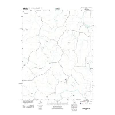
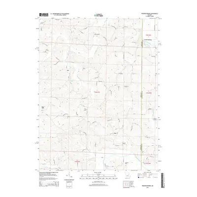
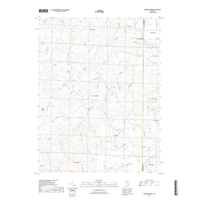
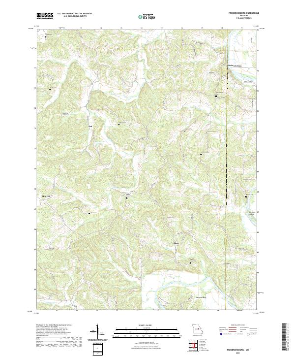 2021 Fredericksburg2021 Print · USGSThe Osage and Gasconade county borderlands are defined by the winding Gasconade River in this modern survey. Genealogists can trace family heritage through local burial sites like Hancock Cem and Baileys Creek Cem or the rural settlements of Fredericksburg and Aud.
End of results
Showing maps 1-14 of 14
Top cities near Fredericksburg
- Hermann historical maps
- Linn historical maps
- Chamois historical maps
- Gasconade historical maps
- Rhineland historical maps
- Morrison historical maps
See more
Frequently asked questions
- What are the different types of historical maps available for Fredericksburg?
- What is the oldest map of Fredericksburg?
- Where can I purchase historical maps of Fredericksburg for my home or office?
- Where can I download high-res historical maps of Fredericksburg?
- Are there historical topographic maps available for Fredericksburg?
- Is there historical aerial imagery available for Fredericksburg?
- Where are historical maps of Fredericksburg sourced from?