Old Maps of Perry County, Missouri for Hiking & Exploration
Hike through history with 153 historic maps of Perry County. Explore old trails, ghost towns, and forgotten backroads — perfect for outdoor adventurers and local explorers.
- Rediscover forgotten places: Map out old mining camps, roads, and footpaths that no longer exist on modern maps.
- Layer with modern tools: Combine with LiDAR or satellite views to plan hikes through historical terrain.
- Made for exploration: Popular among hikers, overlanders, and local history lovers.
Use these maps to find adventure and explore the hidden past of Perry County.
Perry County, MO maps
(153)- 1907 Map of Weingarten, 1961 Print
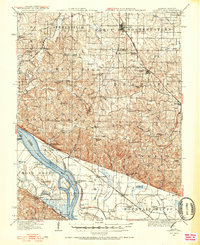
 1907 Weingarten1961 Print · USGSSte. Genevieve County at the start of the twentieth century shows a landscape of riverfront commerce and interior mining. Trace family roots at New Offenburg or locate the old Copper Mine and rural landmarks like the Burns School.2 unique versions available
 - 1909 Map of Weingarten
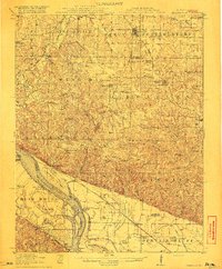
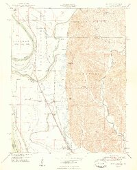
 1909 Weingarten1909 Print · USGSSoutheast Missouri at the dawn of the twentieth century shows a network of river towns and rail-connected hamlets. Genealogists can trace family land near Ste Genevieve and locate vanished landmarks like the Copper Mine or the Pine Valley School.3 unique versions available
 - 1910 Map of Higdon
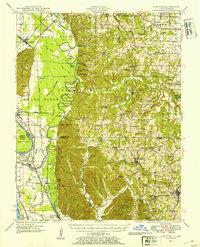
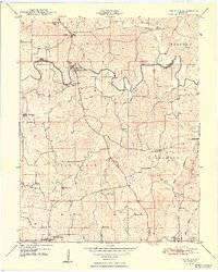
 1910 Higdon1910 Print · USGSThe Missouri Ozarks are captured here at the turn of the century as a landscape of mills and mountain hollows. Genealogists can trace family roots through numerous remote landmarks like Nations Mill, Bandenstistle School, and Spring Valley Church.2 unique versions available
 - 1915 Map of Chester
 1915 Chester1915 Print · USGSThe Mississippi River bottoms and the bluffs of Illinois meet here just before the Great War. Genealogists can trace family footprints across dozens of local schoolhouses like Walnut Ridge School and vanished river landings such as Okaw Ldg.5 unique versions available
 - 1916 Map of Campbell Hill, 1953 Print
 1916 Campbell Hill1953 Print · USGSThe Mississippi River borderlands in the early twentieth century are captured here during a peak era of rail-and-river commerce. Genealogists can trace family names through dozens of rural schools like Oak School and settlements like Shiloh Hill or Wine Hill.3 unique versions available
 - 1918 Map of Altenburg
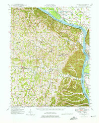
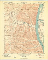
 1918 Altenburg1918 Print · USGSThe riverfronts of Perry and Jackson counties were still shaped by steam and rail when this survey was completed during the First World War. Local historians can trace family ties to small communities like Neunert and Jacob or locate old schoolhouse sites such as Hanlein School.
 - 1918 Map of Campbell Hill
 1918 Campbell Hill1918 Print · USGSThe Illinois-Missouri borderlands near Campbell Hill are shown here during the late First World War era, where rail lines and river landings drove the local economy. Genealogists can trace family footprints across numerous rural school districts like Ebenezer School, Tangen School, and settlements such as Shiloh Hill.3 unique versions available
 - 1923 Map of Perryville, 1960 Print
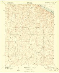
 1923 Perryville1960 Print · USGSSoutheast Missouri's rural townships are documented here during the early twenties, showing a landscape of small mill sites and dozens of neighborhood schools. Researchers can trace family origins through locations like St Marys Seminary, Bollingers Mill, and Schumer Springs.2 unique versions available
 - 1924 Map of Perryville
 1924 Perryville1924 Print · USGSSoutheast Missouri in the early 1920s was a landscape of small river towns and family-named landmarks at the intersection of three counties. Genealogists can trace family roots through numerous country schools like Sim Layton School and local mills such as Bollingers Mill.2 unique versions available
 - 1924 Map of Alto Pass
 1924 Alto Pass1924 Print · USGSSouthern Illinois at the peak of the rail era shows a landscape of river ferries and ridge-top settlements. Genealogists can trace family footprints across dozens of local landmarks like Rattlesnake Ferry, Goodbread Church, and Worthen School.2 unique versions available
 - 1925 Map of Altenburg
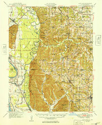
 1925 Altenburg1925 Print · USGSEastern Perry County and the Mississippi riverfront are documented here during the mid-twenties, showcasing a landscape of Saxon Lutheran heritage and river commerce. Genealogists can locate family landmarks like New Bethel Church, Hager School, and the vanished river site of Wittenberg.3 unique versions available
 - 1947 Map of Chester
 1947 Chester1947 Print · USGSThe Illinois-Missouri borderlands are captured here in the mid-forties, showing the shifted course of the river and the isolated Kaskaskia Island. Researchers can trace old river landings and rural schoolhouses like Okaw Ldg, Cain Hill School, and the site of Old Kaskaskia.3 unique versions available
 - 1947 Map of Alto Pass, 1954 Print
 1947 Alto Pass1954 Print · USGSSouthern Illinois in the late 1940s is defined by the high ridges of the Shawnee Hills and the sweeping Mississippi floodplains. Researchers can trace rural life through sites like Dutch Ridge Church, the Macedonia School, and the river crossing at Rattlesnake Ferry.2 unique versions available
 - 1947 Map of Crosstown, 1960 Print
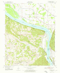
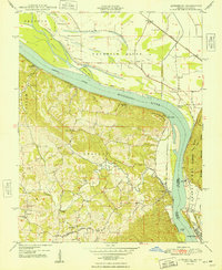
 1947 Crosstown1960 Print · USGSSoutheast Missouri was still a landscape of scattered rural schools and river-rail commerce just after the war. Local researchers can trace the locations of the Schalls Sch, identify the family-named Hager Sch, or follow the St Louis San Francisco line along the Mississippi River.3 unique versions available
 - 1947 Map of Oak Ridge, 1964 Print
 1947 Oak Ridge1964 Print · USGSPerry and Cape Girardeau counties are captured here in the late 1940s, a period when rural school districts and small post offices still anchored Missouri life. Researchers can trace family roots through numerous sites like Old Appleton (PO), Zion Ch, and Liberty Sch No 1.2 unique versions available
 - 1947 Map of Wolf Lake, 1966 Print
 1947 Wolf Lake1966 Print · USGSThe Mississippi River bottoms and Shawnee National Forest hills meet in the late 1940s, showing a landscape shaped by rail and river. Genealogists can trace local landmarks like Galilee Ch and rural schoolhouses such as Cauble Sch and McCann Sch.3 unique versions available
 - 1947 Map of Altenburg, 1976 Print
 1947 Altenburg1976 Print · USGSSoutheastern Missouri's river bluffs and Lutheran heritage are documented here in the mid-forties, showing the close-knit network of river landings and small-town commerce. Genealogists can trace family footprints across Altenburg, Frohna, and dozens of rural schools like Fiehler Sch or Buckeye Sch.
 - 1947 Map of Altenburg, 1976 Print
 1947 Altenburg1976 Print · USGSThe Mississippi River valley at mid-century is captured here, showing the river-and-rail hub of the Missouri and Illinois border. Genealogists can trace the rural communities of Altenburg, Frohna, and Seventysix alongside landmarks like Union Sch and Tower Rock.4 unique versions available
 - 1948 Map of Crosstown
 1948 Crosstown1948 Print · USGSThe rural uplands of Perry County are captured here in the late 1940s as a network of farming hamlets and local school districts. Researchers can locate vanished landmarks like Trickey Sch and Schalls Sch or trace the early paths through Farrar and Brazeau.2 unique versions available
 - 1948 Map of Wolf Lake
 1948 Wolf Lake1948 Print · USGSThe Illinois-Missouri borderlands at the end of the 1940s reveal a landscape of river-driven commerce and scattered rural schoolhouses. Genealogists can trace family footprints at Galilee Ch, Bennett Landing, and the many namesake schools like McCann Sch and McGuire Sch.2 unique versions available
 - 1948 Map of Neelys Landing
 1948 Neelys Landing1948 Print · USGSThe Missouri-Illinois river border is captured here in the late 1940s, showing a landscape of small river landings and ridge-top farms. Genealogists can trace family footprints at New Wells, the New Bethel Ch, and several rural schoolhouses like Oak Hill Sch.5 unique versions available
 - 1948 Map of Oak Ridge
 1948 Oak Ridge1948 Print · USGSThe borderlands of Perry and Cape Girardeau counties are captured here in the late 1940s, showing a high concentration of rural schools and church settlements. Genealogists can trace family roots through localized landmarks like Uniontown School, Goshen Ch, and Old Appleton.2 unique versions available
 - 1948 Map of Altenburg
 1948 Altenburg1948 Print · USGSThe Missouri-Illinois borderlands come alive in the late 1940s, showcasing the riverfront culture and inland farming life of Perry and Jackson Counties. Researchers can trace ancestral footprints through historic landings like Star Landing or locate rural schools such as Solomon Sch and Union Sch.2 unique versions available
 - 1949 Map of Alto Pass
 1949 Alto Pass1949 Print · USGSSouthern Illinois river life and hill country are captured here shortly after the war, showing the Mississippi corridor in detail. You can trace old river crossings like Rattlesnake Ferry and locate rural landmarks such as Bald Knob, Lyerle Chapel, and the Hickory Ridge School.
 - 1949 Map of Paducah
 1949 Paducah1949 Print · USGSThe confluence of the Ohio, Mississippi, Tennessee, and Cumberland rivers at the close of the 1940s reveals a region bound by water and rail. Researchers can trace historic river landings, timberlands in the Shawnee National Forest, and the coal-mining infrastructure around West Frankfort and Herrin.2 unique versions available
Showing maps 1-25 of 153
Top cities of Perry County
Frequently asked questions
- What are the different types of historical maps available for Perry County?
- What is the oldest map of Perry County?
- Where can I purchase historical maps of Perry County for my home or office?
- Where can I download high-res historical maps of Perry County?
- Are there historical topographic maps available for Perry County?
- Is there historical aerial imagery available for Perry County?
- Where are historical maps of Perry County sourced from?