2020s Maps of Edgar Springs, Missouri
Explore 2 historic maps of Edgar Springs from the 2020s. These maps offer a rare glimpse into what life looked like during the 2020s — showing old roads, neighborhoods, homes, and landmarks that have changed or disappeared over time.
Whether you're researching your family's past, planning a metal detecting trip, or studying how Edgar Springs's landscape evolved across the 2020s, these high-resolution maps are a powerful tool for exploring the history of this region.
- Focus on a specific era: All maps on this page are from the 2020s, giving you a focused view of this time period.
- See what’s changed: Compare century-old streets, trails, and buildings to today's modern landscape using overlays and satellite layers.
- Research with precision: Use these maps for genealogy, historical research, land use analysis, or educational projects.
- View, download, or print: Maps are fully viewable online in high resolution, and can be downloaded or printed for your own records.
Start exploring Edgar Springs's history through authentic maps from the 2020s. This is your window into the past.
Edgar Springs, MO maps
(2)- 2021 Map of Edgar Springs, 2021 Print
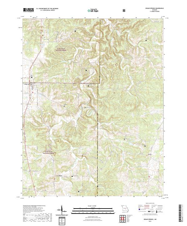 2021 Edgar Springs2021 Print · USGSThe Ozark hills of Phelps and Dent counties come alive in this 2021 survey of the timbered uplands and rural crossroads. Genealogists can trace family heritage across a remarkable number of small burial sites, from Edgar Springs Cem to Roseberry Cem and Cedar Hill Cem.
 - 2021 Map of Flat, 2021 Print
 2021 Flat2021 Print · USGSThe Phelps County uplands are documented here in the early twenty-first century, showing the forest and farm landscape around Flat. Researchers can trace local family history through several burial sites like Trout Cemetery and Smith Cem or locate old water sources at Cave Spring.
End of results
Showing maps 1-2 of 2
Top cities near Edgar Springs
- Rolla historical maps
- Sherrill historical maps
- Licking historical maps
- Doolittle historical maps
- Newburg historical maps
- Powellville historical maps
Frequently asked questions
- What are the different types of historical maps available for Edgar Springs?
- What is the oldest map of Edgar Springs?
- Where can I purchase historical maps of Edgar Springs for my home or office?
- Where can I download high-res historical maps of Edgar Springs?
- Are there historical topographic maps available for Edgar Springs?
- Is there historical aerial imagery available for Edgar Springs?
- Where are historical maps of Edgar Springs sourced from?