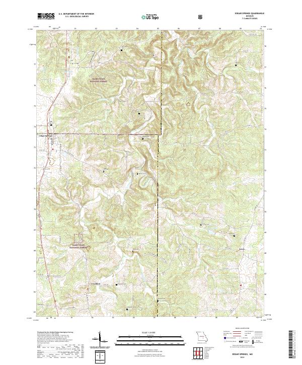
2021 Map of Edgar Springs
USGS Topo · Published 2021About this map
Edgar Springs sits at the intersection of Old Hwy 63 and State Hwy FF, serving as a gateway to the wooded interior of the Mark Twain National Forest. The landscape is deeply carved by drainage systems like Little Piney Cr and Horse Cr, where narrow ridges and hollows such as Solomon Hollow define the topography. This 2021 survey reveals a high density of rural burial grounds, including the Hall/Heavin Cem, Jocoy Cem, and Renaud Cem, pointing to the dispersed family homesteads that have long occupied these Ozark hills.
Find a feature on this map
75 named features on this map. Tap any name to fly to it.
Don’t see what you’re looking for? This feature index may not catch every label — zoom into the map to look around manually.
Map Details
Editions of this 2021 Edgar Springs Map
This is the sole edition of this map. No revisions or reprints were ever made.
Other maps of this area

1912 · Rolla
USGS Topo · 1:62,500

1928 · Meramec Spring
USGS Topo · 1:62,500

1937 · Edgar Springs
USGS Topo · 1:48,000

1941 · Salem
USGS Topo · 1:62,500

1945 · Salem
USGS Topo · 1:62,500

1945 · Edgar Springs
USGS Topo · 1:62,500

1949 · Rolla
USGS Topo · 1:250,000

1949 · Meramec Spring
USGS Topo · 1:62,500
1950 · Kaintuck Hollow
USGS Topo · 1:24,000
1950 · Yancy Mills
USGS Topo · 1:24,000