Old Maps of Phelps County, Missouri
Explore 188 old maps of Phelps County, spanning from 1888 to today. These high-resolution historic maps reveal how streets, neighborhoods, landmarks, and natural features evolved over time — perfect for genealogy, metal detecting, research, and local history exploration.
What you can do with these maps:
- See how Phelps County changed over time: Compare historical maps to modern-day views to trace roads, homesites, rail lines & more.
- View detailed metadata: Each map includes creators, publishers, year, scale, and archive source.
- Overlay maps with satellite & LiDAR: Visualize the past alongside modern tools to explore terrain & human change.
- Trusted historical sources: Maps sourced from the USGS, Library of Congress, and other archives.
- Access maps your way: View online, download high-res files, or order prints for personal or research use.
Start exploring old maps of Phelps County to uncover forgotten places, hidden landmarks, and the deep history beneath your feet.
Phelps County, MO maps
(188)- 1888 Map of Tuscumbia
 1888 Tuscumbia1888 Print · USGSThe Osage River valley comes to life in the 1880s, showcasing the intricate river bends and rugged hills of central Missouri. Genealogists and researchers can trace the original locations of early settlements like Tuscumbia, St. Elizabeth, and Iberia.
 - 1894 Map of Tuscumbia
 1894 Tuscumbia1894 Print · USGSCentral Missouri's river-and-rail landscape is captured here in the 1890s as the Osage River served as the region's main artery. Genealogists and historians can trace the early boundaries of communities like Tuscumbia, St. Elizabeth, and Iberia.3 unique versions available
 - 1912 Map of Rolla
 1912 Rolla1912 Print · USGSThe northern Ozark plateau comes into focus just after the turn of the century as the railroad transforms the river valleys. Genealogists can trace family roots through dozens of rural sites like Western Star School, Turners Mill, and Zion Hill Church.2 unique versions available
 - 1928 Map of Meramec Spring
 1928 Meramec Spring1928 Print · USGSPhelps and Crawford counties in the late twenties are mapped here as a network of rail-side towns and rural school districts. Genealogists can trace family names through dozens of landmarks like Asher Cemetery, Belview Church, and the Bronson Mine.3 unique versions available
 - 1934 Map of Redbird, 1962 Print
 1934 Redbird1962 Print · USGSThe rural landscapes of Phelps, Maries, and Gasconade Counties are captured here in the 1930s, before modern highway expansion altered the backroads. Genealogists can trace family landmarks like Rock Spring Cem, Stockton Mine, and the Soldiers Home.
 - 1936 Map of Waynesville
 1936 Waynesville1936 Print · USGSPulaski County during the mid-1930s is defined by its winding river valleys and the expansion of the Gardner National Forest. Researchers can trace ancestral locations through an extensive network of rural landmarks, including the Old Indian Lead Mine, Riddle Bridge, and the Sweet Home Ch.
 - 1937 Map of Edgar Springs
 1937 Edgar Springs1937 Print · USGSThe Missouri Ozarks are captured here during the mid-1930s, showing the intersection of rural life and New Deal conservation efforts. Genealogists can locate family landmarks like Freemans Store, Mette Sch, and the Blooming Rose CCC Camp No 1732.
 - 1937 Map of Vienna, 1964 Print
 1937 Vienna1964 Print · USGSMaries County in the late 1930s is documented here through its reliance on the river and its network of one-room schools. Genealogists can trace family names at Gaines Ferry, the Terrill Clay Pit, and country churches like Wynn Ch.2 unique versions available
 - 1938 Map of Redbird
 1938 Redbird1938 Print · USGSThe Missouri Ozarks during the late 1930s reveal a landscape of river-carved ridges and small agricultural hubs like St James and Highgate. Genealogists and historians can locate dozens of country landmarks, from Stockton Mines to rural schools like Lanes Prairie and the Southard Cem.3 unique versions available
 - 1938 Map of Vienna
 1938 Vienna1938 Print · USGSMaries County in the late 1930s is a landscape of deep river bends and high ridges where the Gasconade River dictates the pace of life. Family historians can trace local roots through numerous country schools and river crossings like McMinn Sch, Gaines Ferry, and Paydown Ford.
 - 1941 Map of Big Piney
 1941 Big Piney1941 Print · USGSThe Ozarks at the dawn of the war years reveal a landscape of rural schoolhouses and river bends before military expansion. Genealogists can trace family roots through Lone Star Sch, Cook Cem, and the now-transformed settlement of Bloodland.
 - 1942 Map of Waynesville
 1942 Waynesville1942 Print · USGSPulaski County during the early 1940s shows a landscape of deep river bends and the emergence of wartime infrastructure. Genealogists can trace family roots through numerous sites like Burchard Cem, the Old Indian Lead Mine, and the original footprint of Fort Leonard Wood.
 - 1943 Map of Big Piney
 1943 Big Piney1943 Print · USGSThe Missouri Ozarks are shown here during the early years of the Second World War as federal land expansion reshaped the region. Genealogists and local historians can trace family roots through numerous country schools like Lone Star Sch and churches including St Annie Ch and Dondas Ch.2 unique versions available
 - 1944 Map of Waynesville
 1944 Waynesville1944 Print · USGSPulaski County at the peak of the Second World War shows a landscape in transition as the new Fort Leonard Wood takes shape among the Ozark hills. Genealogists and researchers can trace family-named sites like Wheelers Mill, Riddle Bridge, and the Joiner Cem along the winding Gasconade River.2 unique versions available
 - 1945 Map of Edgar Springs
 1945 Edgar Springs1945 Print · USGSThe Missouri Ozarks are captured here in the mid-1940s, showing a landscape of upland ridges and deep hollows at the borders of Phelps and Texas counties. Researchers can trace rural community life through the Blooming Rose CCC Camp and remote sites like Bethlehem Sch & Pray Cem.2 unique versions available
 - 1947 Map of Jefferson City, 1949 Print
 1947 Jefferson City1949 Print · USGSCentral Missouri and the northern Ozarks come into focus in this late 1940s survey of the river-and-rail landscape. Genealogists and historians can trace the growth of Jefferson City and Sedalia or locate family roots near Bagnell Dam and the Lake of the Ozarks.
 - 1948 Map of Tavern, 1973 Print
 1948 Tavern1973 Print · USGSMaries County life in the late 1940s was centered on the river valleys and a network of rural schools. Genealogists can trace family landmarks like Old Van Cleve, the Barnhart Cem, and numerous schoolhouses including Camp Ground Sch.2 unique versions available
 - 1949 Map of Saint Louis
 1949 Saint Louis1949 Print · USGSGreater St. Louis and its surrounding river valleys are captured here just after the war, showing the metropolitan core and the rural Ozark fringe. Researchers can trace the sprawling rail network of the Wabash RR or locate landmarks like Meramec Caverns Airport and Scott Air Force Base.2 unique versions available
 - 1949 Map of Vienna
 1949 Vienna1949 Print · USGSMaries County life in the late 1940s centers on the winding GASCONADE RIVER and the county seat of VIENNA. You can trace rural schoolhouse locations like Bell Sch and Terry Sch or find family landmarks such as Walker Cem and Spencer Store.2 unique versions available
 - 1949 Map of Rolla, 1950 Print
 1949 Rolla1950 Print · USGSThe Missouri Ozarks are captured here just after the war, showing a landscape of deep river valleys and emerging reservoir projects. Genealogists and historians can trace the mining towns of Bonne Terre and Potosi or follow the early route of U.S. Highway 66.
 - 1949 Map of Meramec Spring, 1957 Print
 1949 Meramec Spring1957 Print · USGSPhelps and Dent counties are shown here just after the war, at a time when rural education and mining defined the Missouri Ozarks. Genealogists can locate family landmarks like Wishon Cem, Asher Cemetery, and dozens of district schools such as Roster School.2 unique versions available
 - 1950 Map of Tavern
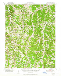 1950 Tavern1950 Print · USGSMaries County and the surrounding Missouri countryside appear here in the late 1940s, showing a landscape defined by river bends and rural schoolhouses. Researchers can locate family landmarks like Ricker Ch, Brinktown Sch, and Barnhart Cem.3 unique versions available
 - 1950 Map of Newburg, 1957 Print
 1950 Newburg1957 Print · USGSMid-century Phelps County comes to life along the river bends and rail lines during the early 1950s. Genealogists and historians can locate family landmarks such as Kitchell Cem and Hickory Point Sch, or trace the old paths of Boulware Ford and U.S. 66.4 unique versions available
 - 1950 Map of Kaintuck Hollow, 1959 Print
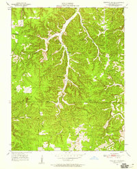 1950 Kaintuck Hollow1959 Print · USGSPhelps County, Missouri, is shown here as it appeared in the mid-1950s, dominated by the dense forests and hollows of the Ozarks. Researchers can trace the network of rural schools and churches, including Western Star Sch, Kaintuck Ch, and the high-elevation Knotwell Lookout Tower.3 unique versions available
 - 1950 Map of Yancy Mills, 1960 Print
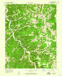 1950 Yancy Mills1960 Print · USGSMid-century Phelps and Dent Counties appear here as a network of ridge-top schools and creek-bottom settlements. Genealogists can locate family landmarks such as the Corn Creek Cem, Philadelphia Ch, and the rural community of Yancy Mills.6 unique versions available
Showing maps 1-25 of 188
Top cities of Phelps County
- Rolla historical maps
- St. James historical maps
- Doolittle historical maps
- Newburg historical maps
- Edgar Springs historical maps
- Powellville historical maps
Frequently asked questions
- What are the different types of historical maps available for Phelps County?
- What is the oldest map of Phelps County?
- Where can I purchase historical maps of Phelps County for my home or office?
- Where can I download high-res historical maps of Phelps County?
- Are there historical topographic maps available for Phelps County?
- Is there historical aerial imagery available for Phelps County?
- Where are historical maps of Phelps County sourced from?