Old Maps of Platte County, Missouri
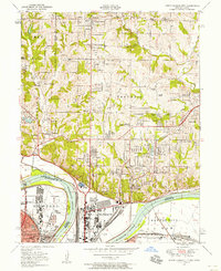
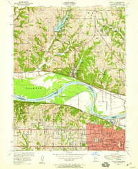
Explore 79 old maps of Platte County, spanning from 1885 to today. These high-resolution historic maps reveal how streets, neighborhoods, landmarks, and natural features evolved over time — perfect for genealogy, metal detecting, research, and local history exploration.
What you can do with these maps:
- See how Platte County changed over time: Compare historical maps to modern-day views to trace roads, homesites, rail lines & more.
- View detailed metadata: Each map includes creators, publishers, year, scale, and archive source.
- Overlay maps with satellite & LiDAR: Visualize the past alongside modern tools to explore terrain & human change.
- Trusted historical sources: Maps sourced from the USGS, Library of Congress, and other archives.
- Access maps your way: View online, download high-res files, or order prints for personal or research use.
Start exploring old maps of Platte County to uncover forgotten places, hidden landmarks, and the deep history beneath your feet.
Platte County, MO maps
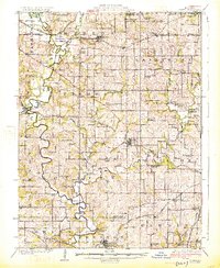
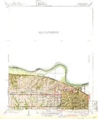
(79)- 1885 Map of Atchison, 1954 Print
 1885 Atchison1954 Print · USGSCovers Platte County, including Atchison, Shannon, and other nearby areas
 - 1886 Map of Oskaloosa, 1954 Print
 1886 Oskaloosa1954 Print · USGSCovers Platte County, including Lawrence, Tonganoxie, and other nearby areas
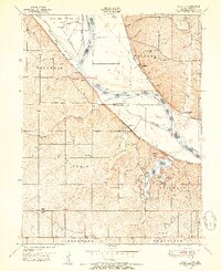
 - 1888 Map of Oskaloosa
 1888 Oskaloosa1888 Print · USGSCovers Platte County, including Lawrence, Tonganoxie, and other nearby areas
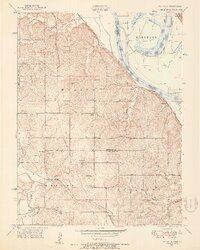
 - 1888 Map of Atchison
 1888 Atchison1888 Print · USGSCovers Platte County, including Atchison, Shannon, and other nearby areas
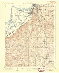
 - 1890 Map of Kansas City
 1890 Kansas City1890 Print · USGSCovers Platte County, including Kansas City, Overland Park, and other nearby areas2 unique versions available
 - 1893 Map of Atchison
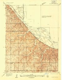
 1893 Atchison1893 Print · USGSCovers Platte County, including Atchison, Shannon, and other nearby areas6 unique versions available
 - 1894 Map of Kansas City
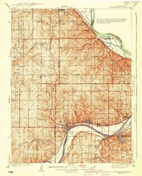
 1894 Kansas City1894 Print · USGSCovers Platte County, including Kansas City, Overland Park, and other nearby areas14 unique versions available
 - 1894 Map of Oskaloosa
 1894 Oskaloosa1894 Print · USGSCovers Platte County, including Lawrence, Tonganoxie, and other nearby areas6 unique versions available
 - 1910 Map of Leavenworth
 1910 Leavenworth1910 Print · USGSCovers Platte County, including Kansas City, Leavenworth, and other nearby areas8 unique versions available
 - 1914 Map of Smithville
 1914 Smithville1914 Print · USGSCovers Platte County, including Kansas City, Smithville, and other nearby areas4 unique versions available
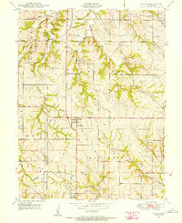
 - 1925 Map of Gower
 1925 Gower1925 Print · USGSCovers Platte County, including Saint Joseph, Gower, and other nearby areas3 unique versions available
 - 1926 Map of Atchison
 1926 Atchison1926 Print · USGSCovers Platte County, including Atchison, Shannon, and other nearby areas5 unique versions available
 - 1927 Map of Dearborn
 1927 Dearborn1927 Print · USGSCovers Platte County, including Saint Joseph, Wathena, and other nearby areas3 unique versions available
 - 1934 Map of Bonner Springs
 1934 Bonner Springs1934 Print · USGSCovers Platte County, including Kansas City, Shawnee, and other nearby areas
 - 1934 Map of Wolcott
 1934 Wolcott1934 Print · USGSCovers Platte County, including Kansas City, Lansing, and other nearby areas
 - 1935 Map of North Kansas City
 1935 North Kansas City1935 Print · USGSCovers Platte County, including Kansas City, Kansas City, and other nearby areas
 - 1940 Map of Bonner Springs
 1940 Bonner Springs1940 Print · USGSCovers Platte County, including Kansas City, Shawnee, and other nearby areas4 unique versions available
 - 1940 Map of North Kansas City
 1940 North Kansas City1940 Print · USGSCovers Platte County, including Kansas City, Kansas City, and other nearby areas2 unique versions available
 - 1943 Map of Quindaro
 1943 Quindaro1943 Print · USGSCovers Platte County, including Kansas City, Kansas City, and other nearby areas
 - 1948 Map of Wolcott, 1954 Print
 1948 Wolcott1954 Print · USGSCovers Platte County, including Kansas City, Lansing, and other nearby areas5 unique versions available
 - 1948 Map of Oak Mills, 1954 Print
 1948 Oak Mills1954 Print · USGSCovers Platte County, including Bean Lake Station, Millwood, and other nearby areas2 unique versions available
 - 1948 Map of Nashua, 1956 Print
 1948 Nashua1956 Print · USGSCovers Platte County, including Kansas City, Smithville, and other nearby areas
 - 1948 Map of Leavenworth, 1957 Print
 1948 Leavenworth1957 Print · USGSCovers Platte County, including Kansas City, Leavenworth, and other nearby areas4 unique versions available
 - 1948 Map of North Kansas City, 1958 Print
 1948 North Kansas City1958 Print · USGSCovers Platte County, including Kansas City, Kansas City, and other nearby areas
 - 1948 Map of Parkville, 1959 Print
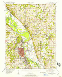
 1948 Parkville1959 Print · USGSCovers Platte County, including Kansas City, Kansas City, and other nearby areas
Showing maps 1-25 of 79
Top cities of Platte County
- Parkville historical maps
- Platte City historical maps
- Riverside historical maps
- Weatherby Lake historical maps
- Weston historical maps
- Lake Waukomis historical maps
See more
Frequently asked questions
- What are the different types of historical maps available for Platte County?
- What is the oldest map of Platte County?
- Where can I purchase historical maps of Platte County for my home or office?
- Where can I download high-res historical maps of Platte County?
- Are there historical topographic maps available for Platte County?
- Is there historical aerial imagery available for Platte County?
- Where are historical maps of Platte County sourced from?