Old Maps of Platte County, Missouri for Metal Detecting
Plan your next treasure hunt with 155 historic maps of Platte County. Find old homesites, ghost towns, trails, and gathering spots that may be lost to time — perfect for identifying promising metal detecting locations.
- Locate forgotten sites: Uncover places like long-lost settlements, abandoned rail lines, or gathering spots.
- Plan better hunts: Use map overlays combined with LiDAR or satellite views to narrow in on historically rich areas.
- Made for detectorists: Thousands of hobbyists use these maps to discover relics, coins, and hidden history.
Use these historic maps to boost your research and find new opportunities beneath the surface of Platte County.
Platte County, MO maps
(155)- 1885 Map of Atchison, 1954 Print
 1885 Atchison1954 Print · USGSNortheast Kansas and the Missouri border appear here in the late nineteenth century as a bustling corridor of river commerce and rail expansion. Genealogists can trace family roots through early settlements like Highland, Troy, and Everest, or locate the bounds of the Iowa Indian Reservation.
 - 1886 Map of Oskaloosa, 1954 Print
 1886 Oskaloosa1954 Print · USGSEastern Kansas in the mid-1880s was a crossroads of major rail expansion and river commerce. Genealogists and historians can trace the early layouts of Oskaloosa and Valley Falls, or locate family sites near Jarbalo Mound and the Delaware River.
 - 1888 Map of Oskaloosa
 1888 Oskaloosa1888 Print · USGSNortheast Kansas in the late 1880s is captured here as a landscape defined by its river valleys and burgeoning rail towns. Researchers can trace the early footprints of Oskaloosa, Valley Falls, and Tonganoxie alongside the historic routes of the Union Pacific Railroad.
 - 1888 Map of Atchison
 1888 Atchison1888 Print · USGSThe Kansas-Missouri borderlands come alive in this late nineteenth-century record of a booming river and rail economy. Genealogists and historians can trace the early footprints of Atchison and Troy, or locate landmarks like the Iowa Indian Reservation and Sugar Lake.
 - 1890 Map of Kansas City
 1890 Kansas City1890 Print · USGSThe Missouri River valley at the turn of the decade shows a booming rail-and-river economy centered on KANSAS CITY. Researchers can trace the early footprints of settlements like White Church, Lansing, and Smithville before modern expansion.2 unique versions available
 - 1893 Map of Atchison
 1893 Atchison1893 Print · USGSNortheastern Kansas is captured here in the late nineteenth century as a bustling rail corridor along the Missouri River. Genealogists and historians can trace the early layout of the Iowa Indian Reservation and locate old trackside settlements like Severance and Effingham.5 unique versions available
 - 1894 Map of Kansas City
 1894 Kansas City1894 Print · USGSThe Missouri River valley at the close of the nineteenth century was a bustling intersection of military life and frontier commerce. Genealogists can trace family roots through river towns like Weston and Parkville or locate early railroad hubs at Settles Station and Beverly Junction.14 unique versions available
 - 1894 Map of Oskaloosa
 1894 Oskaloosa1894 Print · USGSNortheast Kansas in the late nineteenth century was a landscape of burgeoning rail towns and river commerce. Genealogists can trace family roots through early settlements like Oskaloosa, Valley Falls, and Tonganoxie before modern highways reshaped the county.6 unique versions available
 - 1910 Map of Leavenworth
 1910 Leavenworth1910 Print · USGSLeavenworth and the Missouri River borderlands are captured here during a period of significant military and institutional growth. Researchers can trace family sites among dozens of landmarks like Slabtown, the U S Penitentiary Reserve, and Kickapoo School.8 unique versions available
 - 1914 Map of Smithville
 1914 Smithville1914 Print · USGSMissouri's northern river valleys are depicted here just before the Great War, showing a landscape of rail-dependent small towns and rural school districts. Genealogists can trace family footprints through numerous community landmarks like Paradise, Hixson Mill, and Mt. Zion School.4 unique versions available
 - 1925 Map of Gower
 1925 Gower1925 Print · USGSClinton and Buchanan Counties at the mid-twenties are mapped here as a network of rail-side towns and small farm districts. Genealogists can locate dozens of rural landmarks like Matheys Mill, Blinkley Cem, and the many namesake schoolhouses such as Mc Gruhey School.3 unique versions available
 - 1926 Map of Atchison
 1926 Atchison1926 Print · USGSThe Missouri River floodplain comes to life in this mid-century survey of the Kansas-Missouri borderlands. Genealogists and local historians can trace the positions of old schoolhouses like Fairview School and Enterprise School, and the busy rail activity at East Atchison Winthrop Sta.5 unique versions available
 - 1927 Map of Dearborn
 1927 Dearborn1927 Print · USGSNorthwest Missouri thrived as a rail and river hub during the mid-twenties, where the industrial Stockyards of Saint Joseph gave way to a landscape of oxbow lakes. Genealogists can trace family roots through a dense network of rural landmarks, including New Market, De Kalb, and nearly two dozen local schools like Sleepy Hollow School.3 unique versions available
 - 1934 Map of Bonner Springs
 1934 Bonner Springs1934 Print · USGSLeavenworth and Wyandotte counties are shown in detail during the mid-1930s, capturing the rural landscape before post-war suburbanization. Researchers can trace family homesteads near Fairmount, Lansing, and local landmarks like Coal Ridge Sch or Hoge Sch.
 - 1934 Map of Wolcott
 1934 Wolcott1934 Print · USGSThe Missouri River bottoms and the uplands of Wyandotte County appear here as they were in the mid-1930s. Researchers can trace the path of the Missouri Pacific RR and locate rural landmarks like White Church and the Kansas State Prison Camp No 2.
 - 1935 Map of North Kansas City
 1935 North Kansas City1935 Print · USGSNorth Kansas City and the Missouri River bluffs appear here in the mid-1930s as industrial development begins to reshape the river valley. You can trace early aviation sites like Fairfax Landing Field and community anchors like Gashland Sch and Winnwood Lake.
 - 1940 Map of Bonner Springs
 1940 Bonner Springs1940 Print · USGSThe Kansas and Missouri rivers converge near these busy rail corridors just before the Second World War. Researchers can trace rural life through dozens of named schools like Mission Sch and the community center at Elm Grove Community Hall.3 unique versions available
 - 1940 Map of North Kansas City
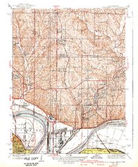 1940 North Kansas City1940 Print · USGSThe industrial riverfront and Clay County uplands are documented here during the mid-1930s as the regional transport network matured. Genealogists and researchers can locate family landmarks like New Stark Cem, Bethel Ch, and the many rural schoolhouses serving Gashland and Barry.2 unique versions available
 - 1943 Map of Quindaro
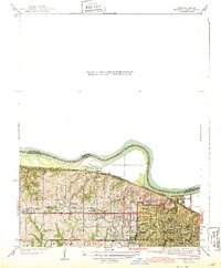 1943 Quindaro1943 Print · USGSThe Missouri-Kansas borderlands in the 1940s reveal a landscape of expanding schools and electric transit. Trace the routes of the Kansas City and Leavenworth Electric Road and find sites like Nearman Sch and Memorial Park Cemetery.
 - 1948 Map of Wolcott, 1954 Print
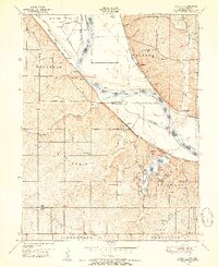 1948 Wolcott1954 Print · USGSThe Missouri River bottoms and Kansas uplands meet in the late 1940s, featuring a mix of prison farms, riverside towns, and new parklands. Genealogists can locate family names at Dunagan Cemetery or trace old school districts like Island Creek School and Center Point School.5 unique versions available
 - 1948 Map of Oak Mills, 1954 Print
 1948 Oak Mills1954 Print · USGSNortheastern Kansas in the late 1940s is captured here, showing the river bluffs and rail lines between Atchison and Leavenworth. Researchers can trace rural life through landmarks like Oak Mills, Lowemont, and numerous country schools such as Rock School and Wyman Sch.2 unique versions available
 - 1948 Map of Nashua, 1956 Print
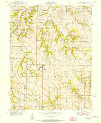 1948 Nashua1956 Print · USGSThe rural uplands of Clay and Platte counties are captured here shortly after the Second World War. Genealogists can trace family farmsteads and find local landmarks like Lone Star School, Mt Olivet Church, and the settlement at Gashland.
 - 1948 Map of Leavenworth, 1957 Print
 1948 Leavenworth1957 Print · USGSThe Missouri River corridor near Leavenworth and Weston was a vital hub of military and civic institutions in the late 1940s. Genealogists and historians can trace family roots at the Society of Sons of Death Cemetery or locate old schoolhouses like Coffin School and Hund School.4 unique versions available
 - 1948 Map of North Kansas City, 1958 Print
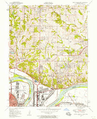 1948 North Kansas City1958 Print · USGSNorth Kansas City and the Missouri River corridor show a bustling mid-century mix of aviation, industry, and early suburban growth. Trace the development of Quindaro, the operations at Fairfax Airport, and local roots at Faubion Cemetery.
 - 1948 Map of Parkville, 1959 Print
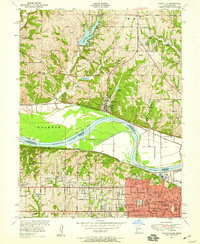 1948 Parkville1959 Print · USGSThe Missouri River state line near Parkville comes alive in the late 1940s as post-war suburban growth meets historic riverfront industry. Researchers can trace early family sites from St Marys Cemetery to the campus of Park College and the old Western University site.
Showing maps 1-25 of 155
Top cities of Platte County
- Parkville historical maps
- Platte City historical maps
- Riverside historical maps
- Weatherby Lake historical maps
- Weston historical maps
- Lake Waukomis historical maps
See more
Frequently asked questions
- What are the different types of historical maps available for Platte County?
- What is the oldest map of Platte County?
- Where can I purchase historical maps of Platte County for my home or office?
- Where can I download high-res historical maps of Platte County?
- Are there historical topographic maps available for Platte County?
- Is there historical aerial imagery available for Platte County?
- Where are historical maps of Platte County sourced from?