Old Maps of Dixon, Missouri for Hiking & Exploration
Hike through history with 29 historic maps of Dixon. Explore old trails, ghost towns, and forgotten backroads — perfect for outdoor adventurers and local explorers.
- Rediscover forgotten places: Map out old mining camps, roads, and footpaths that no longer exist on modern maps.
- Layer with modern tools: Combine with LiDAR or satellite views to plan hikes through historical terrain.
- Made for exploration: Popular among hikers, overlanders, and local history lovers.
Use these maps to find adventure and explore the hidden past of Dixon.
Dixon, MO maps
(29)- 1888 Map of Tuscumbia
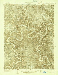
 1888 Tuscumbia1888 Print · USGSThe Osage River valley comes to life in the 1880s, showcasing the intricate river bends and rugged hills of central Missouri. Genealogists and researchers can trace the original locations of early settlements like Tuscumbia, St. Elizabeth, and Iberia.
 - 1894 Map of Tuscumbia
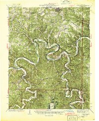
 1894 Tuscumbia1894 Print · USGSCentral Missouri's river-and-rail landscape is captured here in the 1890s as the Osage River served as the region's main artery. Genealogists and historians can trace the early boundaries of communities like Tuscumbia, St. Elizabeth, and Iberia.3 unique versions available
 - 1936 Map of Waynesville
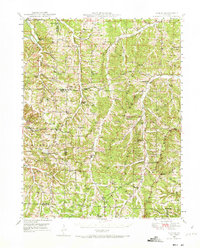
 1936 Waynesville1936 Print · USGSPulaski County during the mid-1930s is defined by its winding river valleys and the expansion of the Gardner National Forest. Researchers can trace ancestral locations through an extensive network of rural landmarks, including the Old Indian Lead Mine, Riddle Bridge, and the Sweet Home Ch.
 - 1942 Map of Waynesville
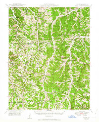
 1942 Waynesville1942 Print · USGSPulaski County during the early 1940s shows a landscape of deep river bends and the emergence of wartime infrastructure. Genealogists can trace family roots through numerous sites like Burchard Cem, the Old Indian Lead Mine, and the original footprint of Fort Leonard Wood.
 - 1944 Map of Waynesville
 1944 Waynesville1944 Print · USGSPulaski County at the peak of the Second World War shows a landscape in transition as the new Fort Leonard Wood takes shape among the Ozark hills. Genealogists and researchers can trace family-named sites like Wheelers Mill, Riddle Bridge, and the Joiner Cem along the winding Gasconade River.2 unique versions available
 - 1947 Map of Jefferson City, 1949 Print
 1947 Jefferson City1949 Print · USGSCentral Missouri and the northern Ozarks come into focus in this late 1940s survey of the river-and-rail landscape. Genealogists and historians can trace the growth of Jefferson City and Sedalia or locate family roots near Bagnell Dam and the Lake of the Ozarks.
 - 1948 Map of Tavern, 1973 Print
 1948 Tavern1973 Print · USGSMaries County life in the late 1940s was centered on the river valleys and a network of rural schools. Genealogists can trace family landmarks like Old Van Cleve, the Barnhart Cem, and numerous schoolhouses including Camp Ground Sch.2 unique versions available
 - 1950 Map of Tavern
 1950 Tavern1950 Print · USGSMaries County and the surrounding Missouri countryside appear here in the late 1940s, showing a landscape defined by river bends and rural schoolhouses. Researchers can locate family landmarks like Ricker Ch, Brinktown Sch, and Barnhart Cem.3 unique versions available
 - 1954 Map of Jefferson City
 1954 Jefferson City1954 Print · USGSCentral Missouri in the early postwar years showcases a landscape defined by the winding Lake of the Ozarks and the state capital at Jefferson City. Researchers can trace the mid-century rail networks of the Missouri Pacific RR and locate rural communities like Tuscumbia, St Elizabeth, and St Anthony.2 unique versions available
 - 1954 Map of Springfield
 1954 Springfield1954 Print · USGSThe Missouri Ozarks are captured here during the post-war era, showing the expansion of Springfield and the surrounding river valleys. Genealogists and historians can trace local landmarks like Mount Comfort Cemetery and the Fort Leonard Wood military grounds.6 unique versions available
 - 1954 Map of Waynesville, 1958 Print
 1954 Waynesville1958 Print · USGSThe Missouri Ozarks are captured here during the mid-fifties, showing the expansion of Fort Leonard Wood and the winding course of the Gasconade River. Researchers can locate dozens of country landmarks, from the Dixon Lookout Tower to rural sites like Wheeler Mill and the Pisgah School.2 unique versions available
 - 1954 Map of Dixon, 1959 Print
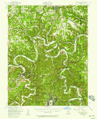
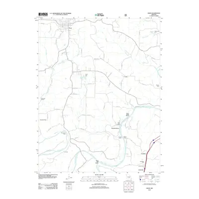
 1954 Dixon1959 Print · USGSThe town of Dixon and the surrounding Ozark hills are captured in the mid-1950s as the rail line still defined the local economy. Genealogists and researchers can trace family landmarks like Egan Cemetery, Boiling Spring, and the Gaddy School (Abandoned).4 unique versions available
 - 1955 Map of Jefferson City, 1967 Print
 1955 Jefferson City1967 Print · USGSCentral Missouri in the mid-fifties is defined by the winding Missouri River and the expanding reach of Lake of the Ozarks. Researchers can trace the rail corridors of the Missouri Pacific or locate the early footprint of Whiteman AFB and Jefferson City.4 unique versions available
 - 1958 Map of Jefferson City
 1958 Jefferson City1958 Print · USGSCentral Missouri in the late fifties shows a region transforming through the growth of Whiteman Air Force Base and the Lake of the Ozarks. Researchers can trace rail lines like the Missouri Pacific or find family roots at Enloe Cemetery and Mount Pleasant Cem.
 - 1958 Map of Springfield
 1958 Springfield1958 Print · USGSThe Missouri Ozarks are captured during the mid-century era of growth, centered on the bustling hub of Springfield. Genealogists and historians can trace family roots through numerous landmarks like Ebenezer Church, Stockton Cem, and the various county courthouses.
 - 1959 Map of Jefferson City
 1959 Jefferson City1959 Print · USGSCentral Missouri is captured during the mid-fifties as the river economy and rail networks like the Missouri Pacific met the rise of the automobile. Local researchers can trace family landmarks and rural infrastructure from the Lake of the Ozarks up to Providence Cemetery and Knob Noster State Park.
 - 1959 Map of Springfield
 1959 Springfield1959 Print · USGSThe Missouri Ozarks are captured here during a decade of postwar growth and increasing highway connectivity. Researchers can trace the legacy of the St Louis-San Francisco RR and locate early sites in Springfield, Lebanon, and Mountain Grove.
 - 1982 Map of Lebanon, 1983 Print
 1982 Lebanon1983 Print · USGSThe Missouri Ozarks are captured in the early eighties as Interstate 44 and the St Louis-San Francisco rail line link growing towns with the Fort Leonard Wood Military Reservation. Genealogists and historians can trace family-named sites like Flatwood Church and old post offices at Sleeper and Nebo.
 - 1983 Map of Lake Of The Ozarks, 1984 Print
 1983 Lake Of The Ozarks1984 Print · USGSThe Lake of the Ozarks region in the early eighties shows a landscape of deep river bends and growing recreation. Genealogists can trace family names and small settlements from Versailles to Meta and locate old mining sites like Tiff Mine.
 - 1987 Map of Big Bend
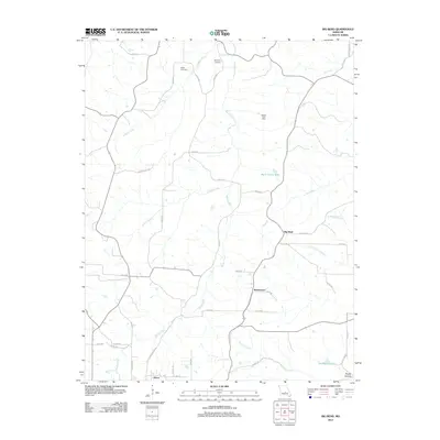
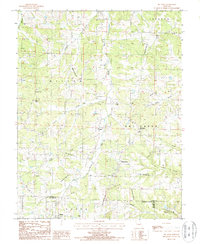 1987 Big Bend1987 Print · USGSThe Maries River valley comes into sharp focus during the late 1980s, showing a landscape shaped by both nature and modern infrastructure. Researchers can trace the rural layout of Big Bend, locate the settlement of Shantytown, and find family sites near Clifty Hollow.
 - 2004 Map of Dixon, 2006 Print
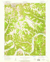
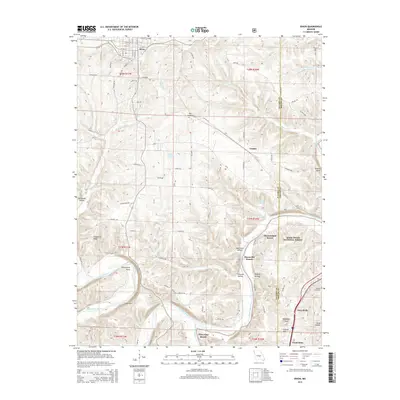
 2004 Dixon2006 Print · USGSThe town of Dixon and the sharp bends of the Gasconade River define this Pulaski County landscape in the early 2000s. Researchers can locate several historical sites, including Gaddy Sch (Site), Goodall Cem, and Portuguese Point along the river cliffs.
 - 2012 Map of Big Bend, 2012 Print
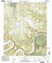
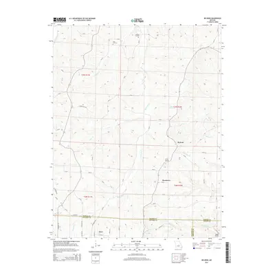
 2012 Big Bend2012 Print · USGSCovers Dixon, including Shantytown, Big Bend, and other nearby areas
 - 2012 Map of Dixon, 2012 Print
 2012 Dixon2012 Print · USGSCovers Dixon, including Franks, Clementine, and other nearby areas
 - 2015 Map of Big Bend, 2015 Print
 2015 Big Bend2015 Print · USGSCovers Dixon, including Shantytown, Big Bend, and other nearby areas
 - 2015 Map of Dixon, 2015 Print
 2015 Dixon2015 Print · USGSCovers Dixon, including Franks, Clementine, and other nearby areas
Showing maps 1-25 of 29
Top cities near Dixon
- Saint Robert historical maps
- Waynesville historical maps
- Crocker historical maps
- Iberia historical maps
- Doolittle historical maps
- Vienna historical maps
See more
Frequently asked questions
- What are the different types of historical maps available for Dixon?
- What is the oldest map of Dixon?
- Where can I purchase historical maps of Dixon for my home or office?
- Where can I download high-res historical maps of Dixon?
- Are there historical topographic maps available for Dixon?
- Is there historical aerial imagery available for Dixon?
- Where are historical maps of Dixon sourced from?