1990s Maps of Ralls County, Missouri
Explore 7 historic maps of Ralls County from the 1990s. These maps offer a rare glimpse into what life looked like during the 1990s — showing old roads, neighborhoods, homes, and landmarks that have changed or disappeared over time.
Whether you're researching your family's past, planning a metal detecting trip, or studying how Ralls County's landscape evolved across the 1990s, these high-resolution maps are a powerful tool for exploring the history of this region.
- Focus on a specific era: All maps on this page are from the 1990s, giving you a focused view of this time period.
- See what’s changed: Compare century-old streets, trails, and buildings to today's modern landscape using overlays and satellite layers.
- Research with precision: Use these maps for genealogy, historical research, land use analysis, or educational projects.
- View, download, or print: Maps are fully viewable online in high resolution, and can be downloaded or printed for your own records.
Start exploring Ralls County's history through authentic maps from the 1990s. This is your window into the past.
Ralls County, MO maps
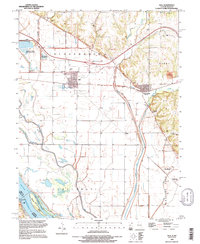
(7)- 1990 Map of Clarence Cannon Dam, 1995 Print
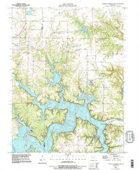 1990 Clarence Cannon Dam1995 Print · USGSThe Salt River valley in the early 1990s reflects a transformed landscape following the completion of the Clarence Cannon Dam. Local researchers can trace family landmarks like the Utterback Cem and the sprawling banks of Mark Twain Lake.
 - 1991 Map of Center, 1995 Print
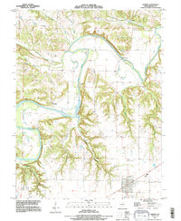 1991 Center1995 Print · USGSRalls County's river-cut terrain is shown in the early nineties, centered on the community of Center and the winding Salt River. Researchers can trace rural lineages through sites like Greathouse Cem or locate old river crossings such as Asher Bridge.
 - 1991 Map of New London, 1995 Print
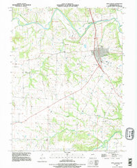 1991 New London1995 Print · USGSNew London and the Ralls County countryside are captured here in the early nineties, centered on the Salt River valley. Genealogists and local historians can trace numerous rural burial sites including Barkley Cem, Flowerree Cem, and Mt Sterling Cem.
 - 1991 Map of Hannibal SE, 1995 Print
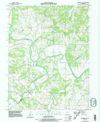 1991 Hannibal SE1995 Print · USGSThe Salt River valley in Ralls County is captured here in the early nineties, showing a landscape defined by flood-control levees and family history. Genealogists can trace dozens of burial sites like Salt River Cem and Jones Cem, or locate landmarks such as Fisher Cave.
 - 1993 Map of Ashburn, 1995 Print
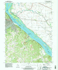
 1993 Ashburn1995 Print · USGSThe Mississippi River bottomlands and bluffs of Missouri and Illinois are captured here in the early nineties. Researchers can trace family plots at Schindler Cem, locate the Mundy Landing site, or explore the winding banks of the Salt River.
 - 1993 Map of Hull, 1996 Print
 1993 Hull1996 Print · USGSPike County settlements and the Mississippi floodplain are documented here in the early nineties. Genealogists and researchers can locate Hull Cem, trace the channel of The Sny, and find Lock and Dam No 22 on the riverbank.
 - 1993 Map of Hannibal East, 1996 Print
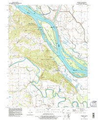
 1993 Hannibal East1996 Print · USGSThe Mississippi River corridor near Hannibal comes to life in this mid-nineties survey of the Missouri-Illinois border. Genealogists and historians can trace Riverside Cem, the Mark Twain Cave, and old river settlements like Saverton and Monkey Run.
End of results
Showing maps 1-7 of 7
Top cities of Ralls County
Frequently asked questions
- What are the different types of historical maps available for Ralls County?
- What is the oldest map of Ralls County?
- Where can I purchase historical maps of Ralls County for my home or office?
- Where can I download high-res historical maps of Ralls County?
- Are there historical topographic maps available for Ralls County?
- Is there historical aerial imagery available for Ralls County?
- Where are historical maps of Ralls County sourced from?